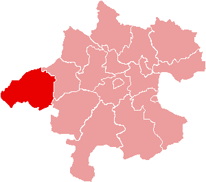
Ротталь-Инн (Rottal-Inn, Landkreis Rottal-Inn)

 Hiking in Ротталь-Инн
Rottal-Inn, located in Bavaria, Germany, is a picturesque area known for its natural beauty and diverse landscapes, making it an excellent destination for hiking enthusiasts. The region is characterized by rolling hills, lush forests, and charming villages, providing a variety of hiking trails suitable for all skill levels. Here are some highlights to consider when hiking in Rottal-Inn:
Trails and Routes
-
Local Hiking Trails: The area offers numerous well-marked trails that range from easy walks to more challenging hikes. Many trails can take you through the scenic countryside, vineyards, and serene forests.
-
The Inn River Trail: Following the Inn River, this trail allows hikers to enjoy both riverside views and the rich biodiversity of the river valley. It’s a great option for those looking for a more relaxed hike.
-
Panoramic Views: Some trails lead to higher elevations, providing stunning panoramic views of the region. Look for hikes that involve a bit of elevation gain for the best vistas.
Nature and Wildlife
- Rottal-Inn is home to diverse flora and fauna, and while hiking, you might encounter various bird species, deer, and other wildlife common to Bavarian forests. Birdwatchers will particularly enjoy the area.
Tips for Hikers
-
Weather: Check the weather before you head out, as conditions can change. Early spring and fall can offer optimal hiking conditions, with mild temperatures and beautiful foliage.
-
Trail Maps: Make sure to carry a detailed map or use a hiking app to navigate the trails, as not all paths may be well-signposted.
-
Local Accommodations: If you're planning to hike for multiple days, consider local accommodations, such as guesthouses or inns, that offer a taste of Bavarian hospitality.
Cultural Aspects
- Besides natural beauty, Rottal-Inn is rich in culture and history. You’ll find charming villages and historical sites along the trails, and it can be rewarding to incorporate cultural exploration into your hiking experience.
Safety Considerations
- Always inform someone about your hiking plans and estimated return time, especially if you're going on solo hikes.
- Carry enough water, snacks, and a basic first aid kit for longer treks.
Rottal-Inn is a hidden gem for hiking, offering a blend of beautiful scenery, diverse trails, and cultural richness. Whether you’re a novice or an experienced hiker, you’re sure to find something that suits your interests in this beautiful region of Bavaria. Enjoy your hiking adventure!
- Страна:

- Столица: Пфаркирхен
- Код автомобильного номера: PAN; VIB; GRI; EG
- Координаты: 48° 25' 12" N, 12° 55' 12" E


- GPS треки (wikiloc): [Ссылка]
- Высота над уровнем моря: 461 м m
- Площадь: 1.28 кв.км
- Население: 104013
- Веб сайт: http://www.rottal-inn.de/
- Википедия русская: wiki(ru)
- Википедия английская: wiki(en)
- Википедия национальная: wiki(de)
- Хранилище Wikidata: Wikidata: Q10477
- Катеория в википедии: [Ссылка]
- код Freebase: [/m/02k6s3]
- код GeoNames: Альт: [2843774]
- код VIAF: Альт: [142544882]
- ID отношения в OpenStreetMap: [62592]
- код GND: Альт: [4050728-2]
- идентификатор местоположения ArchINFORM: [11058]
- код LCNAF: Альт: [n85322946]
- код TGN: [7100860]
- код Historical Gazetteer: [adm_139277]
- Bavarikon ID: [ODB_A00001609]
- код NUTS: [DE22A]
- код района Германии: 09277
Включает регионы:

Цайларн
Hiking in Цайларн
Zeilarn, located in Bavaria, Germany, offers a range of beautiful hiking opportunities for outdoor enthusiasts. The region is characterized by its scenic landscapes, rolling hills, and charming villages....
- Страна:
- Почтовый код: 84367
- Телефонный код: 08572
- Код автомобильного номера: PAN
- Координаты: 48° 18' 0" N, 12° 50' 0" E
- GPS треки (wikiloc): [Ссылка]
- Высота над уровнем моря: 450 м m
- Площадь: 28.9 кв.км
- Население: 2053
- Веб сайт: [Ссылка]

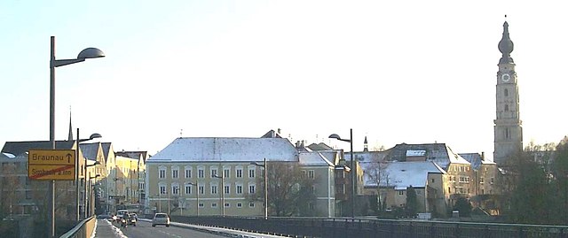
Зимбах-на-Инне
Hiking in Зимбах-на-Инне
Simbach am Inn, located on the border between Germany and Austria, offers a variety of hiking opportunities that showcase the natural beauty of the region. Here are some things to consider if you're planning a hiking excursion in or around Simbach am Inn:...
- Страна:
- Почтовый код: 84359
- Телефонный код: 08571
- Код автомобильного номера: PAN
- Координаты: 48° 16' 0" N, 13° 1' 0" E
- GPS треки (wikiloc): [Ссылка]
- Высота над уровнем моря: 350 м m
- Площадь: 47.33 кв.км
- Население: 8697
- Веб сайт: [Ссылка]

Эггенфельден
Hiking in Эггенфельден
Eggenfelden is a charming town located in Bavaria, Germany, and it's surrounded by picturesque landscapes that make it a delightful destination for hiking enthusiasts. While the town itself isn’t known for high mountain trails, it offers various routes that can be enjoyed by hikers of all skill levels. Here are a few highlights and tips for hiking in and around Eggenfelden:...
- Страна:
- Почтовый код: 84307
- Телефонный код: 08721
- Координаты: 48° 23' 57" N, 12° 44' 53" E
- GPS треки (wikiloc): [Ссылка]
- Высота над уровнем моря: 404 м m
- Площадь: 44.35 кв.км
- Население: 10897
- Веб сайт: [Ссылка]
Миттерскирхен
Hiking in Миттерскирхен
Mitterskirchen, a small village located in the scenic region of Bavaria, Germany, offers a wonderful backdrop for hiking enthusiasts. Nestled among rolling hills and lush forests, the area is known for its natural beauty and tranquility, making it an ideal location for outdoor activities....
- Страна:
- Почтовый код: 84335
- Телефонный код: 08725
- Код автомобильного номера: PAN
- Координаты: 48° 21' 0" N, 12° 44' 0" E
- GPS треки (wikiloc): [Ссылка]
- Высота над уровнем моря: 433 м m
- Площадь: 24.63 кв.км
- Население: 1612
- Веб сайт: [Ссылка]

Шёнау
- муниципалитет в Германии, Бавария
Hiking in Шёнау
Schönau, located in Lower Bavaria, is a delightful destination for hiking enthusiasts. Nestled near the foothills of the Bavarian Forest and close to the picturesque Berchtesgaden National Park, it offers a variety of trails and stunning landscapes. Here are some highlights for hiking in Schönau:...
- Страна:
- Почтовый код: 84337
- Телефонный код: 08726
- Код автомобильного номера: PAN
- Координаты: 48° 29' 0" N, 12° 51' 0" E
- GPS треки (wikiloc): [Ссылка]
- Высота над уровнем моря: 453 м m
- Площадь: 36.14 кв.км
- Население: 1540
- Веб сайт: [Ссылка]

Эгльхам
Hiking in Эгльхам
Egglham is a charming village located in Bavaria, Germany, and it's surrounded by beautiful landscapes, making it a lovely destination for hiking enthusiasts. Here are some key points to consider when hiking in and around Egglham:...
- Страна:
- Почтовый код: 84385
- Телефонный код: 08543
- Код автомобильного номера: PAN
- Координаты: 48° 32' 0" N, 13° 4' 0" E
- GPS треки (wikiloc): [Ссылка]
- Высота над уровнем моря: 353 м m
- Площадь: 36.84 кв.км
- Население: 2298
- Веб сайт: [Ссылка]
Пфаркирхен
Hiking in Пфаркирхен
Pfarrkirchen is a charming town located in Bavaria, Germany, surrounded by beautiful countryside that offers several hiking opportunities. The region is characterized by its rolling hills, lush forests, and tranquil rivers, making it an excellent destination for outdoor enthusiasts....
- Страна:
- Почтовый код: 84347
- Телефонный код: 08561
- Код автомобильного номера: PAN
- Координаты: 48° 26' 31" N, 12° 56' 39" E
- GPS треки (wikiloc): [Ссылка]
- Высота над уровнем моря: 469 м m
- Площадь: 52.35 кв.км
- Население: 10275
- Веб сайт: [Ссылка]

Трифтерн
Hiking in Трифтерн
Triftern is a small town located in the district of Rottal-Inn in Bavaria, Germany. While it may not be as well-known for hiking as some other regions, it offers access to the beautiful Bavarian countryside, where you can enjoy various nature trails and paths....
- Страна:
- Почтовый код: 84371
- Телефонный код: 08562
- Код автомобильного номера: PAN
- Координаты: 48° 24' 0" N, 13° 1' 0" E
- GPS треки (wikiloc): [Ссылка]
- Высота над уровнем моря: 391 м m
- Площадь: 62.24 кв.км
- Население: 5012
- Веб сайт: [Ссылка]

Хебертсфельден
Hiking in Хебертсфельден
Hebertsfelden, located in Bavaria, Germany, is a charming village surrounded by picturesque landscapes that offer excellent hiking opportunities. The region is characterized by rolling hills, lush forests, and scenic views, making it perfect for both casual strolls and more challenging hikes....
- Страна:
- Почтовый код: 84332
- Телефонный код: 08721
- Код автомобильного номера: PAN
- Координаты: 48° 24' 0" N, 12° 49' 0" E
- GPS треки (wikiloc): [Ссылка]
- Высота над уровнем моря: 446 м m
- Площадь: 49.89 кв.км
- Население: 3547
- Веб сайт: [Ссылка]
Йоханнискирхен
Hiking in Йоханнискирхен
Johanniskirchen is a small community in Bavaria, Germany, known for its picturesque landscapes and scenic trails. Hiking in and around Johanniskirchen offers a great opportunity to experience the beauty of the Bavarian countryside. Here are some key points to consider if you're planning a hiking trip in this area:...
- Страна:
- Почтовый код: 84381
- Телефонный код: 08564
- Код автомобильного номера: PAN
- Координаты: 48° 32' 0" N, 12° 57' 0" E
- GPS треки (wikiloc): [Ссылка]
- Высота над уровнем моря: 365 м m
- Площадь: 40.59 кв.км
- Население: 2335
- Веб сайт: [Ссылка]

Дитерсбург
Hiking in Дитерсбург
Dietersburg, located in Bavaria, Germany, offers a variety of hiking opportunities for outdoor enthusiasts. While it may not be as well-known as some of the larger hiking destinations in Bavaria, it is surrounded by beautiful landscapes typical of the region, including rolling hills, forests, and picturesque countryside....
- Страна:
- Почтовый код: 84385; 84378
- Телефонный код: 08726; 08565; 08564; 08561
- Код автомобильного номера: PAN
- Координаты: 48° 30' 0" N, 12° 55' 0" E
- GPS треки (wikiloc): [Ссылка]
- Высота над уровнем моря: 427 м m
- Площадь: 55.03 кв.км
- Население: 3110
- Веб сайт: [Ссылка]

Постмюнстер
Hiking in Постмюнстер
Postmünster is a charming village located in Bavaria, Germany, surrounded by scenic landscapes that make it an excellent destination for hiking enthusiasts. Here are some highlights and tips for hiking in and around Postmünster:...
- Страна:
- Почтовый код: 84389
- Телефонный код: 08561
- Код автомобильного номера: PAN
- Координаты: 48° 25' 0" N, 12° 54' 0" E
- GPS треки (wikiloc): [Ссылка]
- Высота над уровнем моря: 405 м m
- Площадь: 43.5 кв.км
- Население: 2240
- Веб сайт: [Ссылка]
Юльбах
Hiking in Юльбах
Julbach, located in Austria, is a charming village nestled in the picturesque landscape of the Mühlviertel region, known for its lush forests, rolling hills, and scenic trails. Hiking in and around Julbach offers a variety of experiences for outdoor enthusiasts, ranging from leisurely walks to more challenging treks....
- Страна:
- Почтовый код: 84387
- Телефонный код: 08571
- Код автомобильного номера: PAN
- Координаты: 48° 15' 18" N, 12° 57' 33" E
- GPS треки (wikiloc): [Ссылка]
- Высота над уровнем моря: 383 м m
- Площадь: 11.3 кв.км
- Население: 1858
- Веб сайт: [Ссылка]

Виттибройт
Hiking in Виттибройт
Wittibreut, located in Bavaria, Germany, is a scenic area known for its beautiful landscapes and natural surroundings, making it a suitable location for hiking enthusiasts. Here are some key points to consider:...
- Страна:
- Почтовый код: 84384
- Телефонный код: 08574
- Код автомобильного номера: PAN
- Координаты: 48° 19' 45" N, 12° 59' 14" E
- GPS треки (wikiloc): [Ссылка]
- Высота над уровнем моря: 480 м m
- Площадь: 38.32 кв.км
- Население: 1872
- Веб сайт: [Ссылка]

Гератскирхен
Hiking in Гератскирхен
Geratskirchen is a small municipality located in Bavaria, Germany, known for its picturesque landscapes and scenic hiking trails. While it may not be as well-known as larger regions, it offers a charming outdoor experience for hikers looking to explore the natural beauty of Bavaria....
- Страна:
- Почтовый код: 84552
- Телефонный код: 08728
- Код автомобильного номера: PAN
- Координаты: 48° 20' 0" N, 12° 40' 0" E
- GPS треки (wikiloc): [Ссылка]
- Высота над уровнем моря: 441 м m
- Площадь: 12.89 кв.км
- Население: 597
- Веб сайт: [Ссылка]

Фалькенберг
Hiking in Фалькенберг
Falkenberg, located in Lower Bavaria, is a picturesque area that offers wonderful hiking opportunities amidst a blend of natural beauty and cultural heritage. The region is characterized by rolling hills, lush forests, and charming villages, providing a diverse landscape for hikers to explore....
- Страна:
- Почтовый код: 84326
- Телефонный код: 08727
- Код автомобильного номера: PAN
- Координаты: 48° 28' 0" N, 12° 43' 0" E
- GPS треки (wikiloc): [Ссылка]
- Высота над уровнем моря: 487 м m
- Площадь: 66.51 кв.км
- Население: 3480
- Веб сайт: [Ссылка]

Унтердитфурт
Hiking in Унтердитфурт
Unterdietfurt, a small village in Bavaria, Germany, offers beautiful landscapes and scenic trails perfect for hiking enthusiasts. The area is characterized by its rolling hills, lush forests, and quaint rural surroundings, making it an ideal location for both casual walkers and more experienced hikers....
- Страна:
- Почтовый код: 84339
- Телефонный код: 08724
- Код автомобильного номера: PAN
- Координаты: 48° 23' 0" N, 12° 39' 0" E
- GPS треки (wikiloc): [Ссылка]
- Высота над уровнем моря: 420 м m
- Площадь: 27.48 кв.км
- Население: 1844
- Веб сайт: [Ссылка]

Росбах
- муниципалитет в Германии, Бавария
Hiking in Росбах
Roßbach, located in Bavaria, Germany, is a picturesque village that serves as a great starting point for a variety of hiking adventures. The surrounding landscape is characterized by lush forests, rolling hills, and stunning views of the Bavarian countryside....
- Страна:
- Почтовый код: 94439
- Телефонный код: 08547
- Код автомобильного номера: PAN
- Координаты: 48° 36' 0" N, 12° 56' 0" E
- GPS треки (wikiloc): [Ссылка]
- Высота над уровнем моря: 344 м m
- Площадь: 48.15 кв.км
- Население: 2730
- Веб сайт: [Ссылка]

Гангофен
Hiking in Гангофен
Gangkofen is a small municipality located in Bavaria, Germany. While it may not be as widely known for hiking as some larger towns or national parks, there are definitely opportunities for hiking in the surrounding areas....
- Страна:
- Почтовый код: 84140
- Телефонный код: 08735; 08722
- Код автомобильного номера: PAN
- Координаты: 48° 26' 13" N, 12° 33' 48" E
- GPS треки (wikiloc): [Ссылка]
- Высота над уровнем моря: 439 м m
- Площадь: 108.76 кв.км
- Население: 6095
- Веб сайт: [Ссылка]
Римбах
Hiking in Римбах
Rimbach in Lower Bavaria is a delightful destination for hiking enthusiasts who are looking to experience the scenic beauty of the Bavarian countryside. The region is characterized by its diverse landscapes, rich flora, and fauna, as well as cultural landmarks. Here are some key points to consider when hiking in Rimbach:...
- Страна:
- Почтовый код: 84326
- Телефонный код: 08727
- Код автомобильного номера: PAN
- Координаты: 48° 28' 0" N, 12° 39' 0" E
- GPS треки (wikiloc): [Ссылка]
- Высота над уровнем моря: 454 м m
- Площадь: 22.9 кв.км
- Население: 837
- Веб сайт: [Ссылка]

Арнсторф
Hiking in Арнсторф
Arnstorf, located in Bavaria, Germany, is a charming village surrounded by beautiful landscapes that are perfect for hiking enthusiasts. The region offers a mix of gentle hills, meadows, and forests, making it suitable for various skill levels....
- Страна:
- Почтовый код: 94424
- Телефонный код: 08723
- Код автомобильного номера: PAN
- Координаты: 48° 34' 0" N, 12° 49' 0" E
- GPS треки (wikiloc): [Ссылка]
- Высота над уровнем моря: 397 м m
- Площадь: 80.37 кв.км
- Население: 5579
- Веб сайт: [Ссылка]

Вурмансквик
Hiking in Вурмансквик
Wurmannsquick is a small municipality in Bavaria, Germany, known for its picturesque countryside and forests, making it a lovely destination for hiking enthusiasts. The surrounding area offers a variety of trails suitable for different skill levels, from easy walks to more challenging hikes....
- Страна:
- Почтовый код: 84329
- Телефонный код: 08725
- Код автомобильного номера: PAN
- Координаты: 48° 21' 0" N, 12° 47' 0" E
- GPS треки (wikiloc): [Ссылка]
- Высота над уровнем моря: 500 м m
- Площадь: 49.19 кв.км
- Население: 3239
- Веб сайт: [Ссылка]
Kirchdorf am Inn
Hiking in Kirchdorf am Inn
Kirchdorf am Inn is a charming village located in Bavaria, Germany, near the border with Austria. The area is known for its beautiful landscapes, making it a great destination for hiking enthusiasts. Here are some highlights and tips for hiking in and around Kirchdorf am Inn:...
- Страна:
- Почтовый код: 84375
- Телефонный код: 08571
- Код автомобильного номера: PAN
- Координаты: 48° 15' 0" N, 12° 59' 0" E
- GPS треки (wikiloc): [Ссылка]
- Высота над уровнем моря: 359 м m
- Площадь: 31.64 кв.км
- Население: 4064
- Веб сайт: [Ссылка]

Мальгерсдорф
Hiking in Мальгерсдорф
Malgersdorf is a quaint village located in Bavaria, Germany, surrounded by picturesque landscapes that are perfect for hiking enthusiasts. The area boasts a mixture of flat terrain and gentle hills, making it accessible for hikers of all skill levels....
- Страна:
- Почтовый код: 84333
- Телефонный код: 09954
- Код автомобильного номера: PAN
- Координаты: 48° 24' 0" N, 12° 45' 0" E
- GPS треки (wikiloc): [Ссылка]
- Высота над уровнем моря: 398 м m
- Площадь: 11.48 кв.км
- Население: 998
- Веб сайт: [Ссылка]

Байербах
Hiking in Байербах
Bayerbach is a charming area in Bavaria, Germany, known for its picturesque landscapes and excellent hiking opportunities. Situated in the Lower Bavaria region, it's surrounded by rolling hills, forests, and rivers, making it an ideal spot for outdoor enthusiasts....
- Страна:
- Почтовый код: 94137
- Телефонный код: 08532
- Код автомобильного номера: PAN
- Координаты: 48° 25' 0" N, 13° 9' 0" E
- GPS треки (wikiloc): [Ссылка]
- Высота над уровнем моря: 357 м m
- Площадь: 19.43 кв.км
- Население: 1574
- Веб сайт: [Ссылка]

Танн
Hiking in Танн
Hiking in Tann, Bavaria, offers a delightful experience with stunning landscapes, picturesque villages, and a range of trails for all levels of hikers. Nestled in the beautiful Bavarian region, Tann is surrounded by the rolling hills of the Bavarian Forest and offers a mix of well-marked trails, scenic views, and opportunities to immerse yourself in nature....
- Страна:
- Почтовый код: 84367
- Телефонный код: 08572
- Код автомобильного номера: PAN
- Координаты: 48° 19' 0" N, 12° 54' 0" E
- GPS треки (wikiloc): [Ссылка]
- Высота над уровнем моря: 476 м m
- Площадь: 37.55 кв.км
- Население: 3289
- Веб сайт: [Ссылка]
Бад-Бирнбах
Hiking in Бад-Бирнбах
Bad Birnbach, located in the Lower Bavaria region of Germany, is known for its scenic landscapes, natural hot springs, and wellness facilities. The area is a great choice for hiking enthusiasts of all levels, offering a variety of trails that showcase the beautiful Bavarian countryside....
- Страна:
- Почтовый код: 84364
- Телефонный код: 08563
- Код автомобильного номера: PAN
- Координаты: 48° 27' 0" N, 13° 5' 0" E
- GPS треки (wikiloc): [Ссылка]
- Высота над уровнем моря: 376 м m
- Площадь: 68.83 кв.км
- Население: 5743
- Веб сайт: [Ссылка]

Эринг
Hiking in Эринг
Ering is a beautiful area that offers a variety of hiking opportunities, characterized by its stunning natural landscapes, diverse flora and fauna, and picturesque views. While specific trails and details can vary, here are some general aspects you can consider while hiking in Ering:...
- Страна:
- Почтовый код: 94140
- Телефонный код: 08573
- Код автомобильного номера: PAN
- Координаты: 48° 18' 0" N, 13° 9' 0" E
- GPS треки (wikiloc): [Ссылка]
- Высота над уровнем моря: 340 м m
- Площадь: 39.56 кв.км
- Население: 1845
- Веб сайт: [Ссылка]

Ройт
Hiking in Ройт
Reut, located in central Israel near the city of Tel Aviv, is not typically known as a hiking destination compared to other regions in the country like the Galilee, the Golan Heights, or the Negev Desert. However, there are some opportunities for nature walks and outdoor activities in the surrounding areas....
- Страна:
- Почтовый код: 84367
- Телефонный код: 08572
- Код автомобильного номера: PAN
- Координаты: 48° 18' 40" N, 12° 56' 34" E
- GPS треки (wikiloc): [Ссылка]
- Высота над уровнем моря: 460 м m
- Площадь: 30.75 кв.км
- Население: 1599
- Веб сайт: [Ссылка]

Штубенберг
Hiking in Штубенберг
Stubenberg, located in Bavaria, Germany, is a charming area that offers numerous opportunities for hiking enthusiasts. While it may not be as widely known as some of the larger Bavarian hiking destinations, it boasts beautiful landscapes and trails that can cater to various skill levels....
- Страна:
- Почтовый код: 94166
- Телефонный код: 08571
- Код автомобильного номера: PAN
- Координаты: 48° 19' 0" N, 13° 5' 0" E
- GPS треки (wikiloc): [Ссылка]
- Высота над уровнем моря: 425 м m
- Площадь: 18.19 кв.км
- Население: 1307
- Веб сайт: [Ссылка]

Массинг
Hiking in Массинг
Massing, Germany, is located in the Lower Bavaria region and offers a variety of hiking opportunities that allow you to explore the beautiful countryside and nearby natural areas. Although Massing itself is a small town, there are several trails and paths nearby that showcase the scenic beauty of the Bavarian landscape....
- Страна:
- Почтовый код: 84323
- Телефонный код: 08724
- Код автомобильного номера: PAN
- Координаты: 48° 23' 28" N, 12° 36' 33" E
- GPS треки (wikiloc): [Ссылка]
- Высота над уровнем моря: 429 м m
- Площадь: 36.13 кв.км
- Население: 2930
- Веб сайт: [Ссылка]
Граничит с регионами:

Ландсхут
Hiking in Ландсхут
Landshut district, located in Bavaria, Germany, offers a variety of hiking opportunities that cater to different skill levels and preferences. The landscape is characterized by rolling hills, picturesque villages, and lush forests, providing a beautiful backdrop for outdoor activities....
- Страна:
- Столица: Ландсхут
- Код автомобильного номера: LA
- Координаты: 48° 34' 14" N, 12° 10' 50" E
- GPS треки (wikiloc): [Ссылка]
- Высота над уровнем моря: 383 м m
- Площадь: 1348 кв.км
- Население: 115644
- Веб сайт: [Ссылка]


Дингольфинг-Ландау
Hiking in Дингольфинг-Ландау
Dingolfing-Landau, located in Bavaria, Germany, offers a variety of hiking opportunities for enthusiasts of all levels. The region is known for its picturesque landscapes, charming villages, and diverse flora and fauna. Here are some highlights of hiking in Dingolfing-Landau:...
- Страна:
- Столица: Дингольфинг
- Код автомобильного номера: DGF
- Координаты: 48° 40' 12" N, 12° 34' 48" E
- GPS треки (wikiloc): [Ссылка]
- Высота над уровнем моря: 372 м m
- Площадь: 878.00 кв.км
- Население: 75517
- Веб сайт: [Ссылка]


Деггендорф
- район в Баварии
Hiking in Деггендорф
Deggendorf, located in Bavaria, Germany, is a fantastic region for hiking enthusiasts. Nestled at the edge of the Bavarian Forest National Park and alongside the Danube River, it boasts a variety of landscapes and trails suitable for all skill levels....
- Страна:
- Столица: Деггендорф
- Код автомобильного номера: DEG
- Координаты: 48° 49' 48" N, 13° 0' 0" E
- GPS треки (wikiloc): [Ссылка]
- Высота над уровнем моря: 309 м m
- Площадь: 861.00 кв.км
- Население: 115005
- Веб сайт: [Ссылка]

Пассау
Hiking in Пассау
Hiking in the Passau district, located in the southeast of Bavaria, Germany, offers an array of scenic trails and beautiful landscapes characterized by hills, forests, rivers, and charming villages. The Passau area is known for its impressive natural beauty, making it a great destination for hikers of all experience levels. Below are some highlights of hiking in the region:...
- Страна:
- Столица: Пассау
- Код автомобильного номера: PA
- Координаты: 48° 30' 0" N, 13° 19' 48" E
- GPS треки (wikiloc): [Ссылка]
- Высота над уровнем моря: 364 м m
- Площадь: 1530.04 кв.км
- Население: 162355
- Веб сайт: [Ссылка]

Альтёттинг
- район Баварии
Hiking in Альтёттинг
Altötting, located in Bavaria, Germany, is known for its historical significance as a pilgrimage site, but it also offers beautiful landscapes ideal for hiking enthusiasts. Here are some key highlights about hiking in the Altötting district:...
- Страна:
- Столица: Альтэттинг
- Код автомобильного номера: AÖ
- Координаты: 48° 15' 0" N, 12° 45' 0" E
- GPS треки (wikiloc): [Ссылка]
- Высота над уровнем моря: 436 м m
- Площадь: 569.41 кв.км
- Население: 94216
- Веб сайт: [Ссылка]

Мюльдорф-на-Инне
- район Баварии
Hiking in Мюльдорф-на-Инне
Mühldorf District, located in Bavaria, Germany, offers a range of hiking opportunities that cater to different skill levels and preferences. The area features scenic landscapes, including rolling hills, forests, and rivers, making it an attractive destination for nature lovers and outdoor enthusiasts....
- Страна:
- Столица: Мюльдорф-на-Инне
- Код автомобильного номера: MÜ
- Координаты: 48° 15' 0" N, 12° 25' 12" E
- GPS треки (wikiloc): [Ссылка]
- Высота над уровнем моря: 447 м m
- Площадь: 805.32 кв.км
- Население: 92882
Браунау-ам-Инн
Hiking in Браунау-ам-Инн
Braunau am Inn District, located in Austria near the border with Germany, offers a variety of hiking opportunities that cater to different skill levels and preferences. The landscape is characterized by rolling hills, lush greenery, and scenic views, making it an attractive destination for nature lovers and outdoor enthusiasts....
- Страна:

- Столица: Браунау-ам-Инн
- Код автомобильного номера: BR
- Координаты: 48° 7' 52" N, 13° 6' 32" E
- GPS треки (wikiloc): [Ссылка]
- Высота над уровнем моря: 451 м m
- Площадь: 1040.38 кв.км
- Веб сайт: [Ссылка]