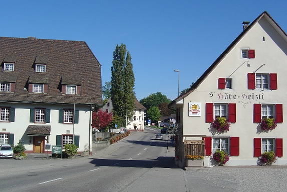
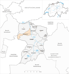
Праттельн (Pratteln, Pratteln)

 Hiking in Праттельн
Pratteln, located in the Basel-Landschaft region of Switzerland, offers a variety of hiking opportunities that cater to different skill levels. The area is rich in natural beauty, featuring lush forests, rolling hills, and panoramic views of the surrounding landscape, including the nearby Jura Mountains.
Popular Hiking Trails
-
Brotplatzweg: This is a relatively easy trail suitable for families. It offers pleasant views and takes you through wooded areas and past meadows. The trail is well-marked and can be completed in a few hours.
-
Pratteln to Augst: A slightly more challenging route, this hike connects Pratteln to the nearby town of Augst. The path winds through scenic countryside and offers opportunities for birdwatching and observing local flora.
-
Jura Trail: For more experienced hikers, portions of the Jura Trail—the long-distance hiking route along the Jura Mountains—can be accessed from Pratteln. This trail provides stunning vistas and a more rugged hiking experience.
-
Rugged Nature Trails: Explore trails that lead you through natural reserves and areas less traveled. These paths can be more challenging but reward hikers with solitude and unique encounters with wildlife.
Tips for Hiking in Pratteln
-
Weather Awareness: Swiss weather can change rapidly, so check the forecast before heading out and be prepared for sudden changes.
-
Footwear: Wear sturdy hiking boots to navigate the varied terrain comfortably.
-
Hydration and Snacks: Bring plenty of water and energy-boosting snacks, especially on longer hikes.
-
Maps and Trail Information: Utilize local maps or hiking apps to ensure you're on the right trail and can track your progress.
-
Respect Nature: Stay on marked paths, and be conscious of wildlife and plants to preserve the natural environment.
Additional Activities
Besides hiking, Pratteln also offers opportunities for biking and exploring historical sites, making it an excellent destination for outdoor enthusiasts. The region's extensive public transport system also makes it easy to access various trailheads.
Overall, Pratteln is a delightful spot for hiking, with a good mix of trails for different abilities and beautiful scenic views to enjoy while on the trail.
- Страна:

- Почтовый код: 4133
- Телефонный код: 061
- Код автомобильного номера: BL
- Координаты: 47° 31' 7" N, 7° 41' 34" E


- GPS треки (wikiloc): [Ссылка]
- Высота над уровнем моря: 292 м m
- Площадь: 10.70 кв.км
- Население: 16388
- Веб сайт: http://www.pratteln.ch
- Википедия русская: wiki(ru)
- Википедия английская: wiki(en)
- Википедия национальная: wiki(de)
- Хранилище Wikidata: Wikidata: Q64679
- Катеория в википедии: [Ссылка]
- код Freebase: [/m/060rp8]
- код GeoNames: Альт: [7286828]
- код VIAF: Альт: [234675730]
- ID отношения в OpenStreetMap: [1683690]
- код GND: Альт: [4237732-8]
- идентификатор местоположения ArchINFORM: [10194]
- место в MusicBrainz: [732b1781-35c9-45ce-87d0-a579e173f84e]
- идентификатор HDS: [1213]
- код швейцарского муниципалитета: [2831]
Граничит с регионами:


Гренцах-Вилен
Hiking in Гренцах-Вилен
Grenzach-Wyhlen is a charming town located in the southern part of Germany, near the borders of Switzerland and France. It's positioned along the banks of the Rhine River, providing a picturesque backdrop for hiking enthusiasts. Here are some key aspects to consider when hiking in this region:...
- Страна:

- Почтовый код: 79639
- Телефонный код: 07624
- Код автомобильного номера: LÖ
- Координаты: 47° 33' 0" N, 7° 41' 0" E
- GPS треки (wikiloc): [Ссылка]
- Высота над уровнем моря: 269 м m
- Площадь: 17.32 кв.км
- Население: 14073
- Веб сайт: [Ссылка]


Муттенц
Hiking in Муттенц
Muttenz is a charming municipality located near Basel in Switzerland, surrounded by lush landscapes and diverse trails, making it a great destination for hiking enthusiasts. Here are some key aspects of hiking in Muttenz:...
- Страна:
- Почтовый код: 4132
- Телефонный код: 061
- Код автомобильного номера: BL
- Координаты: 47° 31' 29" N, 7° 38' 57" E
- GPS треки (wikiloc): [Ссылка]
- Высота над уровнем моря: 287 м m
- Площадь: 16.64 кв.км
- Население: 17805
- Веб сайт: [Ссылка]

Аугст
Hiking in Аугст
Hiking in August can be a fantastic experience, depending on the location and weather conditions. Here are some general points to consider when planning a hike during this month:...
- Страна:
- Почтовый код: 4302
- Телефонный код: 061
- Код автомобильного номера: BL
- Координаты: 47° 31' 55" N, 7° 43' 2" E
- GPS треки (wikiloc): [Ссылка]
- Высота над уровнем моря: 266 м m
- Площадь: 1.64 кв.км
- Население: 1011
- Веб сайт: [Ссылка]
Фюллинсдорф
Hiking in Фюллинсдорф
Füllinsdorf is a charming village located near Basel in the canton of Basel-Landschaft, Switzerland. While the village itself might not have extensive hiking trails, its proximity to the surrounding areas offers various hiking opportunities....
- Страна:
- Почтовый код: 4414
- Телефонный код: 061
- Код автомобильного номера: BL
- Координаты: 47° 30' 39" N, 7° 43' 55" E
- GPS треки (wikiloc): [Ссылка]
- Высота над уровнем моря: 388 м m
- Площадь: 4.62 кв.км
- Население: 4472
- Веб сайт: [Ссылка]


Гемпен
Hiking in Гемпен
Gempen is a beautiful area located in Switzerland, just outside of Basel, offering excellent hiking opportunities with stunning views of the surrounding landscape, including the city of Basel and the Rhine River. The Gempen plateau is characterized by its rolling hills, forests, and open fields, making it an ideal destination for both casual walkers and more experienced hikers....
- Страна:
- Почтовый код: 4145
- Телефонный код: 061
- Код автомобильного номера: SO
- Координаты: 47° 28' 42" N, 7° 39' 33" E
- GPS треки (wikiloc): [Ссылка]
- Высота над уровнем моря: 714 м m
- Площадь: 5.96 кв.км
- Население: 880
- Веб сайт: [Ссылка]

Френкендорф
Hiking in Френкендорф
Frenkendorf is a charming municipality located in the Basel-Landschaft district of Switzerland, surrounded by scenic landscapes and rolling hills. Hiking in Frenkendorf offers a variety of trails that cater to different skill levels, making it a great destination for both novice and experienced hikers....
- Страна:
- Почтовый код: 4402
- Телефонный код: 061
- Код автомобильного номера: BL
- Координаты: 47° 30' 3" N, 7° 41' 49" E
- GPS треки (wikiloc): [Ссылка]
- Высота над уровнем моря: 412 м m
- Площадь: 4.58 кв.км
- Население: 6471
- Веб сайт: [Ссылка]