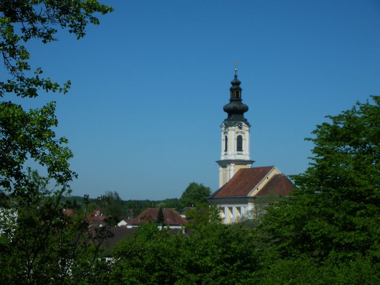
Раб (Raab, Raab)
- ярмарочная коммуна в федеральной земле Верхняя Австрия, Австрия
 Hiking in Раб
Raab, located in Hungary, is known for its beautiful landscapes, historic sites, and extensive opportunities for hiking. The region features a mix of rolling hills, forests, and rivers, making it a picturesque area for outdoor enthusiasts.
Key Hiking Areas and Trails:
-
Raab National Park: This national park is renowned for its diverse flora and fauna. There are various marked trails that range in difficulty and length, suitable for both casual hikers and more experienced adventurers. The park's trails often provide scenic views of the surrounding hills and valleys.
-
Castle Tours: Hiking in the Raab region often includes stops at historic sites, such as castles and fortresses. These hikes can be a great way to combine physical activity with a bit of history, offering stunning views and unique architecture.
-
River Trails: The Raab River itself provides opportunities for riverside hikes. Trails along the riverbanks often allow for both peaceful walks and spots to observe local wildlife.
-
Wine Country: The area is also known for its vineyards. Some hiking routes lead through wine country, where hikers can enjoy the beautiful landscapes and perhaps stop for a tasting at local wineries.
Tips for Hiking in Raab:
- Check Trail Conditions: Before heading out, check local resources for trail conditions, as they can change with weather and seasons.
- Seasonal Considerations: Spring and fall are often the best times for hiking in this region, with mild temperatures and beautiful scenery. Summer can be quite hot, so plan accordingly.
- Prepare for Varied Terrain: The hikes can range from easy walks to more challenging ascents. Make sure to wear appropriate footwear and carry enough water and snacks.
- Respect Nature: As with all hiking, it's important to follow Leave No Trace principles to protect the natural beauty of Raab.
Overall, hiking in Raab offers a blend of nature, history, and culture, making it a rewarding experience for outdoor lovers.
- Страна:

- Почтовый код: 4760
- Телефонный код: 07762
- Код автомобильного номера: SD
- Координаты: 48° 21' 0" N, 13° 39' 0" E


- GPS треки (wikiloc): [Ссылка]
- Высота над уровнем моря: 381 м m
- Площадь: 23 кв.км
- Население: 2270
- Веб сайт: http://www.raab.eu/
- Википедия русская: wiki(ru)
- Википедия английская: wiki(en)
- Википедия национальная: wiki(de)
- Хранилище Wikidata: Wikidata: Q282437
- Катеория в википедии: [Ссылка]
- код Freebase: [/m/02pc5ws]
- код GeoNames: Альт: [7872129]
- код VIAF: Альт: [6146153090605252700]
- идентификатор местоположения ArchINFORM: [45771]
- код австрийского муниципалитета: [41414]
Граничит с регионами:
Целль-на-дер-Праме
Hiking in Целль-на-дер-Праме
Zell an der Pram is a charming village located in the Austrian state of Upper Austria, surrounded by beautiful landscapes that offer various hiking opportunities. The region is characterized by rolling hills, forests, and views of the surrounding countryside, making it an excellent destination for both casual walkers and avid hikers....
- Страна:
- Почтовый код: 4755
- Телефонный код: 07764
- Код автомобильного номера: SD
- Координаты: 48° 19' 0" N, 13° 38' 0" E
- GPS треки (wikiloc): [Ссылка]
- Высота над уровнем моря: 367 м m
- Площадь: 23.39 кв.км
- Население: 2013
- Веб сайт: [Ссылка]

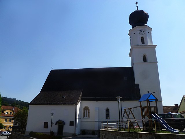
Альчвендт
Hiking in Альчвендт
Altschwendt is a charming small village located in Austria, which offers various outdoor activities, including hiking. The area around Altschwendt features beautiful landscapes, rolling hills, and opportunities to explore natural surroundings, making it ideal for both casual hikers and more experienced trekkers....
- Страна:
- Почтовый код: 4721
- Телефонный код: 07762
- Код автомобильного номера: SD
- Координаты: 48° 19' 0" N, 13° 41' 0" E
- GPS треки (wikiloc): [Ссылка]
- Высота над уровнем моря: 432 м m
- Площадь: 13 кв.км
- Население: 700
- Веб сайт: [Ссылка]

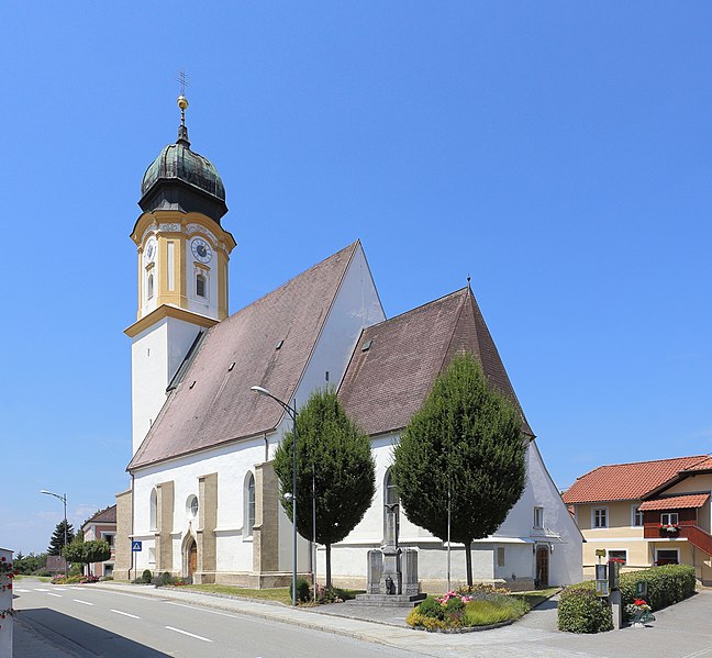
Андорф
- муниципалитет в Австрии
Hiking in Андорф
Andorf, located in the Innviertel region of Austria, offers a charming setting for hiking enthusiasts. The area is characterized by rolling hills, picturesque landscapes, and a mix of forests and open fields, making it suitable for various hiking levels....
- Страна:
- Почтовый код: 4770
- Телефонный код: 07766
- Код автомобильного номера: SD
- Координаты: 48° 22' 0" N, 13° 34' 0" E
- GPS треки (wikiloc): [Ссылка]
- Высота над уровнем моря: 346 м m
- Площадь: 38 кв.км
- Население: 5174
- Веб сайт: [Ссылка]
Энценкирхен
Hiking in Энценкирхен
Enzenkirchen is a scenic area located in Austria, known for its beautiful landscapes and outdoor recreational opportunities, including hiking. Although it may not be as well-known as some of Austria’s larger hiking destinations, it offers a charming experience for those looking to explore the countryside....
- Страна:
- Почтовый код: 4761
- Телефонный код: 07762
- Код автомобильного номера: SD
- Координаты: 48° 23' 0" N, 13° 39' 0" E
- GPS треки (wikiloc): [Ссылка]
- Высота над уровнем моря: 373 м m
- Площадь: 23 кв.км
- Население: 1772
- Веб сайт: [Ссылка]
Санкт-Виллибальд
Hiking in Санкт-Виллибальд
Sankt Willibald, located in Bavaria, Germany, is a charming area known for its scenic landscapes and hiking opportunities. The region is characterized by its beautiful rolling hills, lush forests, and picturesque views, making it ideal for both novice and experienced hikers....
- Страна:
- Почтовый код: 4762
- Телефонный код: 07762
- Код автомобильного номера: SD
- Координаты: 48° 22' 0" N, 13° 41' 0" E
- GPS треки (wikiloc): [Ссылка]
- Высота над уровнем моря: 455 м m
- Площадь: 15 кв.км
- Население: 1100
- Веб сайт: [Ссылка]