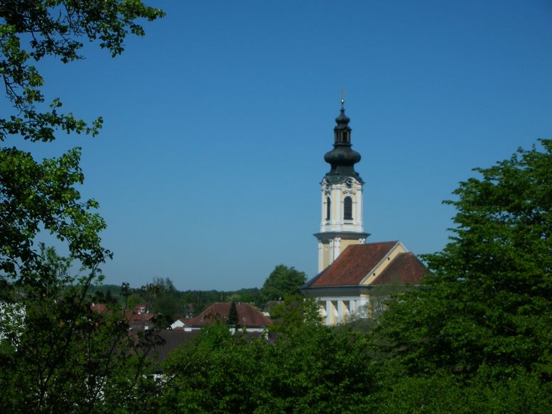
Андорф (Andorf, Andorf)
- муниципалитет в Австрии
 Hiking in Андорф
Andorf, located in the Innviertel region of Austria, offers a charming setting for hiking enthusiasts. The area is characterized by rolling hills, picturesque landscapes, and a mix of forests and open fields, making it suitable for various hiking levels.
Hiking Trails
-
Local Trails: There are several well-marked hiking trails in and around Andorf, ranging from easy family-friendly walks to more challenging routes for experienced hikers. The local municipality often provides information on trail conditions and maps.
-
Innviertel Region: Explore the broader area of Innviertel, which features a network of long-distance hiking trails. One notable trail is the Innovie, which connects various towns and showcases the region's natural beauty.
-
Nature Experiences: Along the trails, you can encounter diverse flora and fauna, along with breathtaking viewpoints of the surrounding landscapes.
Recommendations
- Best Time to Hike: The hiking season typically runs from spring to fall, with the best weather usually in late spring and early fall.
- Preparation: It’s important to wear appropriate hiking boots and clothing, carry enough water, and have a trail map or GPS device.
- Local Amenities: After a day of hiking, you can enjoy local hospitality in Andorf, with options for dining and accommodations that feature traditional Austrian cuisine.
Safety Tips
- Weather Awareness: Always check local weather forecasts before heading out, as conditions can change quickly.
- Trail Etiquette: Respect nature by sticking to marked paths, and be courteous to fellow hikers.
Overall, Andorf provides a peaceful and scenic environment for outdoor enthusiasts looking to explore the beauty of Austria's countryside. Whether you’re a beginner or an experienced hiker, there’s something for everyone to enjoy!
- Страна:

- Почтовый код: 4770
- Телефонный код: 07766
- Код автомобильного номера: SD
- Координаты: 48° 22' 0" N, 13° 34' 0" E


- GPS треки (wikiloc): [Ссылка]
- Высота над уровнем моря: 346 м m
- Площадь: 38 кв.км
- Население: 5174
- Веб сайт: http://www.andorf.at/
- Википедия русская: wiki(ru)
- Википедия английская: wiki(en)
- Википедия национальная: wiki(de)
- Хранилище Wikidata: Wikidata: Q492434
- Катеория в википедии: [Ссылка]
- код Freebase: [/m/03gvbhb]
- код GeoNames: Альт: [2782542]
- код VIAF: Альт: [246548490]
- место в MusicBrainz: [4cdb017e-ceea-44ff-aa72-c26f8d13045f]
- код австрийского муниципалитета: [41402]
Граничит с регионами:
Целль-на-дер-Праме
Hiking in Целль-на-дер-Праме
Zell an der Pram is a charming village located in the Austrian state of Upper Austria, surrounded by beautiful landscapes that offer various hiking opportunities. The region is characterized by rolling hills, forests, and views of the surrounding countryside, making it an excellent destination for both casual walkers and avid hikers....
- Страна:
- Почтовый код: 4755
- Телефонный код: 07764
- Код автомобильного номера: SD
- Координаты: 48° 19' 0" N, 13° 38' 0" E
- GPS треки (wikiloc): [Ссылка]
- Высота над уровнем моря: 367 м m
- Площадь: 23.39 кв.км
- Население: 2013
- Веб сайт: [Ссылка]

Тауфкирхен-на-Праме
Hiking in Тауфкирхен-на-Праме
Taufkirchen an der Pram is a picturesque village located in the Upper Austria region, known for its beautiful landscapes and rural charm. When it comes to hiking in the area, you'll find a variety of trails that showcase the natural beauty of the surrounding countryside. Here are some aspects to consider for hiking in Taufkirchen an der Pram:...
- Страна:
- Почтовый код: 4775
- Телефонный код: 07719
- Код автомобильного номера: SD
- Координаты: 48° 25' 0" N, 13° 32' 0" E
- GPS треки (wikiloc): [Ссылка]
- Высота над уровнем моря: 338 м m
- Площадь: 29.15 кв.км
- Население: 2925
- Веб сайт: [Ссылка]

Раб
- ярмарочная коммуна в федеральной земле Верхняя Австрия, Австрия
Hiking in Раб
Raab, located in Hungary, is known for its beautiful landscapes, historic sites, and extensive opportunities for hiking. The region features a mix of rolling hills, forests, and rivers, making it a picturesque area for outdoor enthusiasts....
- Страна:
- Почтовый код: 4760
- Телефонный код: 07762
- Код автомобильного номера: SD
- Координаты: 48° 21' 0" N, 13° 39' 0" E
- GPS треки (wikiloc): [Ссылка]
- Высота над уровнем моря: 381 м m
- Площадь: 23 кв.км
- Население: 2270
- Веб сайт: [Ссылка]
Энценкирхен
Hiking in Энценкирхен
Enzenkirchen is a scenic area located in Austria, known for its beautiful landscapes and outdoor recreational opportunities, including hiking. Although it may not be as well-known as some of Austria’s larger hiking destinations, it offers a charming experience for those looking to explore the countryside....
- Страна:
- Почтовый код: 4761
- Телефонный код: 07762
- Код автомобильного номера: SD
- Координаты: 48° 23' 0" N, 13° 39' 0" E
- GPS треки (wikiloc): [Ссылка]
- Высота над уровнем моря: 373 м m
- Площадь: 23 кв.км
- Население: 1772
- Веб сайт: [Ссылка]

Майрхоф
Hiking in Майрхоф
Mayrhofen, located in the Zillertal Valley of Austria, is a renowned destination for hiking enthusiasts. The region offers a stunning array of trails that cater to all skill levels, making it an ideal spot for both novice and experienced hikers. Here are some key points about hiking in Mayrhofen:...
- Страна:
- Почтовый код: 4777
- Телефонный код: 07767
- Код автомобильного номера: SD
- Координаты: 48° 21' 0" N, 13° 30' 0" E
- GPS треки (wikiloc): [Ссылка]
- Высота над уровнем моря: 430 м m
- Площадь: 5 кв.км
- Население: 322
- Веб сайт: [Ссылка]

Зигхартинг
Hiking in Зигхартинг
Sigharting is a lovely area in Austria that offers some wonderful hiking opportunities amidst picturesque landscapes. While it may not be as widely known as some other hiking destinations in the country, it still provides a variety of trails that cater to different skill levels....
- Страна:
- Почтовый код: 4771
- Телефонный код: 07766
- Код автомобильного номера: SD
- Координаты: 48° 24' 0" N, 13° 36' 0" E
- GPS треки (wikiloc): [Ссылка]
- Высота над уровнем моря: 343 м m
- Площадь: 5.66 кв.км
- Население: 848
- Веб сайт: [Ссылка]
Эггердинг
Hiking in Эггердинг
Eggerding, a small village located in Austria, is surrounded by beautiful landscapes that offer a range of hiking opportunities. The region is characterized by picturesque alpine scenery, rolling hills, and lush forests, making it a great destination for hikers of all skill levels....
- Страна:
- Почтовый код: 4773
- Телефонный код: 07767
- Код автомобильного номера: SD
- Координаты: 48° 21' 0" N, 13° 29' 0" E
- GPS треки (wikiloc): [Ссылка]
- Высота над уровнем моря: 382 м m
- Площадь: 22 кв.км
- Население: 1320
- Веб сайт: [Ссылка]
Дирсбах
Hiking in Дирсбах
Diersbach, situated in Austria, offers various hiking opportunities for both beginners and experienced hikers due to its picturesque landscapes and diverse terrain. Here are a few highlights you might find enjoyable:...
- Страна:
- Почтовый код: 4776
- Телефонный код: 07719
- Код автомобильного номера: SD
- Координаты: 48° 25' 0" N, 13° 34' 0" E
- GPS треки (wikiloc): [Ссылка]
- Высота над уровнем моря: 335 м m
- Площадь: 28 кв.км
- Население: 1583
- Веб сайт: [Ссылка]

Ламбрехтен
Hiking in Ламбрехтен
Lambrechten, a picturesque area located in Austria, is known for its natural beauty and offers excellent hiking opportunities. Surrounded by lush forests, rolling hills, and stunning alpine scenery, Lambrechten provides diverse trails suitable for all skill levels, from beginners to experienced hikers....
- Страна:
- Почтовый код: 4772
- Телефонный код: 07765
- Код автомобильного номера: RI
- Координаты: 48° 19' 5" N, 13° 30' 56" E
- GPS треки (wikiloc): [Ссылка]
- Высота над уровнем моря: 406 м m
- Площадь: 24 кв.км
- Население: 1300
- Веб сайт: [Ссылка]