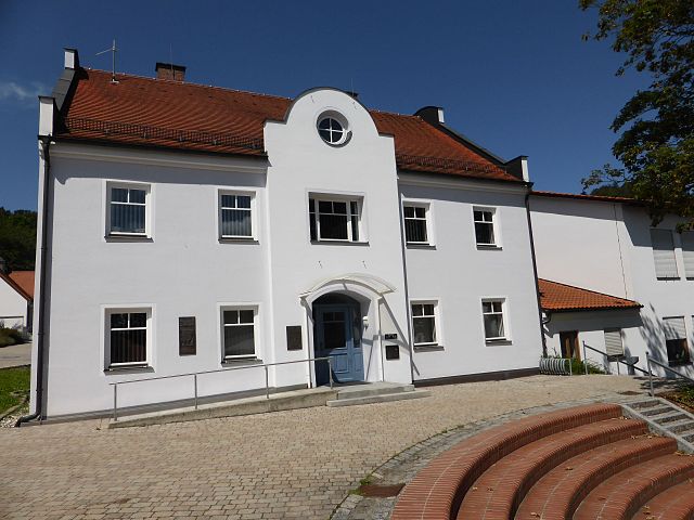
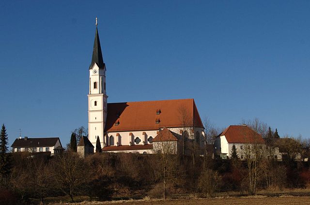
Ройт (Reut, Reut)

 Hiking in Ройт
Reut, located in central Israel near the city of Tel Aviv, is not typically known as a hiking destination compared to other regions in the country like the Galilee, the Golan Heights, or the Negev Desert. However, there are some opportunities for nature walks and outdoor activities in the surrounding areas.
Hiking Opportunities Near Reut:
-
Park HaMekafim: Close to Reut, this park offers various walking paths and green spaces. It's an excellent spot for family outings where you can enjoy shorter, easy hikes.
-
Yarkon Park (Ganei Yehoshua): Located to the east of Reut, this large urban park features trails along the Yarkon River, where you can enjoy walking, jogging, or cycling. This park is more urban but offers pleasant trails and picnic areas.
-
Tuval Forest: Not too far from Reut, this forest has several trails suitable for hiking and nature walks. It’s a great escape into nature while still being close to the city.
Hiking Tips:
- Weather: Always check the weather before you hike, as conditions can change quickly, especially in the warmer months.
- Hydration: Carry plenty of water, especially if you plan on hiking during the warmer parts of the day.
- Footwear: Wear sturdy hiking shoes that provide good support, especially if you're venturing onto rugged paths.
- Trail Maps: While some trails may be well-marked, consider bringing a map or using a hiking app to navigate.
Transportation:
Reut is well-connected by public transport, and you may be able to take buses or trains to reach nearby hiking destinations. Consider carpooling or using rideshare services if you’re going to more remote trails.
Conclusion:
While Reut itself might not have extensive hiking trails, the surrounding areas offer accessible and enjoyable outdoor experiences for hikers of all levels. Always remember to follow safe hiking practices and enjoy your time outdoors!
- Страна:

- Почтовый код: 84367
- Телефонный код: 08572
- Код автомобильного номера: PAN
- Координаты: 48° 18' 40" N, 12° 56' 34" E


- GPS треки (wikiloc): [Ссылка]
- Высота над уровнем моря: 460 м m
- Площадь: 30.75 кв.км
- Население: 1599
- Веб сайт: http://www.reut.de
- Википедия русская: wiki(ru)
- Википедия английская: wiki(en)
- Википедия национальная: wiki(de)
- Хранилище Wikidata: Wikidata: Q632954
- Катеория в википедии: [Ссылка]
- код Freebase: [/m/02pfn19]
- код GeoNames: Альт: [2847865]
- код VIAF: Альт: [247381614]
- ID отношения в OpenStreetMap: [957050]
- код GND: Альт: [4549416-2]
- идентификатор местоположения ArchINFORM: [14752]
- код темы Quora: [Reut]
- Bavarikon ID: [ODB_A00001629]
- идентификатор муниципалитетов в Германии: 09277140
Граничит с регионами:

Цайларн
Hiking in Цайларн
Zeilarn, located in Bavaria, Germany, offers a range of beautiful hiking opportunities for outdoor enthusiasts. The region is characterized by its scenic landscapes, rolling hills, and charming villages....
- Страна:
- Почтовый код: 84367
- Телефонный код: 08572
- Код автомобильного номера: PAN
- Координаты: 48° 18' 0" N, 12° 50' 0" E
- GPS треки (wikiloc): [Ссылка]
- Высота над уровнем моря: 450 м m
- Площадь: 28.9 кв.км
- Население: 2053
- Веб сайт: [Ссылка]

Зимбах-на-Инне
Hiking in Зимбах-на-Инне
Simbach am Inn, located on the border between Germany and Austria, offers a variety of hiking opportunities that showcase the natural beauty of the region. Here are some things to consider if you're planning a hiking excursion in or around Simbach am Inn:...
- Страна:
- Почтовый код: 84359
- Телефонный код: 08571
- Код автомобильного номера: PAN
- Координаты: 48° 16' 0" N, 13° 1' 0" E
- GPS треки (wikiloc): [Ссылка]
- Высота над уровнем моря: 350 м m
- Площадь: 47.33 кв.км
- Население: 8697
- Веб сайт: [Ссылка]
Юльбах
Hiking in Юльбах
Julbach, located in Austria, is a charming village nestled in the picturesque landscape of the Mühlviertel region, known for its lush forests, rolling hills, and scenic trails. Hiking in and around Julbach offers a variety of experiences for outdoor enthusiasts, ranging from leisurely walks to more challenging treks....
- Страна:
- Почтовый код: 84387
- Телефонный код: 08571
- Код автомобильного номера: PAN
- Координаты: 48° 15' 18" N, 12° 57' 33" E
- GPS треки (wikiloc): [Ссылка]
- Высота над уровнем моря: 383 м m
- Площадь: 11.3 кв.км
- Население: 1858
- Веб сайт: [Ссылка]

Виттибройт
Hiking in Виттибройт
Wittibreut, located in Bavaria, Germany, is a scenic area known for its beautiful landscapes and natural surroundings, making it a suitable location for hiking enthusiasts. Here are some key points to consider:...
- Страна:
- Почтовый код: 84384
- Телефонный код: 08574
- Код автомобильного номера: PAN
- Координаты: 48° 19' 45" N, 12° 59' 14" E
- GPS треки (wikiloc): [Ссылка]
- Высота над уровнем моря: 480 м m
- Площадь: 38.32 кв.км
- Население: 1872
- Веб сайт: [Ссылка]
Kirchdorf am Inn
Hiking in Kirchdorf am Inn
Kirchdorf am Inn is a charming village located in Bavaria, Germany, near the border with Austria. The area is known for its beautiful landscapes, making it a great destination for hiking enthusiasts. Here are some highlights and tips for hiking in and around Kirchdorf am Inn:...
- Страна:
- Почтовый код: 84375
- Телефонный код: 08571
- Код автомобильного номера: PAN
- Координаты: 48° 15' 0" N, 12° 59' 0" E
- GPS треки (wikiloc): [Ссылка]
- Высота над уровнем моря: 359 м m
- Площадь: 31.64 кв.км
- Население: 4064
- Веб сайт: [Ссылка]

Танн
Hiking in Танн
Hiking in Tann, Bavaria, offers a delightful experience with stunning landscapes, picturesque villages, and a range of trails for all levels of hikers. Nestled in the beautiful Bavarian region, Tann is surrounded by the rolling hills of the Bavarian Forest and offers a mix of well-marked trails, scenic views, and opportunities to immerse yourself in nature....
- Страна:
- Почтовый код: 84367
- Телефонный код: 08572
- Код автомобильного номера: PAN
- Координаты: 48° 19' 0" N, 12° 54' 0" E
- GPS треки (wikiloc): [Ссылка]
- Высота над уровнем моря: 476 м m
- Площадь: 37.55 кв.км
- Население: 3289
- Веб сайт: [Ссылка]