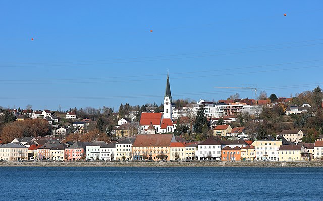
Рид (Ried in der Riedmark, Ried in der Riedmark)

- торговая община в Австрии, Верхняя Австрия, Перг
 Hiking in Рид
Ried in der Riedmark is a charming municipality located in Austria, nestled in the scenic landscape of Upper Austria. The area offers various hiking opportunities for both beginners and more experienced hikers, making it a great destination for outdoor enthusiasts.
Popular Hiking Trails
-
Riedmark Circuit:
- A circular trail that passes through beautiful countryside, offering stunning views of the surrounding hills and valleys. This trail is generally suitable for all skill levels.
-
Forest Trails:
- The nearby forests provide numerous trails where you can enjoy serene woods, spot wildlife, and experience a peaceful atmosphere. These trails can vary in difficulty, so you can choose according to your comfort level.
-
Nearby Hills:
- The Mühlviertel region, where Ried in der Riedmark is located, is characterized by rolling hills. There are numerous trails that lead up to hilltops, where you can enjoy panoramic views and the natural beauty of the area.
-
Theme Trails:
- Some organized theme trails explain the local flora, fauna, and history. These can offer a more enriching hiking experience, combining walking with learning.
Tips for Hiking in Ried in der Riedmark
- Seasonal Considerations: The best times to hike are usually spring and autumn when the weather is temperate, and the scenery is vibrant.
- Trail Maps: It’s advisable to carry a map or have a GPS device, as some trails may not be well-marked.
- Local Guidance: Consider hiring a local guide or joining a hiking group, especially if you're unfamiliar with the area.
- Safety First: Always check the weather conditions before heading out, and ensure you have appropriate gear, such as sturdy footwear, weather-appropriate clothing, and sufficient water and snacks.
Nearby Attractions
- Cultural Sites: After hiking, you might explore local cultural sites, such as churches and historical buildings in Ried in der Riedmark.
- Natural Parks: Consider exploring nearby natural parks for additional hiking opportunities and natural beauty.
In summary, Ried in der Riedmark offers a range of hiking options that allow you to connect with nature while enjoying the beautiful landscapes of Upper Austria. Whether you're looking for a leisurely stroll or a more challenging hike, there are plenty of trails that cater to all levels of experience.
- Страна:

- Почтовый код: 4312
- Телефонный код: 07238
- Код автомобильного номера: PE
- Координаты: 48° 16' 16" N, 14° 32' 44" E


- GPS треки (wikiloc): [Ссылка]
- Высота над уровнем моря: 306 м m
- Площадь: 32.6 кв.км
- Население: 4210
- Веб сайт: http://www.ried-riedmark.at/
- Википедия русская: wiki(ru)
- Википедия английская: wiki(en)
- Википедия национальная: wiki(de)
- Хранилище Wikidata: Wikidata: Q678534
- Галерея изображений в википедии: [Ссылка]
- Катеория в википедии: [Ссылка]
- Карты в википедии: [Ссылка]
- код Freebase: [/m/03gv7mf]
- код GeoNames: Альт: [7872074]
- код BNF: [123562349]
- код VIAF: Альт: [244722480]
- код австрийского муниципалитета: [41118]
Граничит с регионами:

Санкт-Георген-на-Гузене
Hiking in Санкт-Георген-на-Гузене
Sankt Georgen an der Gusen is a picturesque town located in Austria, known for its historical significance and beautiful landscapes. While it may not be as popular as some other hiking destinations in the region, it offers a variety of trails and outdoor activities for hiking enthusiasts....
- Страна:
- Телефонный код: 07237
- Код автомобильного номера: PE
- Координаты: 48° 16' 18" N, 14° 26' 54" E
- GPS треки (wikiloc): [Ссылка]
- Высота над уровнем моря: 262 м m
- Площадь: 7.12 кв.км
- Население: 4119
- Веб сайт: [Ссылка]
Маутхаузен
Hiking in Маутхаузен
Mauthausen, located in Austria, is best known for its historical significance due to the former concentration camp situated nearby. However, the region also offers beautiful hiking opportunities, particularly for those looking to explore the scenic landscapes of Upper Austria....
- Страна:
- Почтовый код: 4310
- Телефонный код: 07238
- Код автомобильного номера: PE
- Координаты: 48° 14' 31" N, 14° 31' 1" E
- GPS треки (wikiloc): [Ссылка]
- Высота над уровнем моря: 265 м m
- Площадь: 14.03 кв.км
- Население: 4936
- Веб сайт: [Ссылка]

Прегартен
Hiking in Прегартен
Pregarten, located in Upper Austria, is a charming town that serves as a gateway for various outdoor activities, including hiking. The surrounding landscape is characterized by gently rolling hills, lush forests, and picturesque natural scenery, making it an excellent destination for both beginner and experienced hikers....
- Страна:
- Почтовый код: 4230
- Телефонный код: 07236
- Код автомобильного номера: FR
- Координаты: 48° 21' 20" N, 14° 31' 50" E
- GPS треки (wikiloc): [Ссылка]
- Высота над уровнем моря: 425 м m
- Площадь: 27.8 кв.км
- Население: 5293
- Веб сайт: [Ссылка]


Швертберг
Hiking in Швертберг
Schwertberg, located in Upper Austria, is a great destination for hiking enthusiasts. The region is characterized by picturesque landscapes, lush forests, and rolling hills, making it suitable for various levels of hikers....
- Страна:
- Почтовый код: 4311
- Телефонный код: 07262
- Код автомобильного номера: PE
- Координаты: 48° 16' 18" N, 14° 35' 0" E
- GPS треки (wikiloc): [Ссылка]
- Высота над уровнем моря: 268 м m
- Площадь: 18.78 кв.км
- Население: 5365
- Веб сайт: [Ссылка]

Катсдорф
Hiking in Катсдорф
Katsdorf, located in the Upper Austria region, offers several charming hiking opportunities. The area is characterized by beautiful countryside, rolling hills, and scenic views, making it ideal for both beginners and experienced hikers....
- Страна:
- Почтовый код: 4223
- Телефонный код: 07235
- Код автомобильного номера: PE
- Координаты: 48° 19' 1" N, 14° 28' 27" E
- GPS треки (wikiloc): [Ссылка]
- Высота над уровнем моря: 306 м m
- Площадь: 14.66 кв.км
- Население: 3086
- Веб сайт: [Ссылка]

Лангенштайн
Hiking in Лангенштайн
Langenstein, a picturesque village in Austria, offers numerous opportunities for hiking enthusiasts. Nestled in the scenic landscapes of Styria, it provides access to lush forests, rolling hills, and stunning mountain views. Here’s a general overview of hiking in the area:...
- Страна:
- Телефонный код: 07237
- Код автомобильного номера: PE
- Координаты: 48° 15' 31" N, 14° 27' 51" E
- GPS треки (wikiloc): [Ссылка]
- Высота над уровнем моря: 245 м m
- Площадь: 12.36 кв.км
- Население: 2534
- Веб сайт: [Ссылка]
Трагвайн
Hiking in Трагвайн
Tragwein, located in the Upper Austria region, offers some serene hiking opportunities amidst beautiful natural landscapes. The area is characterized by rolling hills, lush forests, and picturesque views of the surrounding countryside, making it an excellent choice for hikers of all levels....
- Страна:
- Почтовый код: 4284
- Телефонный код: 07263
- Код автомобильного номера: FR
- Координаты: 48° 19' 50" N, 14° 37' 20" E
- GPS треки (wikiloc): [Ссылка]
- Высота над уровнем моря: 491 м m
- Площадь: 39.5 кв.км
- Население: 3082
- Веб сайт: [Ссылка]

Вартберг-об-дер-Айст
Hiking in Вартберг-об-дер-Айст
Wartberg ob der Aist is a charming municipality located in the northern region of Upper Austria, surrounded by beautiful landscapes that make it an excellent destination for hiking enthusiasts. The area is characterized by scenic hills, lush forests, and tranquil rivers, providing a variety of hiking trails suitable for different skill levels....
- Страна:
- Почтовый код: 4224
- Телефонный код: 07236
- Код автомобильного номера: FR
- Координаты: 48° 20' 50" N, 14° 30' 30" E
- GPS треки (wikiloc): [Ссылка]
- Высота над уровнем моря: 477 м m
- Площадь: 19.4 кв.км
- Население: 4222
- Веб сайт: [Ссылка]