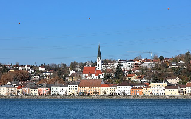
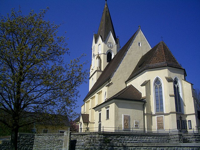
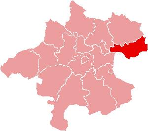
Швертберг (Schwertberg, Schwertberg)

 Hiking in Швертберг
Schwertberg, located in Upper Austria, is a great destination for hiking enthusiasts. The region is characterized by picturesque landscapes, lush forests, and rolling hills, making it suitable for various levels of hikers.
Hiking Options:
-
Trails: Schwertberg offers several well-marked hiking trails that vary in difficulty. You can find gentle paths suitable for families, as well as more challenging routes for experienced hikers.
-
Scenic Views: Many trails provide stunning views over the surrounding hills and valleys, including the Danube River, which is not far from Schwertberg. Elevated points along the trails are perfect for taking in the beautiful scenery.
-
Nature Parks: Nearby nature parks, such as the Mühlviertel region, offer additional trails and opportunities for observing local wildlife and flora.
-
Cultural Stops: Some trails may lead you to historical sites or local points of interest, enriching your hiking experience with a sense of the local culture.
Tips for Hiking in Schwertberg:
- Weather Check: Always check the weather conditions before heading out, as they can change quickly in mountainous areas.
- Equipment: Wear appropriate hiking gear, including sturdy boots and weather-appropriate clothing. Make sure to bring water, snacks, and a basic first-aid kit.
- Trail Maps: Familiarize yourself with the trails by obtaining maps or using hiking apps to ensure you stay on track.
- Respect Nature: Stay on designated trails, pack out what you pack in, and enjoy the natural beauty responsibly.
Nearby Attractions:
- Danube River: Consider extending your trip to explore the hiking paths along the river, which are often flat and offer beautiful scenic routes.
- Local Towns: Explore nearby towns for local restaurants and shops that offer traditional Austrian food and culture.
Hiking in Schwertberg can be a delightful experience, whether you're looking for a leisurely walk or a more strenuous hike. Always remember to hike within your limits and enjoy the beautiful landscape!
- Страна:

- Почтовый код: 4311
- Телефонный код: 07262
- Код автомобильного номера: PE
- Координаты: 48° 16' 18" N, 14° 35' 0" E


- GPS треки (wikiloc): [Ссылка]
- Высота над уровнем моря: 268 м m
- Площадь: 18.78 кв.км
- Население: 5365
- Веб сайт: http://www.schwertberg.at/
- Википедия русская: wiki(ru)
- Википедия английская: wiki(en)
- Википедия национальная: wiki(de)
- Хранилище Wikidata: Wikidata: Q675709
- Катеория в википедии: [Ссылка]
- Карты в википедии: [Ссылка]
- код Freebase: [/m/0ckrl6]
- код GeoNames: Альт: [7873176]
- код VIAF: Альт: [133206869]
- идентификатор местоположения ArchINFORM: [10538]
- код LCNAF: Альт: [n89616159]
- место в MusicBrainz: [4a34e31b-00a3-4733-aa73-f2a5ece16b94]
- код австрийского муниципалитета: [41124]
Граничит с регионами:

Перг
Hiking in Перг
Hiking in Perg, Austria, is a delightful experience, offering a variety of trails that cater to different skill levels and interests. The region is characterized by its beautiful landscapes, including rolling hills, forests, and scenic vistas overlooking the Danube River....
- Страна:
- Почтовый код: 4320
- Телефонный код: 07262
- Код автомобильного номера: PE
- Координаты: 48° 15' 1" N, 14° 38' 1" E
- GPS треки (wikiloc): [Ссылка]
- Высота над уровнем моря: 250 м m
- Площадь: 26.44 кв.км
- Население: 8388
- Веб сайт: [Ссылка]
Маутхаузен
Hiking in Маутхаузен
Mauthausen, located in Austria, is best known for its historical significance due to the former concentration camp situated nearby. However, the region also offers beautiful hiking opportunities, particularly for those looking to explore the scenic landscapes of Upper Austria....
- Страна:
- Почтовый код: 4310
- Телефонный код: 07238
- Код автомобильного номера: PE
- Координаты: 48° 14' 31" N, 14° 31' 1" E
- GPS треки (wikiloc): [Ссылка]
- Высота над уровнем моря: 265 м m
- Площадь: 14.03 кв.км
- Население: 4936
- Веб сайт: [Ссылка]

Нарн-им-Махланде
Hiking in Нарн-им-Махланде
Naarn im Machlande, located in Austria, is not as widely known as some of the country's larger hiking destinations, but it offers a charming experience for those looking to explore the scenic beauty of the region. The area is characterized by its gentle rolling hills, lush fields, and picturesque landscapes, making it suitable for amateur and experienced hikers alike....
- Страна:
- Почтовый код: 4331
- Телефонный код: 07262
- Код автомобильного номера: PE
- Координаты: 48° 13' 36" N, 14° 36' 32" E
- GPS треки (wikiloc): [Ссылка]
- Высота над уровнем моря: 245 м m
- Площадь: 35.17 кв.км
- Население: 3690
- Веб сайт: [Ссылка]

Аллерхайлиген
Hiking in Аллерхайлиген
Allerheiligen im Mühlkreis is a charming village located in Upper Austria, surrounded by lush landscapes and offering a range of hiking opportunities. Here are some aspects to consider if you're planning to hike in this area:...
- Страна:
- Почтовый код: 4320
- Телефонный код: 07262
- Код автомобильного номера: PE
- Координаты: 48° 18' 1" N, 14° 38' 1" E
- GPS треки (wikiloc): [Ссылка]
- Высота над уровнем моря: 568 м m
- Площадь: 20.2 кв.км
- Население: 1261
- Веб сайт: [Ссылка]
Рид
- торговая община в Австрии, Верхняя Австрия, Перг
Hiking in Рид
Ried in der Riedmark is a charming municipality located in Austria, nestled in the scenic landscape of Upper Austria. The area offers various hiking opportunities for both beginners and more experienced hikers, making it a great destination for outdoor enthusiasts....
- Страна:
- Почтовый код: 4312
- Телефонный код: 07238
- Код автомобильного номера: PE
- Координаты: 48° 16' 16" N, 14° 32' 44" E
- GPS треки (wikiloc): [Ссылка]
- Высота над уровнем моря: 306 м m
- Площадь: 32.6 кв.км
- Население: 4210
- Веб сайт: [Ссылка]
Трагвайн
Hiking in Трагвайн
Tragwein, located in the Upper Austria region, offers some serene hiking opportunities amidst beautiful natural landscapes. The area is characterized by rolling hills, lush forests, and picturesque views of the surrounding countryside, making it an excellent choice for hikers of all levels....
- Страна:
- Почтовый код: 4284
- Телефонный код: 07263
- Код автомобильного номера: FR
- Координаты: 48° 19' 50" N, 14° 37' 20" E
- GPS треки (wikiloc): [Ссылка]
- Высота над уровнем моря: 491 м m
- Площадь: 39.5 кв.км
- Население: 3082
- Веб сайт: [Ссылка]