Riederalp (Riederalp)

 Hiking in Riederalp
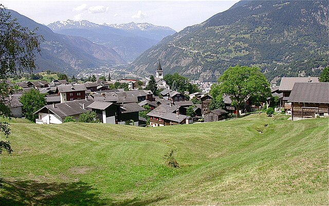
Riederalp, located in the Swiss Alps in the Valais canton, is a fantastic destination for hikers of all skill levels. Nestled at an elevation of about 1,900 meters, it offers stunning views of the surrounding mountains, including the iconic Matterhorn and the Aletsch Glacier, which is the largest glacier in the Alps and a UNESCO World Heritage site.
Hiking Trails
-
Aletsch Glacier Trail: This trail offers breathtaking views of the glacier as you hike along its edges. It's a moderate hike suitable for experienced hikers, and it allows you to appreciate the grandeur of the glacier up-close.
-
Riederalp to Bettmeralp: A scenic hike connecting the two alpine villages. It’s a relatively easy trail that offers panoramic views and is great for families.
-
Hiking to the Schönbiel Hut: A longer hike that challenges more seasoned hikers, leading to a cozy hut with spectacular views of the surrounding peaks.
-
Riederalp Circuit: This is a loop trail that showcases the beauty of the high alpine landscape and offers a chance to see local wildlife and plant life.
-
Moosfluh: For those looking for easier trails, the area around Moosfluh provides gentler paths suitable for families and beginners, with an incredible lookout point at the peak.
Best Time to Hike
The best time for hiking in Riederalp is typically from late June to early October when the trails are clear of snow. Summer is particularly beautiful as the alpine flowers bloom, and the weather is usually mild.
Accessibility
Riederalp is accessible by cable car from the valley and is a car-free zone, which adds to its charm. The area is also linked to a larger network of trails in the wider region, providing ample opportunities for hiking enthusiasts.
Tips for Hikers
- Prepare Adequately: Always check the weather before heading out, and consider your personal fitness level when choosing a trail.
- Hydration: Carry enough water, as alpine hikes can be demanding.
- Footwear: Wear sturdy hiking boots to tackle the varied terrain.
- Layering: Dress in layers to accommodate temperature changes, as conditions can shift rapidly in the mountains.
- Wildlife: Keep an eye out for local wildlife, but maintain a respectful distance.
Riederalp provides not only awe-inspiring scenery but also an opportunity to immerse yourself in the tranquility of the mountains. Whether you’re looking for challenging hikes or leisurely walks, this region has something for everyone.
- Страна:

- Почтовый код: 3987
- Телефонный код: 027
- Код автомобильного номера: VS
- Координаты: 46° 23' 0" N, 8° 2' 0" E


- GPS треки (wikiloc): [Ссылка]
- Высота над уровнем моря: 1905 м m
- Площадь: 21.04 кв.км
- Население: 481
- Веб сайт: http://www.riederalp.ch
- Википедия английская: wiki(en)
- Википедия национальная: wiki(de)
- Хранилище Wikidata: Wikidata: Q70321
- Катеория в википедии: [Ссылка]
- код Freebase: [/m/08hjxd]
- код GeoNames: Альт: [2659038]
- код VIAF: Альт: [122869920]
- ID отношения в OpenStreetMap: [1685359]
- код LCNAF: Альт: [n82206181]
- идентификатор HDS: [36301]
- код швейцарского муниципалитета: [6181]
Граничит с регионами:

Натерс
- община в Швейцарии
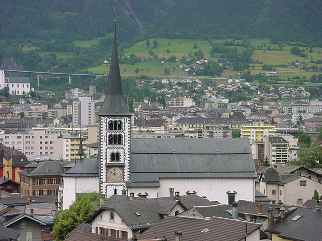
Hiking in Натерс
Naters is a picturesque municipality in the Valais region of Switzerland, located near the popular tourist destination of Brig. The area offers a variety of hiking opportunities, suitable for different skill levels and preferences. Here are some highlights and tips for hiking in Naters:...
- Страна:
- Почтовый код: 3904
- Телефонный код: 027
- Код автомобильного номера: VS
- Координаты: 46° 19' 25" N, 7° 59' 19" E
- GPS треки (wikiloc): [Ссылка]
- Высота над уровнем моря: 2774 м m
- Площадь: 101.26 кв.км
- Население: 9983
- Веб сайт: [Ссылка]
Termen
Hiking in Termen
Termen is a small municipality located in the southern region of Switzerland, known for its beautiful alpine landscapes. While it's not one of the most widely recognized hiking destinations compared to its neighbors, it does offer some excellent opportunities for hikers seeking tranquility and stunning views....
- Страна:
- Почтовый код: 3912
- Телефонный код: 027
- Код автомобильного номера: VS
- Координаты: 46° 19' 0" N, 8° 1' 0" E
- GPS треки (wikiloc): [Ссылка]
- Высота над уровнем моря: 925 м m
- Площадь: 18.8 кв.км
- Население: 913
- Веб сайт: [Ссылка]


Betten
Hiking in Betten
Betten is a picturesque village located in the Valais region of Switzerland, known for its stunning alpine scenery and outdoor activities, including hiking. Here are some key points about hiking in Betten:...
- Страна:
- Почтовый код: 3991
- Телефонный код: 027
- Код автомобильного номера: VS
- Координаты: 46° 22' 0" N, 8° 4' 0" E
- GPS треки (wikiloc): [Ссылка]
- Высота над уровнем моря: 1192 м m
- Площадь: 26.4 кв.км
- Веб сайт: [Ссылка]


Mörel-Filet
Hiking in Mörel-Filet
Mörel-Filet is a charming area located in the Valais region of Switzerland, nestled in the heart of the Alps. It offers a range of beautiful hiking trails, stunning landscapes, and opportunities for both novice and experienced hikers....
- Страна:
- Почтовый код: 3983
- Телефонный код: 027
- Код автомобильного номера: VS
- Координаты: 46° 21' 25" N, 8° 2' 53" E
- GPS треки (wikiloc): [Ссылка]
- Высота над уровнем моря: 746 м m
- Площадь: 8.4 кв.км
- Население: 678
- Веб сайт: [Ссылка]