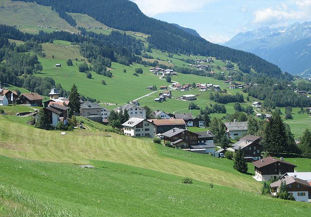
Ruis (Kreis Ruis)
 Hiking in Ruis
Ruis, located in the scenic region of Graubünden in Switzerland, is a lesser-known but beautiful area for hiking enthusiasts. The region is characterized by stunning mountain views, lush valleys, and traditional Swiss architecture. Although Ruis itself may not be as famous as some other Swiss hiking destinations, it offers a perfect backdrop for anyone looking to explore the great outdoors.
Hiking Trails
-
Ruis to Arosa: This is a moderate hike that takes you through picturesque meadows and forests, offering breathtaking views of the surrounding Alps. The trail is well-marked and typically takes a few hours to complete.
-
Flims and Laax: A short drive from Ruis, these areas boast an extensive network of well-maintained trails. You can explore routes that range from easy to challenging, with options for both day hikes and longer treks.
-
Valley Trails: The valleys surrounding Ruis often have flatter, easier trails that are great for leisurely walks or family hikes. Many of these trails follow rivers and offer peaceful natural scenery.
Tips for Hiking in Ruis
- Check Weather Conditions: The weather can change quickly in the mountains, so it's important to check forecasts and dress in layers.
- Trail Maps: Make sure to carry a local hiking map or download hiking apps that provide GPS-enabled trails.
- Equipment: Good hiking boots are essential, and trekking poles can be helpful, especially on uneven terrain.
- Local Guidelines: Be sure to follow local guidelines and regulations regarding wildlife and plant preservation.
Best Time to Hike
The best time to hike in Ruis and the surrounding areas is typically from late spring (May) to early autumn (October). Summer months provide the best conditions, but early fall also brings stunning autumn colors.
Getting There
Ruis is accessible by car, and public transportation is available in the surrounding larger towns. From there, you can explore various trailheads.
Accommodations
While Ruis may have limited accommodations, nearby towns offer options ranging from hotels to guesthouses. It's advisable to book in advance, especially during peak hiking season.
Whether you are an experienced hiker or new to the trails, Ruis provides a wonderful opportunity to enjoy the serenity and beauty of the Swiss Alps. Happy hiking!
- Страна:

- Координаты: 46° 46' 42" N, 9° 9' 3" E


- GPS треки (wikiloc): [Ссылка]
- Википедия английская: wiki(en)
- Википедия национальная: wiki(de)
- Хранилище Wikidata: Wikidata: Q688669
- Катеория в википедии: [Ссылка]
- код Freebase: [/m/0rpj899]
Включает регионы:

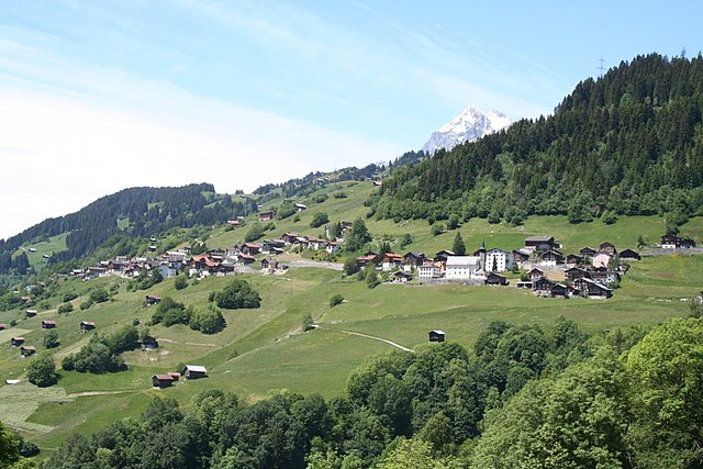
Оберзаксен
Hiking in Оберзаксен
Obersaxen is a beautiful region located in the scenic Swiss Alps, specifically in the canton of Graubünden. It is known for its stunning landscapes, diverse trails, and outdoor activities, making it an excellent destination for hiking enthusiasts. Here are some highlights and tips for hiking in Obersaxen:...
- Страна:
- Почтовый код: 7134
- Телефонный код: 081
- Координаты: 46° 44' 0" N, 9° 6' 0" E
- GPS треки (wikiloc): [Ссылка]
- Высота над уровнем моря: 1281 м m
- Площадь: 61.77 кв.км
- Веб сайт: [Ссылка]


Вальтенсбург
Hiking in Вальтенсбург
Waltensburg-Vuorz is a beautiful destination located in the Graubünden region of Switzerland, known for its stunning landscapes and outdoor activities, including hiking. The area offers a variety of trails that cater to different skill levels, making it an ideal spot for both casual hikers and experienced trekkers....
- Страна:
- Почтовый код: 7158
- Телефонный код: 081
- Код автомобильного номера: GR
- Координаты: 46° 46' 35" N, 9° 7' 0" E
- GPS треки (wikiloc): [Ссылка]
- Высота над уровнем моря: 1876 м m
- Площадь: 32.31 кв.км
- Население: 325
- Веб сайт: [Ссылка]

Андиаст
Hiking in Андиаст
Andiast is a picturesque village located in the canton of Graubünden in Switzerland, known for its stunning landscapes and excellent hiking opportunities. Nestled in the Swiss Alps, it offers a variety of trails suitable for hikers of all levels, from leisurely walks to more challenging treks....
- Страна:
- Почтовый код: 7159
- Телефонный код: 081
- Код автомобильного номера: GR
- Координаты: 46° 46' 59" N, 9° 6' 59" E
- GPS треки (wikiloc): [Ссылка]
- Высота над уровнем моря: 1178 м m
- Площадь: 13.63 кв.км
- Население: 211
- Веб сайт: [Ссылка]

Сиат
Hiking in Сиат
Siat is a charming village located in the picturesque region of the Swiss Alps. While it may not be as well-known as some major hiking destinations in Switzerland, it offers a range of beautiful trails and outdoor experiences for those looking to explore its stunning landscapes....
- Страна:
- Почтовый код: 7157
- Телефонный код: 081
- Код автомобильного номера: GR
- Координаты: 46° 46' 59" N, 9° 9' 0" E
- GPS треки (wikiloc): [Ссылка]
- Высота над уровнем моря: 1296 м m
- Площадь: 13.48 кв.км
- Население: 181
- Веб сайт: [Ссылка]


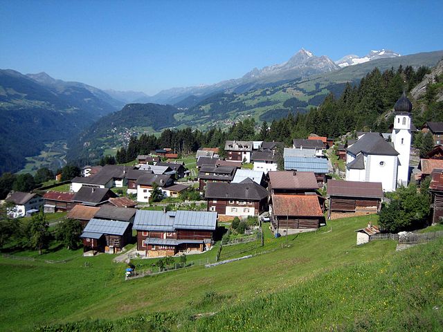
Руэун
Hiking in Руэун
Rueun is a picturesque village located in the Swiss canton of Graubünden, nestled among the stunning landscapes of the Swiss Alps. It serves as a great base for hiking enthusiasts looking to explore the natural beauty of the region. Here are some key points to know about hiking in and around Rueun:...
- Страна:
- Почтовый код: 7156
- Телефонный код: 081
- Код автомобильного номера: GR
- Координаты: 46° 45' 59" N, 9° 8' 59" E
- GPS треки (wikiloc): [Ссылка]
- Высота над уровнем моря: 788 м m
- Площадь: 11.58 кв.км
- Веб сайт: [Ссылка]


Пиньиу
Hiking in Пиньиу
Pigniu is a small village located in the Swiss canton of Grisons (Graubünden), known for its stunning alpine scenery and charming landscapes. Hiking in this region offers a variety of trails that cater to different skill levels, making it a great destination for both beginners and experienced hikers....
- Страна:
- Почтовый код: 7156
- Телефонный код: 081
- Код автомобильного номера: GR
- Координаты: 46° 47' 59" N, 9° 5' 59" E
- GPS треки (wikiloc): [Ссылка]
- Высота над уровнем моря: 1301 м m
- Площадь: 17.98 кв.км
- Веб сайт: [Ссылка]