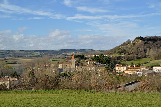
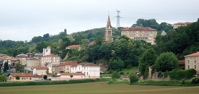
Saint-Avit (Saint-Avit)

 Hiking in Saint-Avit
Saint-Avit, located in the Drôme department in southeastern France, offers a variety of hiking opportunities thanks to its stunning natural landscapes, rolling hills, and charming villages. The area is characterized by its diverse terrain, which includes vineyards, forests, and rocky outcrops, making it ideal for outdoor enthusiasts.
Hiking Trails
-
Cultural and Scenic Trails: Many trails in the region not only offer beautiful views but also pass through historical sites, such as old stone villages, churches, and castles. These trails often provide insight into the local heritage and culture.
-
Nature Trails: The surrounding countryside features trails that navigate through picturesque natural settings, which might include the Drôme River and various flora and fauna. These trails can be great for birdwatching and observing local wildlife.
-
Guided Hikes: Some local organizations or hiking clubs may offer guided hikes. These can provide a richer experience, as guides often share knowledge about the biodiversity and history of the area.
Recommended Hiking Tips
- Preparation: Make sure to wear appropriate hiking shoes and bring enough water, food, and snacks, especially if you plan to be out for several hours.
- Weather: Check the weather conditions before you head out, as they can change quickly in the region.
- Maps and Navigation: Familiarize yourself with the trails and consider carrying a map or GPS device, as not all trails may be well-marked.
- Respect Nature: Follow local guidelines, stay on marked paths, and leave no trace to preserve the natural beauty of the area.
Nearby Attractions
- Vercors Natural Regional Park: Not far from Saint-Avit, this park offers even more hiking options and is known for its dramatic cliffs, diverse ecosystems, and rich wildlife.
- Local Vineyards: Take time to enjoy a tour of local vineyards; many of them offer tastings that can be a lovely way to relax after a day of hiking.
In summary, hiking in Saint-Avit, Drôme, can be a rewarding experience with its beautiful landscapes, cultural richness, and opportunities for exploration. Whether you're a seasoned hiker or a beginner, there’s something to enjoy for everyone.
- Страна:

- Почтовый код: 26330
- Координаты: 45° 11' 48" N, 4° 58' 11" E


- GPS треки (wikiloc): [Ссылка]
- Площадь: 8.94 кв.км
- Население: 298
- Веб сайт: https://www.saint-avit-drome.fr/
- Википедия английская: wiki(en)
- Википедия национальная: wiki(fr)
- Хранилище Wikidata: Wikidata: Q661171
- Катеория в википедии: [Ссылка]
- код Freebase: [/m/03mhjxz]
- номер SIREN: [212602932]
- код BNF: [15253153t]
- код муниципалитета INSEE: 26293
Граничит с регионами:

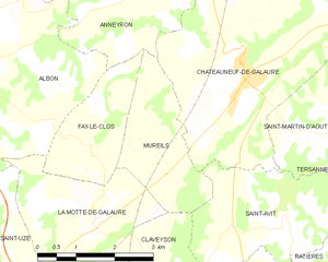
Mureils
- коммуна во Франции
Hiking in Mureils
It seems like you might be referring to a specific area or hiking location, but "Mureils" doesn't appear to be a widely recognized hiking destination or location as of my last knowledge update in October 2023. It’s possible you meant a different location with a similar name or a less commonly known local site....
- Страна:
- Почтовый код: 26240
- Координаты: 45° 12' 32" N, 4° 55' 48" E
- GPS треки (wikiloc): [Ссылка]
- Площадь: 5.45 кв.км
- Население: 466


Saint-Martin-d'Août
- коммуна во Франции
Hiking in Saint-Martin-d'Août
Saint-Martin-d'Août is a beautiful location for hiking enthusiasts, situated in the Rhône-Alpes region of France. This village is surrounded by the stunning natural landscapes of the Vercors and the Drôme Provençale, offering a variety of hiking trails that cater to different skill levels....
- Страна:
- Почтовый код: 26330
- Координаты: 45° 13' 3" N, 4° 59' 5" E
- GPS треки (wikiloc): [Ссылка]
- Площадь: 7.67 кв.км
- Население: 381

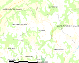
Tersanne
- коммуна во Франции
Hiking in Tersanne
Tersanne is a picturesque region in the French Alps, known for its stunning landscapes, diverse wildlife, and a variety of hiking trails catering to different skill levels. Hiking in this area offers a unique opportunity to experience the natural beauty of the Alps, from lush valleys and meandering rivers to towering mountain peaks....
- Страна:
- Почтовый код: 26390
- Координаты: 45° 13' 34" N, 5° 1' 2" E
- GPS треки (wikiloc): [Ссылка]
- Площадь: 9.49 кв.км
- Население: 359


Bathernay
- коммуна во Франции
Hiking in Bathernay
Bathernay is a charming commune in the Rhône department of France, nestled in the Auvergne-Rhône-Alpes region. While it may not be as widely known as some other hiking destinations, the surrounding areas offer beautiful landscapes and opportunities for outdoor exploration....
- Страна:
- Почтовый код: 26260
- Координаты: 45° 10' 46" N, 4° 59' 39" E
- GPS треки (wikiloc): [Ссылка]
- Площадь: 5.71 кв.км
- Население: 247
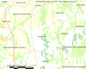
Claveyson
- коммуна во Франции
Hiking in Claveyson
It seems there might be a misunderstanding with the name "Claveyson," as I couldn't find any specific hiking location by that name in my database. It’s possible you might be referring to a different area, or perhaps it’s a lesser-known trail or region....
- Страна:
- Почтовый код: 26240
- Координаты: 45° 10' 50" N, 4° 55' 48" E
- GPS треки (wikiloc): [Ссылка]
- Площадь: 16.13 кв.км
- Население: 877

Châteauneuf-de-Galaure
- коммуна во Франции
Hiking in Châteauneuf-de-Galaure
Châteauneuf-de-Galaure is a charming village located in the Auvergne-Rhône-Alpes region of France, known for its picturesque landscapes and access to hiking trails. Here are some points of interest for hiking in and around Châteauneuf-de-Galaure:...
- Страна:
- Почтовый код: 26330
- Координаты: 45° 13' 55" N, 4° 57' 25" E
- GPS треки (wikiloc): [Ссылка]
- Площадь: 18.08 кв.км
- Население: 1770


Ratières
- коммуна во Франции
Hiking in Ratières
Ratières is a small village located in the Drôme department of the Auvergne-Rhône-Alpes region of France, not far from the Vercors Massif. It offers a peaceful environment surrounded by nature, making it an attractive spot for hiking enthusiasts. Here’s what you can expect when hiking in the area:...
- Страна:
- Почтовый код: 26330
- Координаты: 45° 10' 54" N, 4° 58' 5" E
- GPS треки (wikiloc): [Ссылка]
- Площадь: 9.01 кв.км
- Население: 268