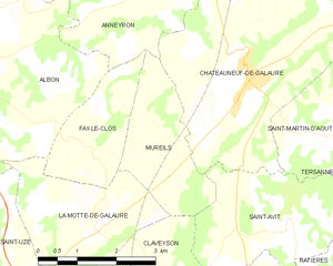
Châteauneuf-de-Galaure (Châteauneuf-de-Galaure)

- коммуна во Франции
 Hiking in Châteauneuf-de-Galaure
Châteauneuf-de-Galaure is a charming village located in the Auvergne-Rhône-Alpes region of France, known for its picturesque landscapes and access to hiking trails. Here are some points of interest for hiking in and around Châteauneuf-de-Galaure:
Scenic Trails
-
Natural Surroundings: The area is characterized by rolling hills, lush forests, and beautiful agricultural landscapes. The trails often provide scenic views of the Rhône Valley and the surrounding mountains.
-
Marked Hiking Paths: Various well-marked hiking trails are available for different skill levels, allowing hikers to enjoy leisurely walks or more challenging hikes.
-
Rivers and Waterfalls: The nearby Galaure River provides opportunities for walks that feature riverside paths, and there are spots where you can see waterfalls and enjoy nature.
Local Highlights
-
Historical Sites: As you hike, you might come across historical buildings or remnants of ancient structures, adding a cultural aspect to your journey.
-
Flora and Fauna: The region boasts rich biodiversity. Keep an eye out for local wildlife and various plant species along the trails.
-
Wine Trails: Châteauneuf-de-Galaure lies near wine-growing regions. Some hiking routes may lead through vineyards, where you can enjoy tastings and learn about local viticulture.
Hiking Tips
-
Seasonal Considerations: Spring and fall are ideal times for hiking in this region, offering pleasant weather and beautiful foliage. Summers can be warm, while winters might present challenges with snow in higher areas.
-
Equipment: Wear suitable hiking boots and clothing, and bring plenty of water and snacks, especially for longer hikes.
-
Navigation: Make sure to carry a map or GPS device, as some trails may not always be well-signposted.
-
Cultural Etiquette: Respect local customs and private lands while hiking; some paths may cross private property.
Conclusion
Châteauneuf-de-Galaure offers a wonderful hiking experience for nature lovers and those seeking to explore the beautiful landscapes of southeastern France. Whether you're looking for a relaxing stroll or a more rigorous hike, this area has something to offer for everyone. Enjoy your adventure!
- Страна:

- Почтовый код: 26330
- Координаты: 45° 13' 55" N, 4° 57' 25" E


- GPS треки (wikiloc): [Ссылка]
- Площадь: 18.08 кв.км
- Население: 1770
- Википедия английская: wiki(en)
- Википедия национальная: wiki(fr)
- Хранилище Wikidata: Wikidata: Q863711
- Катеория в википедии: [Ссылка]
- код Freebase: [/m/07xx0x]
- код GeoNames: Альт: [3026241]
- номер SIREN: [212600837]
- код BNF: [15252944t]
- код муниципалитета INSEE: 26083
Граничит с регионами:

Mureils
- коммуна во Франции
Hiking in Mureils
It seems like you might be referring to a specific area or hiking location, but "Mureils" doesn't appear to be a widely recognized hiking destination or location as of my last knowledge update in October 2023. It’s possible you meant a different location with a similar name or a less commonly known local site....
- Страна:
- Почтовый код: 26240
- Координаты: 45° 12' 32" N, 4° 55' 48" E
- GPS треки (wikiloc): [Ссылка]
- Площадь: 5.45 кв.км
- Население: 466


Saint-Sorlin-en-Valloire
- коммуна во Франции
Hiking in Saint-Sorlin-en-Valloire
Saint-Sorlin-en-Valloire is a picturesque village located in the French Alps, known for its stunning natural beauty and an array of outdoor activities, especially hiking. Here are some highlights and tips for hiking in this beautiful area:...
- Страна:
- Почтовый код: 26210
- Координаты: 45° 17' 21" N, 4° 57' 5" E
- GPS треки (wikiloc): [Ссылка]
- Площадь: 26.5 кв.км
- Население: 2233


Saint-Martin-d'Août
- коммуна во Франции
Hiking in Saint-Martin-d'Août
Saint-Martin-d'Août is a beautiful location for hiking enthusiasts, situated in the Rhône-Alpes region of France. This village is surrounded by the stunning natural landscapes of the Vercors and the Drôme Provençale, offering a variety of hiking trails that cater to different skill levels....
- Страна:
- Почтовый код: 26330
- Координаты: 45° 13' 3" N, 4° 59' 5" E
- GPS треки (wikiloc): [Ссылка]
- Площадь: 7.67 кв.км
- Население: 381


Hauterives
- коммуна во Франции
Hiking in Hauterives
Hauterives is a charming village located in the Drôme department of southeastern France, known for its scenic landscapes and rich cultural heritage. While it might not be as well-known as some major hiking destinations, it offers several opportunities for those looking to explore nature and enjoy the outdoors....
- Страна:
- Почтовый код: 26390
- Координаты: 45° 15' 20" N, 5° 1' 35" E
- GPS треки (wikiloc): [Ссылка]
- Площадь: 30.51 кв.км
- Население: 1904


Saint-Avit
Hiking in Saint-Avit
Saint-Avit, located in the Drôme department in southeastern France, offers a variety of hiking opportunities thanks to its stunning natural landscapes, rolling hills, and charming villages. The area is characterized by its diverse terrain, which includes vineyards, forests, and rocky outcrops, making it ideal for outdoor enthusiasts....
- Страна:
- Почтовый код: 26330
- Координаты: 45° 11' 48" N, 4° 58' 11" E
- GPS треки (wikiloc): [Ссылка]
- Площадь: 8.94 кв.км
- Население: 298
- Веб сайт: [Ссылка]

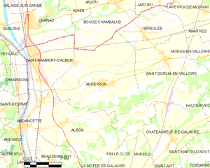
Аннейрон
- коммуна во Франции
Hiking in Аннейрон
Anneyron is a charming town located in the Drôme department in southeastern France. Nestled in the Rhône Valley, it's a great starting point for exploring the surrounding natural landscapes. Here are some highlights and tips for hiking in and around Anneyron:...
- Страна:
- Почтовый код: 26140
- Координаты: 45° 16' 16" N, 4° 53' 16" E
- GPS треки (wikiloc): [Ссылка]
- Площадь: 36.23 кв.км
- Население: 3924
- Веб сайт: [Ссылка]