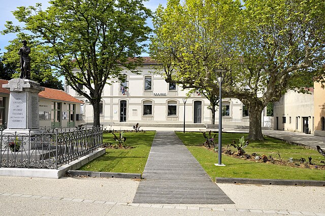
Saint-Bardoux (Saint-Bardoux)

- коммуна во Франции
 Hiking in Saint-Bardoux
Saint-Bardoux, located in the Rhône-Alpes region of France, offers a variety of hiking opportunities for both beginners and experienced hikers. Here are some key points to consider when hiking in this picturesque area:
Trails and Scenery
- Diverse Terrain: The trails around Saint-Bardoux feature a mix of forests, meadows, and panoramic views of the surrounding countryside and mountains. The natural beauty is particularly striking in the spring and fall.
- Trail Difficulty: There are hiking trails of varying difficulty levels, from easy walks suitable for families to more challenging routes that may require a good level of fitness and experience. Always check trail markers and maps before setting out.
Popular Hiking Routes
- Local Trail Networks: Look for marked hiking networks that connect to nearby villages and points of interest. Some trails may lead to local vineyards or historical sites.
- Guided Hikes: Consider joining a guided hike to gain insights into the local flora, fauna, and history.
Preparation and Safety
- Weather: Always check the weather forecast before setting out, as conditions can change quickly in mountainous areas.
- Gear: Wear sturdy, comfortable hiking shoes and dress in layers. It's also a good idea to carry a map, compass, and sufficient water and snacks.
- Stay on Trails: To help preserve the environment, stick to marked trails and be mindful of wildlife.
Best Time to Hike
- Spring and Fall: These seasons offer pleasant temperatures and stunning natural colors, making them ideal for hiking.
- Summer: It can get hot, so plan hikes for early morning or late afternoon. Be sure to stay hydrated.
Local Amenities
- Accommodations: Nearby villages may offer various lodging options, from hotels to guesthouses. It’s wise to book in advance, especially during peak tourist seasons.
- Dining: After a day of hiking, enjoy local cuisine at nearby restaurants or cafés, sampling regional specialties that the Rhône-Alpes area is known for.
Conclusion
Hiking in Saint-Bardoux can be a rewarding experience with its beautiful landscapes and diverse trails. Make sure to plan ahead, pack appropriately, and enjoy the stunning natural surroundings!
- Страна:

- Почтовый код: 26260
- Координаты: 45° 5' 8" N, 4° 58' 22" E


- GPS треки (wikiloc): [Ссылка]
- Площадь: 10.63 кв.км
- Население: 600
- Википедия английская: wiki(en)
- Википедия национальная: wiki(fr)
- Хранилище Wikidata: Wikidata: Q1075897
- Катеория в википедии: [Ссылка]
- код Freebase: [/m/03mhjy9]
- код GeoNames: Альт: [6430205]
- номер SIREN: [212602940]
- код BNF: [152531545]
- код муниципалитета INSEE: 26294
Граничит с регионами:


Saint-Donat-sur-l'Herbasse
- коммуна во Франции
Hiking in Saint-Donat-sur-l'Herbasse
Saint-Donat-sur-l'Herbasse is a charming commune located in the Drôme department in the Auvergne-Rhône-Alpes region of southeastern France. While it may not be as famous as some of the larger hiking destinations, it offers beautiful landscapes and a variety of trails suitable for hikers of all levels....
- Страна:
- Почтовый код: 26260
- Координаты: 45° 7' 23" N, 4° 58' 58" E
- GPS треки (wikiloc): [Ссылка]
- Площадь: 19.52 кв.км
- Население: 4018


Granges-les-Beaumont
- коммуна во Франции
Hiking in Granges-les-Beaumont
Granges-les-Beaumont is a charming village located in the Auvergne-Rhône-Alpes region of France, known for its picturesque landscapes and outdoor activities, including hiking. Here are some key points to consider if you’re planning a hiking trip in this area:...
- Страна:
- Почтовый код: 26600
- Координаты: 45° 3' 4" N, 4° 58' 59" E
- GPS треки (wikiloc): [Ссылка]
- Высота над уровнем моря: 120 м m
- Площадь: 7.51 кв.км
- Население: 943


Роман-сюр-Изер
- коммуна во Франции
Hiking in Роман-сюр-Изер
Romans-sur-Isère is a charming town located in the Drôme department in southeastern France. Nestled near the banks of the Isère River, the area offers a variety of hiking opportunities that allow you to explore the natural beauty of the region....
- Страна:
- Почтовый код: 26100
- Координаты: 45° 2' 44" N, 5° 3' 3" E
- GPS треки (wikiloc): [Ссылка]
- Площадь: 33.08 кв.км
- Население: 33465
- Веб сайт: [Ссылка]

Пейрен
- коммуна во Франции
Hiking in Пейрен
Peyrins is a charming commune located in the Drôme department in southeastern France, nestled in the foothills of the French Alps. While it may not be as widely known as some of the larger hiking destinations in the region, Peyrins and its surrounding areas offer several scenic walking trails that cater to a range of hiking experiences....
- Страна:
- Почтовый код: 26380
- Координаты: 45° 5' 35" N, 5° 2' 50" E
- GPS треки (wikiloc): [Ссылка]
- Площадь: 25.16 кв.км
- Население: 2708


Clérieux
- коммуна во Франции
Hiking in Clérieux
Clérieux is a charming commune located in the Drôme region of southeastern France. It offers a variety of hiking opportunities for outdoor enthusiasts looking to explore the beautiful natural landscape of the area. Here are some details about hiking in Clérieux:...
- Страна:
- Почтовый код: 26260
- Координаты: 45° 4' 41" N, 4° 57' 34" E
- GPS треки (wikiloc): [Ссылка]
- Площадь: 13.53 кв.км
- Население: 2021
- Веб сайт: [Ссылка]