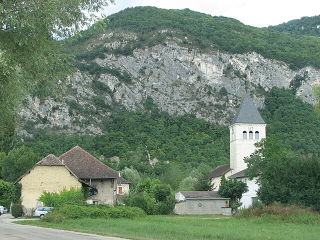
Сен-Бенуа (Saint-Bois, Saint-Bois)
- коммуна во Франции
 Hiking in Сен-Бенуа
Saint-Bois is a small village located in the Vosges department in northeastern France. While it may not be as widely known as some other hiking destinations, the surrounding areas offer beautiful landscapes and a variety of trails that cater to hikers of all skill levels.
Hiking in and around Saint-Bois:
1. :
- The Vosges mountains feature rolling hills, dense forests, and picturesque views, making for enjoyable hiking experiences.
- Look for marked trails such as the GR5 (Grande Randonnée) which runs through the Vosges and offers breathtaking vistas.
2. :
- The region is rich in biodiversity. While hiking, you may encounter various species of flora and fauna.
- Take the time to appreciate the natural beauty, including streams, lakes, and reserved areas.
3. :
- It’s often helpful to stop by the local tourist office or consult hiking maps available in the area for up-to-date trail conditions and recommendations.
- Ensure you check for any local regulations regarding staying on designated paths, especially in protected areas.
4. :
- Always wear appropriate hiking gear, including good footwear and clothing suitable for changing weather conditions.
- Carry enough water and snacks for your hike, and inform someone of your plans if you’re hiking alone.
5. :
- Consider exploring nearby towns or points of interest such as Gérardmer or La Bresse, which provide additional hiking opportunities and outdoor activities.
- Enrich your hiking experience by visiting local attractions and enjoying the regional cuisine.
Whether you’re looking for a leisurely walk through nature or a more challenging hike, the area around Saint-Bois offers a range of options. Always prepare adequately and respect the environment as you explore this lovely region!
- Страна:

- Почтовый код: 01300
- Координаты: 45° 41' 58" N, 5° 38' 7" E


- GPS треки (wikiloc): [Ссылка]
- Площадь: 9.42 кв.км
- Население: 146
- Википедия русская: wiki(ru)
- Википедия английская: wiki(en)
- Википедия национальная: wiki(fr)
- Хранилище Wikidata: Wikidata: Q776844
- Катеория в википедии: [Ссылка]
- Карты в википедии: [Ссылка]
- код Freebase: [/m/081qmc]
- код Freebase: [/m/081qmc]
- код GeoNames: Альт: [6424654]
- код GeoNames: Альт: [6424654]
- код муниципалитета INSEE: 01340
- код муниципалитета INSEE: 01340
Граничит с регионами:


Арбиньё
- коммуна в департаменте Эн, Франция
Hiking in Арбиньё
Arbignieu is a charming village in the Ain department of the Auvergne-Rhône-Alpes region in southeastern France. The area surrounding Arbignieu offers various hiking opportunities, showcasing beautiful landscapes, forests, and the peaceful ambiance of the French countryside....
- Страна:
- Почтовый код: 01300
- Координаты: 45° 43' 42" N, 5° 39' 2" E
- GPS треки (wikiloc): [Ссылка]
- Площадь: 13.07 кв.км
- Население: 491

Конзьё
- коммуна во Франции
Hiking in Конзьё
Conzieu is a small village located in the Ain department of the Auvergne-Rhône-Alpes region in France. While it may not be as widely known as some other hiking destinations in the Alps, it offers various opportunities for nature lovers and hikers to explore its beautiful landscapes....
- Страна:
- Почтовый код: 01300
- Координаты: 45° 43' 34" N, 5° 36' 26" E
- GPS треки (wikiloc): [Ссылка]
- Площадь: 7.2 кв.км
- Население: 146
Arboys-en-Bugey
Hiking in Arboys-en-Bugey
Arboys-en-Bugey, located in the Ain department of the Auvergne-Rhône-Alpes region in southeastern France, offers a scenic and diverse landscape that is great for hiking enthusiasts. The area is characterized by its rolling hills, forests, and stunning views of the surrounding mountains, making it an excellent spot for both casual walkers and experienced hikers....
- Страна:
- Почтовый код: 01300
- Координаты: 45° 43' 46" N, 5° 39' 4" E
- GPS треки (wikiloc): [Ссылка]
- Площадь: 22.49 кв.км
- Веб сайт: [Ссылка]
Groslée-Saint-Benoit
Hiking in Groslée-Saint-Benoit
Groslée-Saint-Benoît is a picturesque commune located in the Auvergne-Rhône-Alpes region of France. Known for its stunning natural landscapes, it offers a variety of hiking opportunities that attract outdoor enthusiasts....
- Страна:
- Почтовый код: 01680; 01300
- Координаты: 45° 41' 42" N, 5° 35' 14" E
- GPS треки (wikiloc): [Ссылка]
- Площадь: 28.92 кв.км
Saint-Benoît
- коммуна во Франции
Hiking in Saint-Benoît
Saint-Benoît, located in the Ain department of France, offers a picturesque setting for hiking enthusiasts. Nestled in the foothills of the Jura Mountains, the area features a mix of lush forests, rolling hills, and stunning views of the surrounding landscape, making it an ideal location for both casual walkers and experienced hikers....
- Страна:
- Почтовый код: 01300
- Координаты: 45° 41' 40" N, 5° 35' 19" E
- GPS треки (wikiloc): [Ссылка]
- Площадь: 21.65 кв.км
- Население: 833
Коломьё
- коммуна во Франции
Hiking in Коломьё
Colomieu is a small commune located in the Auvergne-Rhône-Alpes region of France, known for its beautiful natural landscapes and outdoor activities. While it may not be as widely recognized as some larger hiking destinations, it offers various opportunities for those seeking to explore the great outdoors in a picturesque environment....
- Страна:
- Почтовый код: 01300
- Координаты: 45° 43' 59" N, 5° 37' 19" E
- GPS треки (wikiloc): [Ссылка]
- Площадь: 5.96 кв.км
- Население: 130
- Веб сайт: [Ссылка]

Премейзель
- коммуна во Франции
Hiking in Премейзель
Prémeyzel is a charming Alpine village located in the Canton of Vaud, Switzerland. It's positioned at an altitude of approximately 1,300 meters (4,265 feet), nestled in the Jura Mountains, which makes it a great spot for hiking enthusiasts. Here are some key aspects to consider when hiking in and around Prémeyzel:...
- Страна:
- Почтовый код: 01300
- Координаты: 45° 41' 2" N, 5° 38' 53" E
- GPS треки (wikiloc): [Ссылка]
- Площадь: 7.63 кв.км
- Население: 238
- Веб сайт: [Ссылка]