Saint-Bonnet-de-Valclérieux (Saint-Bonnet-de-Valclérieux)

- коммуна во Франции
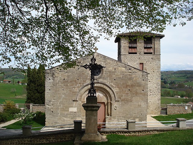
 Hiking in Saint-Bonnet-de-Valclérieux
Saint-Bonnet-de-Valclérieux is a charming village located in the Auvergne-Rhône-Alpes region of France, nestled in the picturesque countryside. The area is known for its natural beauty and offers a range of hiking opportunities, making it a great destination for outdoor enthusiasts.
Trails and Routes
-
Local Footpaths: There are various well-marked local hiking trails that allow you to explore the surrounding landscapes, including forests, hills, and beautiful views of the Rhône valley. Many of these paths are suitable for various skill levels, from beginners to more experienced hikers.
-
GR Trails: The village is situated near several Grande Randonnée (GR) trails, which are long-distance hiking routes that traverse beautiful regions of France. Check the local maps for routes that connect to these trails.
-
Scenic Views: Hikes around Saint-Bonnet-de-Valclérieux often reward adventurers with breathtaking panoramas of the surrounding hills and valleys. Don’t forget to bring your camera!
Nature and Wildlife
While hiking, you can encounter diverse flora and fauna. The region is home to various species of trees, wildflowers, and wildlife. Keep an eye out for birds and small mammals as you trek along the trails.
Seasonal Considerations
- Spring and Summer: These seasons are ideal for hiking due to mild weather and blooming vegetation. Be cautious of ticks in grassy areas.
- Fall: Autumn offers stunning foliage and is a lovely time for hiking, but temperatures can start to drop, so dress accordingly.
- Winter: Some trails can be accessible during winter, but snow and ice may make hiking more challenging. Proper gear is essential.
Safety Tips
- Ensure you have a suitable map or a GPS device, as some trails may not be well marked.
- Carry sufficient water and snacks, especially on longer hikes.
- Wear appropriate hiking gear and sturdy boots.
- Check the weather forecast before heading out, and be prepared for changes in conditions.
Local Amenities
After a day of hiking, you might want to explore the local village, enjoy a meal at one of the local eateries, or even visit nearby towns for more cultural experiences.
Whether you’re looking for a peaceful nature walk or an adventurous hike, Saint-Bonnet-de-Valclérieux offers a beautiful setting to connect with nature.
- Страна:

- Почтовый код: 26350
- Координаты: 45° 11' 43" N, 5° 8' 35" E


- GPS треки (wikiloc): [Ссылка]
- Площадь: 8.29 кв.км
- Население: 217
- Википедия английская: wiki(en)
- Википедия национальная: wiki(fr)
- Хранилище Wikidata: Wikidata: Q1075849
- Катеория в википедии: [Ссылка]
- код Freebase: [/m/03mhk4j]
- номер SIREN: [212602973]
- код BNF: [152531576]
- код муниципалитета INSEE: 26297
Граничит с регионами:


Дьоне
- коммуна во Франции
Hiking in Дьоне
Dionay, located in the Auvergne-Rhône-Alpes region of France, is a picturesque area that offers beautiful hiking opportunities, particularly for those who enjoy nature, mountainous landscapes, and the tranquility of the countryside....
- Страна:
- Почтовый код: 38160
- Координаты: 45° 12' 11" N, 5° 13' 11" E
- GPS треки (wikiloc): [Ссылка]
- Площадь: 14.01 кв.км
- Население: 117
- Веб сайт: [Ссылка]


Montrigaud
- коммуна во Франции
Hiking in Montrigaud
Montrigaud is a charming commune located in the Isère department in the Auvergne-Rhône-Alpes region of southeastern France. This area offers various hiking opportunities, particularly for those looking to enjoy scenic views and natural landscapes....
- Страна:
- Почтовый код: 26350
- Координаты: 45° 13' 8" N, 5° 7' 52" E
- GPS треки (wikiloc): [Ссылка]
- Площадь: 28.73 кв.км
- Население: 482


Montmiral
Hiking in Montmiral
Montmiral, located in the picturesque region of the Occitanie near the Tarn department in France, offers a charming hiking experience surrounded by stunning landscapes and historical architecture. The area is known for its rolling hills, vineyards, and medieval villages, making it an excellent destination for outdoor enthusiasts and history buffs alike....
- Страна:
- Почтовый код: 26750
- Координаты: 45° 9' 19" N, 5° 8' 59" E
- GPS треки (wikiloc): [Ссылка]
- Площадь: 26.69 кв.км
- Население: 652
- Веб сайт: [Ссылка]


Saint-Laurent-d'Onay
- коммуна во Франции
Hiking in Saint-Laurent-d'Onay
Saint-Laurent-d'Onay is a beautiful commune located in the French region of Auvergne-Rhône-Alpes. While it is lesser-known compared to some of the more famous hiking destinations in France, it offers a peaceful setting with opportunities for hiking enthusiasts to explore its natural landscapes....
- Страна:
- Почтовый код: 26350
- Координаты: 45° 10' 56" N, 5° 6' 5" E
- GPS треки (wikiloc): [Ссылка]
- Площадь: 6.28 кв.км
- Население: 152

Miribel
Hiking in Miribel
Miribel is a picturesque commune in the Drôme department of southeastern France, surrounded by stunning landscapes that are perfect for hiking enthusiasts. The region is characterized by its rolling hills, scenic vineyards, and lush forests, making it an ideal destination for outdoor activities....
- Страна:
- Почтовый код: 26350
- Координаты: 45° 11' 57" N, 5° 6' 39" E
- GPS треки (wikiloc): [Ссылка]
- Высота над уровнем моря: 393 м m
- Площадь: 6.55 кв.км
- Население: 298