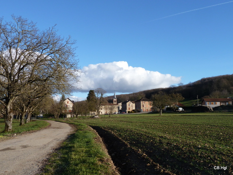
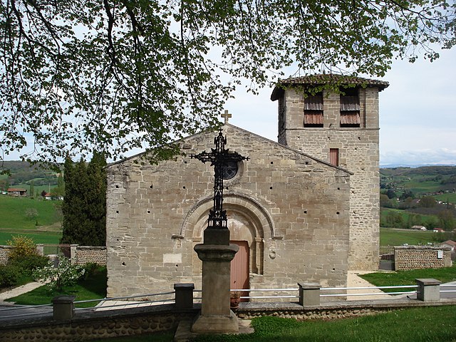
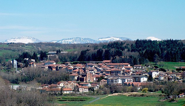
Montrigaud (Montrigaud)

- коммуна во Франции
 Hiking in Montrigaud
Montrigaud is a charming commune located in the Isère department in the Auvergne-Rhône-Alpes region of southeastern France. This area offers various hiking opportunities, particularly for those looking to enjoy scenic views and natural landscapes.
Hiking Trails and Features:
-
Scenic Views: The region surrounding Montrigaud is characterized by rolling hills, valleys, and agricultural landscapes, making for beautiful vistas along the trails.
-
Diversity of Terrain: Hikers can expect a mix of terrains, including forested paths, open fields, and possibly some hills that provide elevation gains for more challenging hikes.
-
Wildlife and Flora: The varied ecosystems here can be home to diverse wildlife, and you'll likely encounter a variety of flora that blooms throughout the seasons. Spring and summer offer vibrant wildflowers while fall brings colorful foliage.
-
Nearby Trails: Consider exploring the nearby Vercors Regional Natural Park, which offers extensive hiking trails and is renowned for its dramatic limestone cliffs, caves, and rich biodiversity.
Tips for Hiking in Montrigaud:
- Trail Maps: Before heading out, it's beneficial to obtain a trail map or guide to ensure you find the best routes suited to your ability level.
- Weather Check: Always check the weather report, as conditions can change rapidly in mountainous terrain.
- Stay Hydrated and Pack Food: Bring plenty of water and snacks, especially if you plan to hike for several hours.
- Respect the Environment: Follow Leave No Trace principles to protect the natural beauty of the area.
Suggested Equipment:
- Footwear: Proper hiking boots or shoes with good grip are essential.
- Clothing: Dress in layers, as temperatures can vary, and consider moisture-wicking fabrics.
- Navigation: A GPS device or a smartphone with downloaded maps can help if you venture into less marked areas.
Additional Activities:
If hiking is part of a broader outdoor experience, consider enjoying other activities like cycling, wildlife watching, or exploring local villages to experience the culture and cuisine of the region.
In summary, Montrigaud offers a unique and enjoyable hiking experience, perfect for those looking to immerse themselves in the natural beauty of southeastern France. Happy hiking!
- Страна:

- Почтовый код: 26350
- Координаты: 45° 13' 8" N, 5° 7' 52" E


- GPS треки (wikiloc): [Ссылка]
- Площадь: 28.73 кв.км
- Население: 482
- Википедия английская: wiki(en)
- Википедия национальная: wiki(fr)
- Хранилище Wikidata: Wikidata: Q1014973
- Катеория в википедии: [Ссылка]
- код Freebase: [/m/03mgjtr]
- код GeoNames: Альт: [6430150]
- номер SIREN: [212602106]
- код BNF: [15253071g]
- код муниципалитета INSEE: 26210
Граничит с регионами:


Дьоне
- коммуна во Франции
Hiking in Дьоне
Dionay, located in the Auvergne-Rhône-Alpes region of France, is a picturesque area that offers beautiful hiking opportunities, particularly for those who enjoy nature, mountainous landscapes, and the tranquility of the countryside....
- Страна:
- Почтовый код: 38160
- Координаты: 45° 12' 11" N, 5° 13' 11" E
- GPS треки (wikiloc): [Ссылка]
- Площадь: 14.01 кв.км
- Население: 117
- Веб сайт: [Ссылка]


Сен-Клер-сюр-Галор
- коммуна во Франции
Hiking in Сен-Клер-сюр-Галор
Saint-Clair-sur-Galaure, a picturesque village in the Drôme department of southeastern France, offers a delightful environment for hiking enthusiasts. The region is characterized by its rolling hills, lush landscapes, and scenic views of the surrounding countryside....
- Страна:
- Почтовый код: 38940
- Координаты: 45° 15' 37" N, 5° 8' 40" E
- GPS треки (wikiloc): [Ссылка]
- Площадь: 15.3 кв.км
- Население: 280

Монфалькон
- коммуна во Франции
Hiking in Монфалькон
Montfalcon is a scenic area that offers various hiking opportunities, particularly for those who appreciate nature and outdoor activities. While specific trails and conditions can change, here are some general insights into hiking in Montfalcon:...
- Страна:
- Почтовый код: 38940
- Координаты: 45° 15' 16" N, 5° 10' 18" E
- GPS треки (wikiloc): [Ссылка]
- Площадь: 5.82 кв.км
- Население: 123


Saint-Christophe-et-le-Laris
- коммуна во Франции
Hiking in Saint-Christophe-et-le-Laris
Saint-Christophe-et-le-Laris is a picturesque commune located in the Drôme department in southeastern France. While it may not be as widely known as some larger hiking areas, it offers beautiful landscapes and opportunities for outdoor activities in a serene environment....
- Страна:
- Почтовый код: 26350
- Координаты: 45° 12' 36" N, 5° 4' 19" E
- GPS треки (wikiloc): [Ссылка]
- Площадь: 11.35 кв.км
- Население: 413


Saint-Bonnet-de-Valclérieux
- коммуна во Франции
Hiking in Saint-Bonnet-de-Valclérieux
Saint-Bonnet-de-Valclérieux is a charming village located in the Auvergne-Rhône-Alpes region of France, nestled in the picturesque countryside. The area is known for its natural beauty and offers a range of hiking opportunities, making it a great destination for outdoor enthusiasts....
- Страна:
- Почтовый код: 26350
- Координаты: 45° 11' 43" N, 5° 8' 35" E
- GPS треки (wikiloc): [Ссылка]
- Площадь: 8.29 кв.км
- Население: 217

Miribel
Hiking in Miribel
Miribel is a picturesque commune in the Drôme department of southeastern France, surrounded by stunning landscapes that are perfect for hiking enthusiasts. The region is characterized by its rolling hills, scenic vineyards, and lush forests, making it an ideal destination for outdoor activities....
- Страна:
- Почтовый код: 26350
- Координаты: 45° 11' 57" N, 5° 6' 39" E
- GPS треки (wikiloc): [Ссылка]
- Высота над уровнем моря: 393 м m
- Площадь: 6.55 кв.км
- Население: 298

Руабон
- коммуна во Франции
Hiking in Руабон
Roybon, located in the Auvergne-Rhône-Alpes region of France, offers several hiking opportunities for outdoor enthusiasts. The area is characterized by its beautiful landscapes, ranging from forests to rolling hills, making it ideal for both novice and experienced hikers....
- Страна:
- Почтовый код: 38940
- Координаты: 45° 15' 31" N, 5° 14' 39" E
- GPS треки (wikiloc): [Ссылка]
- Площадь: 67.31 кв.км
- Население: 1229
- Веб сайт: [Ссылка]


Le Grand-Serre
- коммуна во Франции
Hiking in Le Grand-Serre
Le Grand-Serre is a beautiful hiking destination located in the French Alps, specifically in the department of Isère. This area offers stunning mountain scenery, diverse wildlife, and a variety of trails suitable for different skill levels. Here are some key points to consider when planning a hike in Le Grand-Serre:...
- Страна:
- Почтовый код: 26530
- Координаты: 45° 16' 12" N, 5° 6' 12" E
- GPS треки (wikiloc): [Ссылка]
- Площадь: 24.74 кв.км
- Население: 902