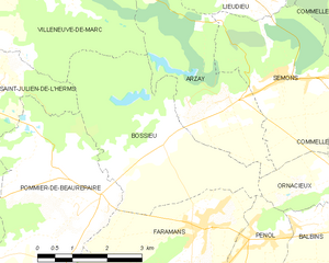
Сен-Жюльен-де-л'Эрмс (Saint-Julien-de-l'Herms, Saint-Julien-de-l'Herms)

- коммуна во Франции
 Hiking in Сен-Жюльен-де-л'Эрмс
Saint-Julien-de-l'Herms is a charming village located in the French Alps, known for its stunning natural landscapes and outdoor recreational opportunities.
Hiking Trails
Hiking in this region offers a variety of trails suitable for different skill levels, from easy walks to more challenging treks. The area is characterized by lush forests, scenic mountain views, and serene alpine meadows. Some popular hikes in and around Saint-Julien-de-l'Herms include:
-
Lac de la Moucherolle: This hike takes you to a picturesque mountain lake, providing stunning views of the surrounding peaks. The trail is manageable for most hikers.
-
Pic de la Belle Etoile: For those looking for a more challenging hike, this trail leads to a summit with breathtaking panoramic views. The ascent can be steep in places, so good physical fitness and proper gear are recommended.
-
Forest Trails: Many easy-to-moderate trails wind through the forests surrounding the village, perfect for a leisurely afternoon hike and admiring local flora and fauna.
Best Time to Hike
The best time for hiking in this area is typically from late spring (May) to early autumn (October), when the weather is mild and the trails are generally dry. Be cautious of snow and ice in the higher elevations during early spring and late fall.
Preparedness
- Equipment: Good hiking boots, appropriate clothing for the weather, a map or GPS device, and plenty of water are essential.
- Wildlife: Be aware that you might encounter local wildlife; respecting their space is important.
- Navigation: Familiarize yourself with the trails before setting out, and consider downloading maps or having a guide.
Local Tips
- Check local conditions or visitor centers for any trail updates or advice, especially regarding weather and trail availability.
- Engage with local hiking groups or guides if you want to learn more about the area and meet fellow hikers.
Hiking in Saint-Julien-de-l'Herms can be an unforgettable experience, offering both adventure and a chance to immerse yourself in the stunning natural beauty of the French Alps. Enjoy your hike!
- Страна:

- Почтовый код: 38122
- Координаты: 45° 25' 57" N, 5° 5' 40" E


- GPS треки (wikiloc): [Ссылка]
- Площадь: 9.17 кв.км
- Население: 144
- Википедия русская: wiki(ru)
- Википедия английская: wiki(en)
- Википедия национальная: wiki(fr)
- Хранилище Wikidata: Wikidata: Q1067832
- Катеория в википедии: [Ссылка]
- код Freebase: [/m/03nvgyz]
- номер SIREN: [213804065]
- код BNF: [152582163]
- код муниципалитета INSEE: 38406
Граничит с регионами:

Босье
- коммуна во Франции
Hiking in Босье
Bossieu, a small commune in the Isère department of southeastern France, offers some charming opportunities for hiking enthusiasts. The region is characterized by its picturesque landscapes, which include rolling hills, forests, and views of the surrounding mountains....
- Страна:
- Почтовый код: 38260
- Координаты: 45° 25' 1" N, 5° 8' 53" E
- GPS треки (wikiloc): [Ссылка]
- Площадь: 13.48 кв.км
- Население: 281
- Веб сайт: [Ссылка]


Вильнев-де-Марк
- коммуна во Франции
Hiking in Вильнев-де-Марк
Villeneuve-de-Marc is a charming village located in the Auvergne-Rhône-Alpes region of France. It's situated near the Rhône River and offers a picturesque landscape that is perfect for hiking enthusiasts. Here are some details to help you plan a hiking trip in and around Villeneuve-de-Marc:...
- Страна:
- Почтовый код: 38440
- Координаты: 45° 28' 33" N, 5° 6' 8" E
- GPS треки (wikiloc): [Ссылка]
- Площадь: 26.18 кв.км
- Население: 1140
- Веб сайт: [Ссылка]


Помье-де-Борепер
- коммуна во Франции
Hiking in Помье-де-Борепер
Pommier-de-Beaurepaire is a small commune in the Auvergne-Rhône-Alpes region of France, known for its scenic landscapes and rural charm. While it may not be as well-known as some major hiking destinations, it offers opportunities for outdoor enthusiasts to explore the beauty of the surrounding countryside....
- Страна:
- Почтовый код: 38260
- Координаты: 45° 24' 0" N, 5° 7' 11" E
- GPS треки (wikiloc): [Ссылка]
- Площадь: 19.16 кв.км
- Население: 710


Пизьё
- коммуна во Франции
Hiking in Пизьё
Pisieu, a commune located in the Auvergne-Rhône-Alpes region of France, offers beautiful landscapes and opportunities for hiking enthusiasts. While it may not be as widely known as some larger hiking destinations, it provides access to picturesque trails through the surrounding natural areas....
- Страна:
- Почтовый код: 38270
- Координаты: 45° 23' 14" N, 5° 3' 37" E
- GPS треки (wikiloc): [Ссылка]
- Площадь: 18.76 кв.км
- Население: 538
- Веб сайт: [Ссылка]

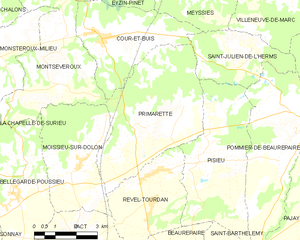
Примарет
- коммуна во Франции
Hiking in Примарет
It seems there might be a typo or misunderstanding regarding "Primarette." I am not familiar with a specific hiking location by that name. However, if you meant a different location, such as a national park, region, or trail, please clarify, and I’d be happy to provide information on hiking in that area!...
- Страна:
- Почтовый код: 38270
- Координаты: 45° 24' 7" N, 5° 1' 49" E
- GPS треки (wikiloc): [Ссылка]
- Площадь: 21.76 кв.км
- Население: 724
- Веб сайт: [Ссылка]


Мейсье
- коммуна во Франции
Hiking in Мейсье
Meyssiez is a small town located in the Auvergne-Rhône-Alpes region of France, surrounded by beautiful natural landscapes that make it a great spot for hiking enthusiasts. Here are some details about hiking in and around Meyssiez:...
- Страна:
- Почтовый код: 38440
- Координаты: 45° 28' 13" N, 5° 3' 15" E
- GPS треки (wikiloc): [Ссылка]
- Площадь: 13.88 кв.км
- Население: 619


Кур-э-Бюи
- коммуна во Франции
Hiking in Кур-э-Бюи
Cour-et-Buis is a picturesque commune located in the Isère department in the Auvergne-Rhône-Alpes region of southeastern France. It offers beautiful natural landscapes, ideal for hiking enthusiasts. Here are some highlights about hiking in the area:...
- Страна:
- Почтовый код: 38122
- Координаты: 45° 26' 25" N, 5° 0' 18" E
- GPS треки (wikiloc): [Ссылка]
- Высота над уровнем моря: 462 м m
- Площадь: 13.73 кв.км
- Население: 852
- Веб сайт: [Ссылка]