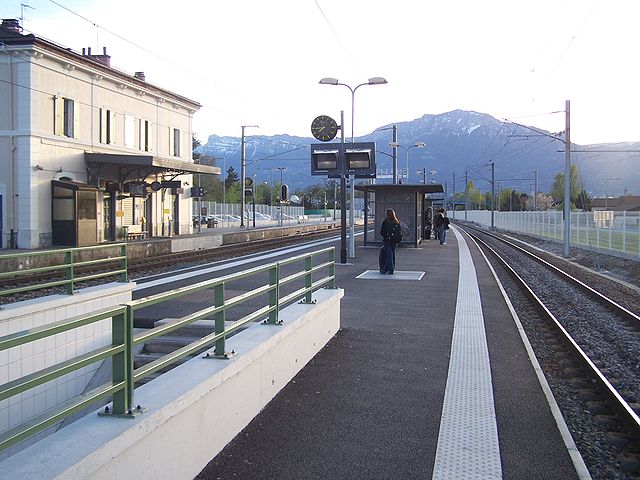
Сен-Мартен-д'Ирьяж (Saint-Martin-d'Uriage, Saint-Martin-d'Uriage)

- коммуна во Франции
 Hiking in Сен-Мартен-д'Ирьяж
Saint-Martin-d'Uriage is a charming commune located in the Isère department of southeastern France. Nestled at the foothills of the Belledonne mountain range, it offers a variety of hiking opportunities that cater to different skill levels and preferences.
Hiking Highlights in Saint-Martin-d'Uriage
-
Scenic Trails: The area is known for its beautiful landscapes, including lush forests, alpine meadows, and panoramic views of the surrounding mountains. The trails often showcase the stunning natural beauty of the Belledonne range.
-
Accessibility: Many of the trails in Saint-Martin-d'Uriage are easily accessible, making it suitable for families and beginner hikers. There are paths for more advanced hikers as well, providing a range of experiences.
-
Uriage Thermal Baths: After a day of hiking, consider visiting the nearby Uriage-les-Bains for its thermal baths. It’s a great way to relax and rejuvenate your body after a strenuous hike.
-
Trail Recommendations:
- Les Balcons de Belledonne: This trail offers spectacular views and can lead you to various alpine pastures and panoramic viewpoints.
- Le Col de Porte: A popular trail that leads to a mountain pass offering breathtaking vistas, ideal for intermediate hikers.
- Circuit des 7 Lacs: A longer hike suitable for more experienced trekkers, leading you to the area's beautiful lakes.
-
Wildlife and Flora: Be prepared to encounter diverse flora and fauna along the trails. The region is home to various species of plants and animals, including mountain goats and a variety of birds.
Practical Tips
- Season: The best time for hiking in this area is during the late spring, summer, and early fall when the weather is milder and the trails are more accessible.
- Gear: Wear appropriate hiking footwear and carry a map or GPS device. It’s also wise to bring enough water, snacks, and basic safety supplies.
- Local Regulations: Respect local wildlife and stay on designated trails to protect the environment.
Getting There
Saint-Martin-d'Uriage is easily reachable by car or public transport from Grenoble, making it a convenient destination for a day hike or a longer adventure.
Whether you’re looking for a peaceful stroll or a challenging hike, Saint-Martin-d'Uriage offers something for everyone. Enjoy the beauty of the French Alps and have a fantastic hiking experience!
- Страна:

- Почтовый код: 38410
- Координаты: 45° 9' 8" N, 5° 50' 21" E


- GPS треки (wikiloc): [Ссылка]
- Площадь: 29.69 кв.км
- Население: 5408
- Веб сайт: http://www.saint-martin-uriage.com
- Википедия русская: wiki(ru)
- Википедия английская: wiki(en)
- Википедия национальная: wiki(fr)
- Хранилище Wikidata: Wikidata: Q1153203
- Катеория в википедии: [Ссылка]
- код Freebase: [/m/03nvh1r]
- номер SIREN: [213804222]
- код BNF: [152582310]
- код VIAF: Альт: [145470890]
- код SUDOC: [050402528]
- код муниципалитета INSEE: 38422
Граничит с регионами:

Вонаве-ле-О
- коммуна во Франции
Hiking in Вонаве-ле-О
Vaulnaveys-le-Haut is a charming village located in the French Alps, nestled just south of Grenoble. This picturesque area offers a variety of hiking opportunities for outdoor enthusiasts of all skill levels. The beautiful landscapes, stunning mountain views, and rich natural surroundings make it an ideal destination for hiking....
- Страна:
- Почтовый код: 38410
- Координаты: 45° 7' 6" N, 5° 48' 37" E
- GPS треки (wikiloc): [Ссылка]
- Площадь: 19.86 кв.км
- Население: 3707
- Веб сайт: [Ссылка]


Ревель
Hiking in Ревель
Revel, located in the Isère department of the Auvergne-Rhône-Alpes region in southeastern France, is a fantastic destination for hiking enthusiasts. The area is characterized by its stunning alpine scenery, diverse landscapes, and a variety of trails suitable for different skill levels. Here are some highlights and tips for hiking in Revel:...
- Страна:
- Почтовый код: 38420
- Координаты: 45° 11' 9" N, 5° 52' 5" E
- GPS треки (wikiloc): [Ссылка]
- Площадь: 29.55 кв.км
- Население: 1340
- Веб сайт: [Ссылка]


Венон
- коммуна во Франции
Hiking in Венон
Venon, located in the Isère department of the Auvergne-Rhône-Alpes region in France, is a beautiful area for hiking, offering stunning landscapes and various trails to explore. The scenery showcases the natural beauty of the French Alps, with opportunities to see mountains, valleys, and lush greenery....
- Страна:
- Почтовый код: 38610
- Координаты: 45° 10' 19" N, 5° 48' 16" E
- GPS треки (wikiloc): [Ссылка]
- Площадь: 4.34 кв.км
- Население: 723
- Веб сайт: [Ссылка]


Эрбей
- коммуна во Франции
Hiking in Эрбей
Herbeys is a charming village located near the French Alps, offering a range of hiking opportunities for outdoor enthusiasts. Here are some highlights and tips for hiking in Herbeys:...
- Страна:
- Почтовый код: 38320
- Координаты: 45° 8' 20" N, 5° 47' 36" E
- GPS треки (wikiloc): [Ссылка]
- Площадь: 7.73 кв.км
- Население: 1364
- Веб сайт: [Ссылка]

Жьер
- коммуна во Франции
Hiking in Жьер
Gières is a charming village located in the Auvergne-Rhône-Alpes region of France, near the city of Grenoble. It boasts a scenic backdrop of the surrounding mountains, making it a wonderful place for hiking enthusiasts. Here are some key points to consider if you're planning to hike in or around Gières:...
- Страна:
- Почтовый код: 38610
- Координаты: 45° 10' 55" N, 5° 47' 31" E
- GPS треки (wikiloc): [Ссылка]
- Площадь: 6.93 кв.км
- Население: 6483
- Веб сайт: [Ссылка]


Мюрьянетт
- коммуна во Франции
Hiking in Мюрьянетт
Murianette is a beautiful area located in the region of Piedmont, Italy, near the city of Turin. It offers a variety of hiking trails that showcase stunning landscapes, lush greenery, and a rich diversity of flora and fauna. Here are a few key points about hiking in the Murianette area:...
- Страна:
- Почтовый код: 38420
- Координаты: 45° 11' 30" N, 5° 49' 13" E
- GPS треки (wikiloc): [Ссылка]
- Площадь: 6.07 кв.км
- Население: 886
- Веб сайт: [Ссылка]

Шанрус
- коммуна во Франции
Hiking in Шанрус
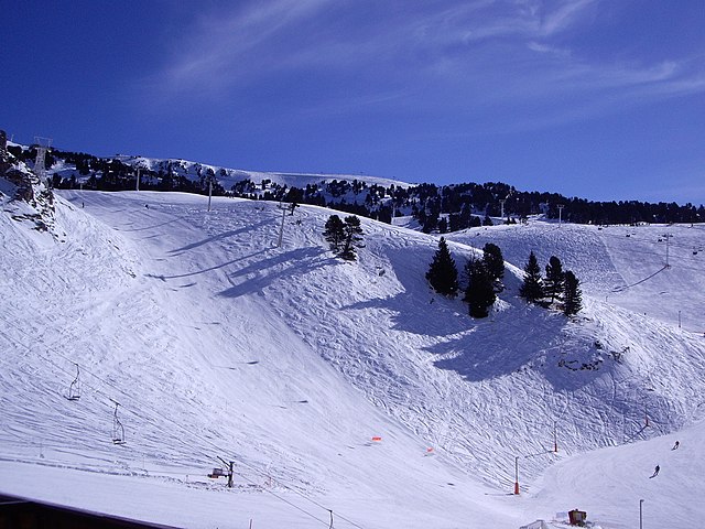
Chamrousse, located in the French Alps, is a fantastic destination for hiking enthusiasts, offering stunning landscapes, a variety of trails, and the opportunity to experience the natural beauty of the region. Here are some key points to consider when planning a hiking trip in Chamrousse:...
- Страна:
- Почтовый код: 38410
- Координаты: 45° 6' 42" N, 5° 52' 30" E
- GPS треки (wikiloc): [Ссылка]
- Высота над уровнем моря: 1660 м m
- Площадь: 13.29 кв.км
- Население: 462
- Веб сайт: [Ссылка]