Saint-Thiébaud (Saint-Thiébaud)

- коммуна во Франции
 Hiking in Saint-Thiébaud
Saint-Thiébaud is a charming area located in the Jura region of France. While it may not be as widely known as some national parks, it offers beautiful landscapes, serene hiking trails, and a chance to connect with nature. Here are some key points to consider when hiking in and around Saint-Thiébaud:
Trails
-
Accessibility: The trails vary in difficulty, catering to both beginners and more experienced hikers. Always check local maps for trail conditions and difficulty levels.
-
Natural Beauty: The area is known for its picturesque scenery, including rolling hills, dense forests, and stunning views of the Jura Mountains. Look out for local flora and fauna as you hike.
-
Marked Paths: Many trails in the region are well-marked, but it's still wise to carry a map or use GPS to navigate, especially if you're exploring less traveled paths.
Preparation
-
Footwear: Good hiking boots are essential, as some trails can be rocky or uneven. Make sure they are broken in to avoid blisters.
-
Weather: Check the weather forecast before heading out. The Jura can experience sudden changes in weather, so layers are recommended.
-
Supplies: Bring enough water and snacks for your hike. Depending on the length of your hike, a packed lunch might also be a nice addition.
-
Timing: Plan your hike to allow sufficient time to complete the loop and return before dark, especially during shorter daylight hours in winter.
Safety and Wildlife
-
Stay on Paths: To protect the environment and prevent erosion, stick to the marked trails.
-
Wildlife: Be aware of local wildlife and practice responsible hiking. Make noise to avoid surprising animals and maintain a safe distance if you encounter any.
Local Attractions
-
Cultural Sites: After your hike, consider visiting nearby historical sites or tasting local cheeses, as the Jura region is famous for its delicious dairy products.
-
Other Activities: Depending on the season, options for winter sports or cycling may be available.
In summary, hiking in Saint-Thiébaud can be a rewarding experience filled with natural beauty and tranquility. Always plan ahead, be prepared for the environment, and most importantly, enjoy exploring this lovely part of France!
- Страна:

- Почтовый код: 39110
- Координаты: 46° 58' 19" N, 5° 51' 55" E


- GPS треки (wikiloc): [Ссылка]
- Площадь: 7.94 кв.км
- Население: 62
- Википедия английская: wiki(en)
- Википедия национальная: wiki(fr)
- Хранилище Wikidata: Wikidata: Q773976
- Катеория в википедии: [Ссылка]
- код Freebase: [/m/03nvv3w]
- код Freebase: [/m/03nvv3w]
- код GeoNames: Альт: [6433747]
- код GeoNames: Альт: [6433747]
- номер SIREN: [213904956]
- номер SIREN: [213904956]
- код BNF: [15258857b]
- код BNF: [15258857b]
- код муниципалитета INSEE: 39495
- код муниципалитета INSEE: 39495
Граничит с регионами:


La Chapelle-sur-Furieuse
- коммуна во Франции
Hiking in La Chapelle-sur-Furieuse
La Chapelle-sur-Furieuse is a picturesque village situated in the Doubs department of France, nestled in the Jura Mountains. It’s a great location for hiking enthusiasts looking to explore the beautiful natural landscapes of this region. Here’s what you can expect when hiking around La Chapelle-sur-Furieuse:...
- Страна:
- Почтовый код: 39110
- Координаты: 46° 59' 52" N, 5° 51' 27" E
- GPS треки (wikiloc): [Ссылка]
- Площадь: 9.03 кв.км
- Население: 322

Salins-les-Bains
- коммуна во Франции
Hiking in Salins-les-Bains
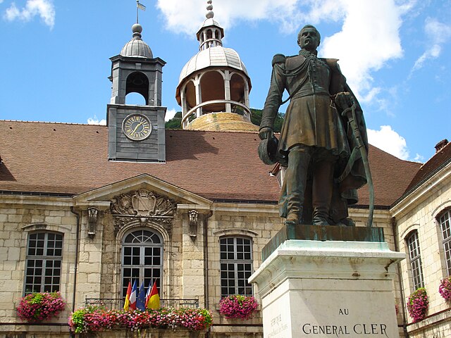
Salins-les-Bains, located in the Jura region of France, is known for its beautiful landscapes, rich historical heritage, and therapeutic salt springs. Hiking in this area offers a mix of natural beauty, cultural landmarks, and opportunities to enjoy the unique geology of the Jura Mountains....
- Страна:
- Почтовый код: 39110
- Координаты: 46° 56' 28" N, 5° 52' 42" E
- GPS треки (wikiloc): [Ссылка]
- Высота над уровнем моря: 350 м m
- Площадь: 24.68 кв.км
- Население: 2718
- Веб сайт: [Ссылка]


Ивре
- коммуна во Франции
Hiking in Ивре
It seems like there might be a little confusion with the name "Ivrey." If you're referring to hiking in a specific region or trail, I would need a bit more information to provide accurate guidance....
- Страна:
- Почтовый код: 39110
- Координаты: 46° 59' 25" N, 5° 53' 39" E
- GPS треки (wikiloc): [Ссылка]
- Площадь: 6.67 кв.км
- Население: 64