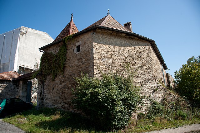
Ивре (Ivrey, Ivrey)

- коммуна во Франции
 Hiking in Ивре
It seems like there might be a little confusion with the name "Ivrey." If you're referring to hiking in a specific region or trail, I would need a bit more information to provide accurate guidance.
However, if you're looking for hiking in a particular area known for its natural beauty or trails (like Ireland or a specific National Park), please clarify, and I would be delighted to give you more details!
In general, when embarking on a hiking adventure, consider the following tips:
-
Know Your Trail: Research the trail you plan to hike in terms of distance, difficulty level, and the estimated time it takes to complete.
-
Weather Check: Always check the weather conditions before heading out. This can affect trail conditions and your overall experience.
-
Stay Hydrated: Carry enough water and consider packing electrolyte-rich snacks for longer hikes.
-
Gear Up Properly: Wear appropriate footwear and carry essentials like a map, compass, first aid kit, and enough food.
-
Leave No Trace: Respect the natural environment by adhering to Leave No Trace principles, ensuring you clean up after yourself and minimize your impact.
If you provide more details about "Ivrey" or what you're interested in, I can give tailored advice or recommendations!
- Страна:

- Почтовый код: 39110
- Координаты: 46° 59' 25" N, 5° 53' 39" E


- GPS треки (wikiloc): [Ссылка]
- Площадь: 6.67 кв.км
- Население: 64
- Википедия русская: wiki(ru)
- Википедия английская: wiki(en)
- Википедия национальная: wiki(fr)
- Хранилище Wikidata: Wikidata: Q845544
- Катеория в википедии: [Ссылка]
- код Freebase: [/m/03nptc_]
- код Freebase: [/m/03nptc_]
- код GeoNames: Альт: [6433584]
- код GeoNames: Альт: [6433584]
- номер SIREN: [213902687]
- номер SIREN: [213902687]
- код BNF: [152586313]
- код BNF: [152586313]
- ID отношения в OpenStreetMap: [546929]
- ID отношения в OpenStreetMap: [546929]
- код муниципалитета INSEE: 39268
- код муниципалитета INSEE: 39268
Граничит с регионами:


Saint-Thiébaud
- коммуна во Франции
Hiking in Saint-Thiébaud
Saint-Thiébaud is a charming area located in the Jura region of France. While it may not be as widely known as some national parks, it offers beautiful landscapes, serene hiking trails, and a chance to connect with nature. Here are some key points to consider when hiking in and around Saint-Thiébaud:...
- Страна:
- Почтовый код: 39110
- Координаты: 46° 58' 19" N, 5° 51' 55" E
- GPS треки (wikiloc): [Ссылка]
- Площадь: 7.94 кв.км
- Население: 62

Bartherans
- коммуна во Франции
Hiking in Bartherans
It seems there might be a typo or misunderstanding regarding "Bartherans," as I am not aware of a specific location by that name associated with hiking. If "Bartherans" refers to a particular area that is less well-known or perhaps a local term, please provide a bit more context or clarify the name....
- Страна:
- Почтовый код: 25440
- Координаты: 47° 2' 30" N, 5° 55' 43" E
- GPS треки (wikiloc): [Ссылка]
- Площадь: 5.81 кв.км
- Население: 50


La Chapelle-sur-Furieuse
- коммуна во Франции
Hiking in La Chapelle-sur-Furieuse
La Chapelle-sur-Furieuse is a picturesque village situated in the Doubs department of France, nestled in the Jura Mountains. It’s a great location for hiking enthusiasts looking to explore the beautiful natural landscapes of this region. Here’s what you can expect when hiking around La Chapelle-sur-Furieuse:...
- Страна:
- Почтовый код: 39110
- Координаты: 46° 59' 52" N, 5° 51' 27" E
- GPS треки (wikiloc): [Ссылка]
- Площадь: 9.03 кв.км
- Население: 322
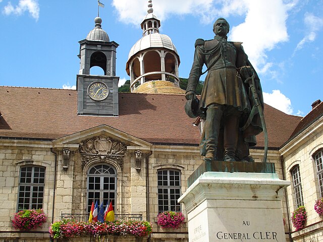

Salins-les-Bains
- коммуна во Франции
Hiking in Salins-les-Bains
Salins-les-Bains, located in the Jura region of France, is known for its beautiful landscapes, rich historical heritage, and therapeutic salt springs. Hiking in this area offers a mix of natural beauty, cultural landmarks, and opportunities to enjoy the unique geology of the Jura Mountains....
- Страна:
- Почтовый код: 39110
- Координаты: 46° 56' 28" N, 5° 52' 42" E
- GPS треки (wikiloc): [Ссылка]
- Высота над уровнем моря: 350 м m
- Площадь: 24.68 кв.км
- Население: 2718
- Веб сайт: [Ссылка]


By
Hiking in By
By, located in the Doubs department of France, is a charming destination for hiking enthusiasts. The region is known for its stunning natural landscapes, characterized by rolling hills, dense forests, and picturesque views of the surrounding countryside and rivers....
- Страна:
- Почтовый код: 25440
- Координаты: 47° 0' 47" N, 5° 53' 22" E
- GPS треки (wikiloc): [Ссылка]
- Площадь: 7.34 кв.км
- Население: 65

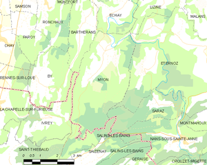
Myon
- коммуна во Франции
Hiking in Myon
Myon is a small commune in the Doubs department of the Bourgogne-Franche-Comté region in eastern France. The area is known for its beautiful natural landscapes, making it a great spot for hiking and enjoying the outdoors....
- Страна:
- Почтовый код: 25440
- Координаты: 47° 1' 29" N, 5° 56' 30" E
- GPS треки (wikiloc): [Ссылка]
- Площадь: 16.06 кв.км
- Население: 194