
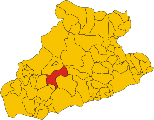
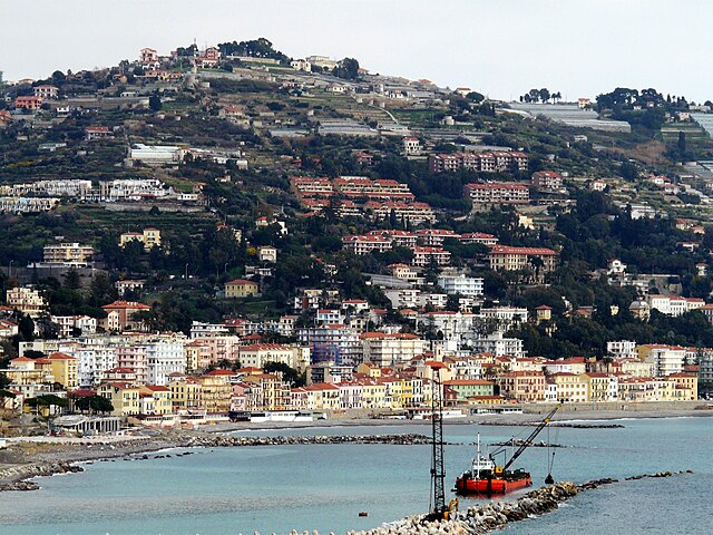
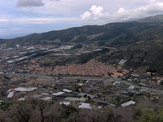
Сан-Ремо (Sanremo, Sanremo)
.svg)
- коммуна Италии
 Hiking in Сан-Ремо
Sanremo, located on the Italian Riviera in the region of Liguria, is well-known for its beautiful landscapes, mild climate, and stunning coastal views. Hiking in and around Sanremo offers a wonderful opportunity to explore the natural beauty of the area, from the Mediterranean coast to the surrounding hills and mountains. Here are some highlights and tips for hiking in Sanremo:
Popular Hiking Trails
-
Monte Bignone:
- This is one of the prominent peaks near Sanremo, offering breathtaking views over the coastline and the entire region. The trail can be accessed from various points, and it's a popular choice for both locals and tourists. The ascent can be steep, but the panoramic views at the summit are worth the effort.
-
Old railway path (Pista Ciclabile):
- A scenic, relatively flat path along the old railway tracks that used to connect Sanremo to other coastal towns. This trail runs along the coastline, providing stunning views of the sea, and is perfect for a leisurely hike or a bike ride.
-
San Romolo to Sanremo:
- This trail connects the village of San Romolo, located in the hills above Sanremo, to the city. It offers a mix of forested areas and olive groves, with charming views of the coast and the hinterland.
-
The Argentina Valley:
- A bit further inland, exploring the trails in the Argentina Valley leads hikers through lush greenery, picturesque villages, and along the river. The valley offers a variety of difficulty levels, making it a suitable option for all hiking abilities.
Tips for Hiking in Sanremo
-
Best Time to Hike: The ideal times for hiking in Sanremo are during spring (April to June) and autumn (September to October) when the temperatures are milder and the landscapes are vibrant.
-
Gear: Sturdy hiking shoes, adequate clothing layers, and a good backpack with water and snacks are essential. Don't forget sunscreen and a hat, as the sun can be strong, especially in the summer months.
-
Local Maps and Resources: Consider picking up local maps at visitor centers or tourist offices. There are also various apps and websites that provide detailed trail information.
-
Respect Nature: Always follow the "Leave No Trace" principles, staying on marked trails, and respecting local wildlife and vegetation.
-
Public Transport: Sanremo is well connected by public transport, making it easy to reach various trailheads. However, if you're planning to venture further into the mountains, consider renting a car for easy access.
Hiking around Sanremo offers not just physical activity but also a chance to immerse yourself in the rich nature and culture of the Italian Riviera. Enjoy your hikes!
- Страна:

- Почтовый код: 18038
- Телефонный код: 0184
- Код автомобильного номера: IM
- Координаты: 43° 49' 17" N, 7° 47' 12" E


- GPS треки (wikiloc): [Ссылка]
- Высота над уровнем моря: 15 м m
- Площадь: 55.96 кв.км
- Население: 54824
- Веб сайт: http://www.comunedisanremo.it/
- Википедия русская: wiki(ru)
- Википедия английская: wiki(en)
- Википедия национальная: wiki(it)
- Хранилище Wikidata: Wikidata: Q33962
- Галерея изображений в википедии: [Ссылка]
- Катеория в википедии: [Ссылка]
- Карты в википедии: [Ссылка]
- код Freebase: [/m/01kjqj]
- код GeoNames: Альт: [6542207]
- код BNF: [120924168]
- код VIAF: Альт: [127873888]
- ID отношения в OpenStreetMap: [42651]
- код GND: Альт: [4118347-2]
- идентификатор местоположения ArchINFORM: [944]
- код LCNAF: Альт: [n82255306]
- код тезауруса PACTOLS: [pcrt8LIGS1b88y]
- место в MusicBrainz: [88553c95-218c-470b-a9fe-01b341c1e863]
- код темы Quora: [San-Remo-1]
- UN/LOCODE: [ITSRE]
- код в Большой каталанской энциклопедии: [0058820]
- код в Большой российской энциклопедии онлайн: [3533520]
- идентификатор NE.se: [san-remo]
- код ISTAT: 008055
- кадастровый код Италии: I138
- код US National Archives: 10044673
Граничит с регионами:


Априкале
- коммуна Италии
Hiking in Априкале
Apricale, a picturesque village in the Liguria region of Italy, offers some fantastic hiking opportunities. Nestled in the Sanremo valleys and surrounded by lush vegetation, it boasts beautiful landscapes, historical sites, and a rich cultural experience....
- Страна:
- Почтовый код: 18035
- Телефонный код: 0184
- Код автомобильного номера: IM
- Координаты: 43° 52' 50" N, 7° 39' 38" E
- GPS треки (wikiloc): [Ссылка]
- Высота над уровнем моря: 291 м m
- Площадь: 19.94 кв.км
- Население: 618
- Веб сайт: [Ссылка]

Баярдо
- коммуна Италии
Hiking in Баярдо
Bajardo, a charming village located in the Liguria region of Italy, offers some beautiful hiking opportunities, particularly for those who appreciate nature and stunning landscapes. Nestled in the hills of the Italian Riviera, it's surrounded by lush greenery, picturesque vistas, and a rich cultural heritage....
- Страна:
- Почтовый код: 18031
- Телефонный код: 0184
- Код автомобильного номера: IM
- Координаты: 43° 54' 13" N, 7° 43' 6" E
- GPS треки (wikiloc): [Ссылка]
- Высота над уровнем моря: 900 м m
- Площадь: 24.32 кв.км
- Население: 326
- Веб сайт: [Ссылка]
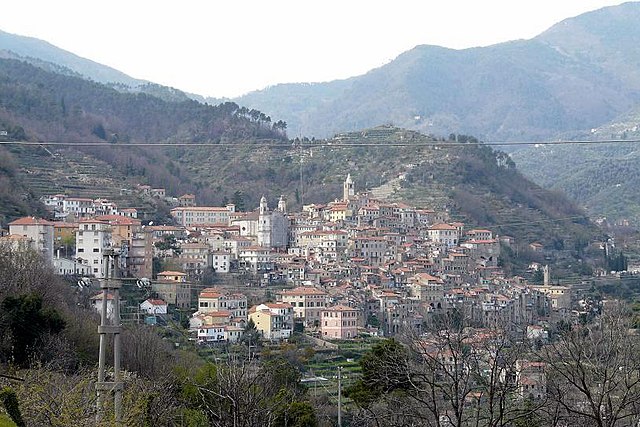

Чериана
- коммуна Италии
Hiking in Чериана
Ceriana is a charming medieval village located in the Italian region of Liguria, not far from the beautiful Ligurian coast and the Riviera dei Fiori. The area boasts stunning landscapes, with rolling hills, olive groves, and panoramic views of the surrounding countryside and the sea. Here are some key highlights for hiking in and around Ceriana:...
- Страна:
- Почтовый код: 18034
- Телефонный код: 0184
- Код автомобильного номера: IM
- Координаты: 43° 52' 45" N, 7° 46' 29" E
- GPS треки (wikiloc): [Ссылка]
- Высота над уровнем моря: 369 м m
- Площадь: 31.79 кв.км
- Население: 1214
- Веб сайт: [Ссылка]

Оспедалетти
- коммуна Италии
Hiking in Оспедалетти
Ospedaletti, located along the Italian Riviera near the French border in the region of Liguria, offers beautiful coastal landscapes, charming towns, and access to a variety of hiking trails. Here are some highlights about hiking in and around Ospedaletti:...
- Страна:
- Почтовый код: 18014
- Телефонный код: 0184
- Код автомобильного номера: IM
- Координаты: 43° 48' 2" N, 7° 43' 4" E
- GPS треки (wikiloc): [Ссылка]
- Высота над уровнем моря: 5 м m
- Площадь: 5.45 кв.км
- Население: 3292
- Веб сайт: [Ссылка]


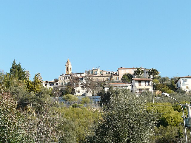
Перинальдо
- коммуна Италии
Hiking in Перинальдо
Perinaldo is a charming village located in the Italian region of Liguria, known for its stunning natural landscapes and historic architecture. It's situated in the hills above the Riviera dei Fiori, offering excellent opportunities for hiking and outdoor activities. Here are some key points about hiking in Perinaldo:...
- Страна:
- Почтовый код: 18032
- Телефонный код: 0184
- Код автомобильного номера: IM
- Координаты: 43° 52' 1" N, 7° 40' 28" E
- GPS треки (wikiloc): [Ссылка]
- Высота над уровнем моря: 572 м m
- Площадь: 20.3 кв.км
- Население: 871
- Веб сайт: [Ссылка]

Себорга
- коммуна Италии
Hiking in Себорга
Seborga is a charming village located in the Italian Riviera, within the province of Imperia in the Liguria region. Known for its picturesque views, historic architecture, and a rich cultural history, Seborga also offers a variety of hiking opportunities for outdoor enthusiasts. Here’s what you need to know about hiking in and around Seborga:...
- Страна:
- Почтовый код: 18012
- Телефонный код: 0184
- Код автомобильного номера: IM
- Координаты: 43° 49' 34" N, 7° 41' 38" E
- GPS треки (wikiloc): [Ссылка]
- Высота над уровнем моря: 500 м m
- Площадь: 4.87 кв.км
- Население: 297
- Веб сайт: [Ссылка]

Таджа
- коммуна Италии
Hiking in Таджа
Taggia is a charming town located in the Liguria region of Italy, known for its rich history, traditional olive production, and beautiful landscapes. Hiking around Taggia offers a variety of trails that cater to different skill levels, displaying the stunning scenery of the Italian Riviera, hills, and valleys....
- Страна:
- Почтовый код: 18018
- Телефонный код: 0184
- Код автомобильного номера: IM
- Координаты: 43° 50' 38" N, 7° 51' 3" E
- GPS треки (wikiloc): [Ссылка]
- Высота над уровнем моря: 39 м m
- Площадь: 31.36 кв.км
- Население: 14003
- Веб сайт: [Ссылка]