
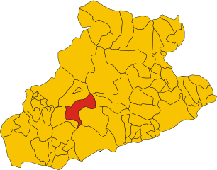
Априкале (Apricale, Apricale)
.svg)
- коммуна Италии
 Hiking in Априкале
Apricale, a picturesque village in the Liguria region of Italy, offers some fantastic hiking opportunities. Nestled in the Sanremo valleys and surrounded by lush vegetation, it boasts beautiful landscapes, historical sites, and a rich cultural experience.
Hiking Trails
-
Apricale to Bajardo Trail: This scenic route takes you from Apricale to the quaint village of Bajardo. The trail provides stunning views of the surrounding hills and valleys. Along the way, you can explore ancient ruins and charming rural landscapes.
-
Valle Argentina: The nearby Valle Argentina offers more extensive hiking options. You can explore various trails that lead through forests, along rivers, and past waterfalls. It's ideal for those looking for a day of adventure and nature.
-
Via dei Muretti: This route is known for its dry stone walls (muretti) that are characteristic of the region. It’s a great way to experience both the natural beauty and the cultural heritage of Liguria.
What to Expect
- Scenery: Expect breathtaking views of the Ligurian countryside, especially during the spring when wildflowers bloom.
- Wildlife: Keep an eye out for local wildlife, including various bird species, deer, and rabbits.
- Local Culture: Apricale itself is rich in history, with narrow cobbled streets, stone houses, and medieval architecture. Exploring the village before or after your hike is highly recommended.
Tips for Hiking in Apricale
- Footwear: Wear comfortable hiking shoes with good grip, as some trails may be steep or rocky.
- Hydration and Nutrition: Carry enough water and snacks, as some trails may be longer and lack facilities.
- Weather: Check the weather forecast before your hike. Spring in Liguria can be unpredictable, so be prepared for occasional rain.
- Guided Hikes: Consider joining a guided hike for the best experience, especially if exploring less-marked paths.
Hiking in and around Apricale offers a blend of adventure, natural beauty, and cultural immersion, making it a rewarding experience for outdoor enthusiasts. Enjoy your hike!
- Страна:

- Почтовый код: 18035
- Телефонный код: 0184
- Код автомобильного номера: IM
- Координаты: 43° 52' 50" N, 7° 39' 38" E


- GPS треки (wikiloc): [Ссылка]
- Высота над уровнем моря: 291 м m
- Площадь: 19.94 кв.км
- Население: 618
- Веб сайт: http://www.apricale.org
- Википедия русская: wiki(ru)
- Википедия английская: wiki(en)
- Википедия национальная: wiki(it)
- Хранилище Wikidata: Wikidata: Q268067
- Галерея изображений в википедии: [Ссылка]
- Катеория в википедии: [Ссылка]
- код Freebase: [/m/0gby4h]
- код GeoNames: Альт: [6536064]
- код VIAF: Альт: [149006102]
- ID отношения в OpenStreetMap: [42713]
- код TGN: [5002480]
- код ISTAT: 008002
- кадастровый код Италии: A338
Граничит с регионами:

Баярдо
- коммуна Италии
Hiking in Баярдо
Bajardo, a charming village located in the Liguria region of Italy, offers some beautiful hiking opportunities, particularly for those who appreciate nature and stunning landscapes. Nestled in the hills of the Italian Riviera, it's surrounded by lush greenery, picturesque vistas, and a rich cultural heritage....
- Страна:
- Почтовый код: 18031
- Телефонный код: 0184
- Код автомобильного номера: IM
- Координаты: 43° 54' 13" N, 7° 43' 6" E
- GPS треки (wikiloc): [Ссылка]
- Высота над уровнем моря: 900 м m
- Площадь: 24.32 кв.км
- Население: 326
- Веб сайт: [Ссылка]


Кастель-Витторио
- коммуна Италии
Hiking in Кастель-Витторио
Castel Vittorio, a charming medieval village located in the Italian region of Liguria, is nestled in the scenic hills of the Nervia Valley. Hiking in this area offers a mix of natural beauty, cultural heritage, and various trails suitable for different skill levels....
- Страна:
- Почтовый код: 18030
- Телефонный код: 0184
- Код автомобильного номера: IM
- Координаты: 43° 55' 40" N, 7° 40' 27" E
- GPS треки (wikiloc): [Ссылка]
- Высота над уровнем моря: 420 м m
- Площадь: 25.93 кв.км
- Население: 288
- Веб сайт: [Ссылка]


Дольчеаккуа
- коммуна Италии
Hiking in Дольчеаккуа
Dolceacqua is a charming village located in the Italian region of Liguria, near the border with France. It’s known for its picturesque medieval architecture, stunning landscapes, and the beautiful surrounding hills and valleys that offer a variety of hiking opportunities....
- Страна:
- Почтовый код: 18035
- Телефонный код: 0184
- Код автомобильного номера: IM
- Координаты: 43° 50' 53" N, 7° 37' 26" E
- GPS треки (wikiloc): [Ссылка]
- Высота над уровнем моря: 51 м m
- Площадь: 20.28 кв.км
- Население: 2093
- Веб сайт: [Ссылка]


Изолабона
- коммуна Италии
Hiking in Изолабона
Isolabona is a charming village located in the Province of Imperia in the Liguria region of northwestern Italy. It is nestled in the picturesque Nervia Valley, surrounded by lush hills and stunning landscapes, making it a hidden gem for hikers and outdoor enthusiasts....
- Страна:
- Почтовый код: 18035
- Телефонный код: 0184
- Код автомобильного номера: IM
- Координаты: 43° 52' 46" N, 7° 38' 20" E
- GPS треки (wikiloc): [Ссылка]
- Высота над уровнем моря: 106 м m
- Площадь: 12.35 кв.км
- Население: 695
- Веб сайт: [Ссылка]


Перинальдо
- коммуна Италии
Hiking in Перинальдо
Perinaldo is a charming village located in the Italian region of Liguria, known for its stunning natural landscapes and historic architecture. It's situated in the hills above the Riviera dei Fiori, offering excellent opportunities for hiking and outdoor activities. Here are some key points about hiking in Perinaldo:...
- Страна:
- Почтовый код: 18032
- Телефонный код: 0184
- Код автомобильного номера: IM
- Координаты: 43° 52' 1" N, 7° 40' 28" E
- GPS треки (wikiloc): [Ссылка]
- Высота над уровнем моря: 572 м m
- Площадь: 20.3 кв.км
- Население: 871
- Веб сайт: [Ссылка]


Пинья
- коммуна Италии
Hiking in Пинья
Pigna, a picturesque village in the Italian region of Liguria, offers a wonderful hiking experience characterized by its enchanting landscapes, olive groves, and stunning views of the surrounding mountains and valleys. Here are some key points to consider when planning a hiking trip to Pigna:...
- Страна:
- Почтовый код: 18037
- Телефонный код: 0184
- Код автомобильного номера: IM
- Координаты: 43° 55' 57" N, 7° 39' 50" E
- GPS треки (wikiloc): [Ссылка]
- Высота над уровнем моря: 280 м m
- Площадь: 53.23 кв.км
- Население: 843
- Веб сайт: [Ссылка]


Роккетта-Нервина
- коммуна Италии
Hiking in Роккетта-Нервина
Rocchetta Nervina is a charming village located in the Liguria region of Italy, specifically in the Province of Imperia. Nestled in the Nervia Valley and surrounded by stunning mountainous terrain, it serves as an excellent base for hiking enthusiasts looking to explore the natural beauty of the area....
- Страна:
- Почтовый код: 18030
- Телефонный код: 0184
- Код автомобильного номера: IM
- Координаты: 43° 53' 24" N, 7° 36' 1" E
- GPS треки (wikiloc): [Ссылка]
- Высота над уровнем моря: 235 м m
- Площадь: 15.29 кв.км
- Население: 299
- Веб сайт: [Ссылка]


Сан-Ремо
- коммуна Италии
Hiking in Сан-Ремо
Sanremo, located on the Italian Riviera in the region of Liguria, is well-known for its beautiful landscapes, mild climate, and stunning coastal views. Hiking in and around Sanremo offers a wonderful opportunity to explore the natural beauty of the area, from the Mediterranean coast to the surrounding hills and mountains. Here are some highlights and tips for hiking in Sanremo:...
- Страна:
- Почтовый код: 18038
- Телефонный код: 0184
- Код автомобильного номера: IM
- Координаты: 43° 49' 17" N, 7° 47' 12" E
- GPS треки (wikiloc): [Ссылка]
- Высота над уровнем моря: 15 м m
- Площадь: 55.96 кв.км
- Население: 54824
- Веб сайт: [Ссылка]