
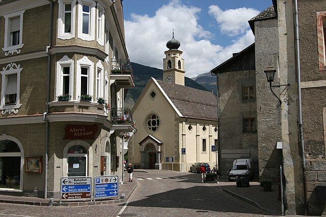
Слудерно (Schluderns, Sluderno)
.svg)
- коммуна в Италии
 Hiking in Слудерно
Schluderns, located in South Tyrol, Italy, is a charming village surrounded by stunning landscapes and offers a variety of hiking opportunities. The region is characterized by its mountainous terrain, lush forests, and picturesque valleys. Here are some key points to consider when planning a hike in and around Schluderns:
Hiking Trails
-
Sentiero del Sole: This trail offers panoramic views of the Vinschgau Valley and the surrounding mountains. It's a fairly easy hike, suitable for families and beginner hikers.
-
Hiking to the Texel Group Nature Park: The nearby Texel Group is part of a protected nature reserve, featuring a myriad of well-marked trails with varying levels of difficulty. You can expect to encounter diverse flora and fauna, as well as stunning alpine scenery.
-
Mals – Schluderns Trail: This trail connects Mals (Malles Venosta) to Schluderns, offering a beautiful walk through vineyards and rustic farmhouses, alongside scenic views of the surrounding Alps.
-
Castles and Historical Sites: Hike to nearby castles such as Churburg Castle, which not only provides a cultural experience but also serves as a scenic backdrop for hikers.
Things to Consider
-
Season: The best time for hiking in Schluderns is generally from late spring to early autumn. Snow may cover higher paths in early spring, and summers can get warm, so be prepared for varying conditions.
-
Gear: Standard hiking gear such as sturdy footwear, weather-appropriate clothing, and a good backpack with water and snacks is essential. Also, consider bringing trekking poles for uneven terrain.
-
Maps and Guidance: It’s advisable to have a map of the area or a reliable hiking app to help navigate the trails. Local tourist information centers can provide trail maps and updates on conditions.
-
Safety: Always let someone know your hiking plans, especially if you’re venturing into less-traveled areas. It's wise to check the weather before starting, as conditions can change rapidly in the mountains.
Local Highlights
-
Culinary Experiences: After a day of hiking, enjoy local cuisine at one of the nearby restaurants, which often feature traditional South Tyrolean dishes.
-
Cultural Experiences: Explore the unique blend of Italian and German cultures in the area, visible in the architecture, language, and food.
Schluderns serves as an excellent base for exploring the beautiful hiking trails of the Vinschgau Valley and the adjacent mountains, making it a wonderful destination for outdoor enthusiasts. Enjoy your hike!
- Страна:

- Почтовый код: 39020
- Телефонный код: 0473
- Код автомобильного номера: BZ
- Координаты: 46° 39' 55" N, 10° 35' 0" E


- GPS треки (wikiloc): [Ссылка]
- Высота над уровнем моря: 921 м m
- Площадь: 20.72 кв.км
- Население: 1820
- Веб сайт: http://www.comune.sluderno.bz.it/system/web/default.aspx?sprache=3
- Википедия русская: wiki(ru)
- Википедия английская: wiki(en)
- Википедия национальная: wiki(it)
- Хранилище Wikidata: Wikidata: Q493790
- Галерея изображений в википедии: [Ссылка]
- Катеория в википедии: [Ссылка]
- код Freebase: [/m/0g9jzm]
- код GeoNames: Альт: [6535931]
- код VIAF: Альт: [244735769]
- ID отношения в OpenStreetMap: [47294]
- код GND: Альт: [4570776-5]
- идентификатор местоположения ArchINFORM: [14770]
- код ISTAT: 021094
- кадастровый код Италии: I771
Граничит с регионами:

Глоренца
- коммуна Италии
Hiking in Глоренца
Glurns (or Glorenza) is a small historical town located in the South Tyrol region of northern Italy. It's nestled in the Venosta Valley and is known for its charming medieval architecture, stunning mountain scenery, and a rich cultural heritage....
- Страна:
- Почтовый код: 39020
- Телефонный код: 0473
- Код автомобильного номера: BZ
- Координаты: 46° 40' 16" N, 10° 33' 25" E
- GPS треки (wikiloc): [Ссылка]
- Высота над уровнем моря: 907 м m
- Площадь: 13.22 кв.км
- Население: 897
- Веб сайт: [Ссылка]


Лаза
- коммуна Италии
Hiking in Лаза
Laas, located in the stunning South Tyrol region of northern Italy, is a small village known for its beautiful landscapes and excellent hiking opportunities. Nestled in the heart of the Alps, Laas boasts a mix of gentle trails and more challenging routes, making it suitable for hikers of all levels....
- Страна:
- Почтовый код: 39023
- Телефонный код: 0473
- Код автомобильного номера: BZ
- Координаты: 46° 37' 4" N, 10° 41' 52" E
- GPS треки (wikiloc): [Ссылка]
- Высота над уровнем моря: 868 м m
- Площадь: 110.23 кв.км
- Население: 4028
- Веб сайт: [Ссылка]


Маллес-Веноста
- коммуна Италии
Hiking in Маллес-Веноста
Mals, located in the Vinschgau Valley in South Tyrol, Italy, is a fantastic spot for hiking enthusiasts. Surrounded by stunning landscapes, picturesque villages, and a rich cultural heritage, it offers a variety of trails suitable for different skill levels....
- Страна:
- Почтовый код: 39024
- Телефонный код: 0473
- Код автомобильного номера: BZ
- Координаты: 46° 41' 16" N, 10° 32' 48" E
- GPS треки (wikiloc): [Ссылка]
- Высота над уровнем моря: 1051 м m
- Площадь: 247.43 кв.км
- Население: 5225
- Веб сайт: [Ссылка]


Прато-алло-Стельвио
- коммуна в Италии
Hiking in Прато-алло-Стельвио
Prad am Stilfser Joch is a charming village located in the South Tyrol region of Italy, nestled at the entrance to the Stilfser Joch National Park. This area is renowned for its stunning natural landscapes, mountainous terrain, and excellent hiking opportunities. Here are some highlights and tips for hiking in this region:...
- Страна:
- Почтовый код: 39026
- Телефонный код: 0473
- Код автомобильного номера: BZ
- Координаты: 46° 37' 8" N, 10° 35' 29" E
- GPS треки (wikiloc): [Ссылка]
- Высота над уровнем моря: 3375 м m
- Площадь: 51.49 кв.км
- Население: 3474
- Веб сайт: [Ссылка]