
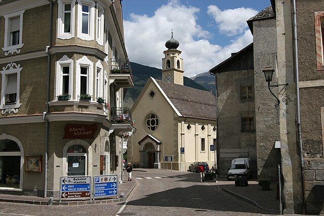
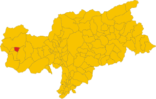
Маллес-Веноста (Mals, Malles Venosta)
.svg)
- коммуна Италии
 Hiking in Маллес-Веноста
Mals, located in the Vinschgau Valley in South Tyrol, Italy, is a fantastic spot for hiking enthusiasts. Surrounded by stunning landscapes, picturesque villages, and a rich cultural heritage, it offers a variety of trails suitable for different skill levels.
Hiking Highlights in Mals:
-
Scenic Routes: The region is known for its diverse landscapes, including lush meadows, rugged mountains, and serene lakes. Trails often feature breathtaking views of the Ortler Alps and the surrounding valleys.
-
Trail Options:
- Beginner Trails: There are easy paths, such as those around the village, which are perfect for leisurely walks and families with children.
- Intermediate and Advanced Trails: More challenging routes lead you higher into the mountains, offering rewarding vistas. Trails like the one to the alpine hut "Vöraner Alm" or to the “Hirzer” peak can be great options.
-
Cultural Experience: As you hike, you'll encounter charming villages and traditional farms. The area is known for its apple orchards and vineyards, so don't miss the opportunity to taste local produce.
-
Seasonal Hiking: Hiking is popular year-round. In summer, the meadows are alive with wildflowers, while in autumn, the fall colors create a picturesque tapestry. Winter hiking and snowshoeing are also popular when trails are covered in snow.
-
Wildlife and Nature: The area is rich in biodiversity. Keep an eye out for local wildlife, including chamois, marmots, and a variety of bird species.
-
Hiking Tips:
- Always check the weather conditions before heading out.
- Carry sufficient water and snacks, especially on longer hikes.
- Wear appropriate footwear and dress in layers to adapt to changing temperatures.
- Consider using hiking maps or GPS for navigation, especially on less-marked trails.
-
Guided Tours and Resources: If you're unfamiliar with the area or want to learn about the local flora and fauna, consider joining a guided hike. Local tourist information centers can provide maps, tips, and organized hiking tours.
Mals offers a wonderful mix of natural beauty, culture, and outdoor adventure, making it a great destination for hikers of all levels!
- Страна:

- Почтовый код: 39024
- Телефонный код: 0473
- Код автомобильного номера: BZ
- Координаты: 46° 41' 16" N, 10° 32' 48" E


- GPS треки (wikiloc): [Ссылка]
- Высота над уровнем моря: 1051 м m
- Площадь: 247.43 кв.км
- Население: 5225
- Веб сайт: http://www.comune.malles.bz.it
- Википедия русская: wiki(ru)
- Википедия английская: wiki(en)
- Википедия национальная: wiki(it)
- Хранилище Wikidata: Wikidata: Q427187
- Галерея изображений в википедии: [Ссылка]
- Катеория в википедии: [Ссылка]
- код Freebase: [/m/0g9hbv]
- код GeoNames: Альт: [6535907]
- код BNF: [13508227z]
- код VIAF: Альт: [151418079]
- ID отношения в OpenStreetMap: [47302]
- код GND: Альт: [4037254-6]
- код LCNAF: Альт: [n93004104]
- место в MusicBrainz: [33e478a9-7414-4e1c-a7dd-34342327b14a]
- код ISTAT: 021046
- кадастровый код Италии: E862
Граничит с регионами:


Курон-Веноста
- коммуна Италии
Hiking in Курон-Веноста
Graun im Vinschgau, located in the beautiful Vinschgau Valley of South Tyrol, Italy, is a fantastic destination for hikers. Surrounded by stunning alpine scenery, including the Ortler Alps and the Texel Group Nature Park, it offers a variety of trails suitable for all skill levels. Here are some highlights and tips for hiking in this region:...
- Страна:
- Почтовый код: 39020
- Телефонный код: 0473
- Код автомобильного номера: BZ
- Координаты: 46° 48' 30" N, 10° 32' 34" E
- GPS треки (wikiloc): [Ссылка]
- Высота над уровнем моря: 1520 м m
- Площадь: 209.65 кв.км
- Население: 2381
- Веб сайт: [Ссылка]

Глоренца
- коммуна Италии
Hiking in Глоренца
Glurns (or Glorenza) is a small historical town located in the South Tyrol region of northern Italy. It's nestled in the Venosta Valley and is known for its charming medieval architecture, stunning mountain scenery, and a rich cultural heritage....
- Страна:
- Почтовый код: 39020
- Телефонный код: 0473
- Код автомобильного номера: BZ
- Координаты: 46° 40' 16" N, 10° 33' 25" E
- GPS треки (wikiloc): [Ссылка]
- Высота над уровнем моря: 907 м m
- Площадь: 13.22 кв.км
- Население: 897
- Веб сайт: [Ссылка]


Лаза
- коммуна Италии
Hiking in Лаза
Laas, located in the stunning South Tyrol region of northern Italy, is a small village known for its beautiful landscapes and excellent hiking opportunities. Nestled in the heart of the Alps, Laas boasts a mix of gentle trails and more challenging routes, making it suitable for hikers of all levels....
- Страна:
- Почтовый код: 39023
- Телефонный код: 0473
- Код автомобильного номера: BZ
- Координаты: 46° 37' 4" N, 10° 41' 52" E
- GPS треки (wikiloc): [Ссылка]
- Высота над уровнем моря: 868 м m
- Площадь: 110.23 кв.км
- Население: 4028
- Веб сайт: [Ссылка]

Слудерно
- коммуна в Италии
Hiking in Слудерно
Schluderns, located in South Tyrol, Italy, is a charming village surrounded by stunning landscapes and offers a variety of hiking opportunities. The region is characterized by its mountainous terrain, lush forests, and picturesque valleys. Here are some key points to consider when planning a hike in and around Schluderns:...
- Страна:
- Почтовый код: 39020
- Телефонный код: 0473
- Код автомобильного номера: BZ
- Координаты: 46° 39' 55" N, 10° 35' 0" E
- GPS треки (wikiloc): [Ссылка]
- Высота над уровнем моря: 921 м m
- Площадь: 20.72 кв.км
- Население: 1820
- Веб сайт: [Ссылка]


Силандро
- коммуна в Италии
Hiking in Силандро
Schlanders, located in the South Tyrol region of northern Italy, offers a wonderful hiking experience amid stunning alpine scenery. Surrounded by the impressive peaks of the Ortler Alps and near the beautiful Vinschgau Valley, this area is ideal for both novice and experienced hikers....
- Страна:
- Почтовый код: 39028
- Телефонный код: 0473
- Код автомобильного номера: BZ
- Координаты: 46° 37' 42" N, 10° 46' 5" E
- GPS треки (wikiloc): [Ссылка]
- Высота над уровнем моря: 720 м m
- Площадь: 115.17 кв.км
- Население: 6181
- Веб сайт: [Ссылка]

Сеналес
- коммуна в Италии
Hiking in Сеналес
Schnals, located in the South Tyrol region of Italy, is a picturesque valley that offers stunning landscapes and diverse hiking opportunities. Nestled in the Ötztal Alps, it is a popular destination for outdoor enthusiasts, especially those who enjoy alpine hiking....
- Страна:
- Почтовый код: 39020
- Телефонный код: 0473
- Код автомобильного номера: BZ
- Координаты: 46° 42' 0" N, 10° 55' 0" E
- GPS треки (wikiloc): [Ссылка]
- Высота над уровнем моря: 1317 м m
- Площадь: 209.84 кв.км
- Население: 1231
- Веб сайт: [Ссылка]


Тубре
- коммуна в Италии
Hiking in Тубре
Taufers im Münstertal, located in the Bavarian Alps in South Tyrol, Italy, offers a stunning backdrop for hiking enthusiasts of all levels. The area is characterized by its picturesque valleys, lush forests, and panoramic mountain views, making it an ideal destination for nature lovers....
- Страна:
- Почтовый код: 39020
- Телефонный код: 0473
- Код автомобильного номера: BZ
- Координаты: 46° 38' 39" N, 10° 27' 48" E
- GPS треки (wikiloc): [Ссылка]
- Высота над уровнем моря: 1240 м m
- Площадь: 46.27 кв.км
- Население: 981
- Веб сайт: [Ссылка]

Зёльден
Hiking in Зёльден
Sölden, located in the Ötztal Valley of Tyrol, Austria, is a fantastic destination for hiking enthusiasts. It's known for its stunning alpine scenery, diverse trails, and a wide range of outdoor activities. Here’s what you can expect when hiking in Sölden:...
- Страна:

- Почтовый код: 6450
- Телефонный код: 05254
- Код автомобильного номера: IM
- Координаты: 46° 58' 0" N, 11° 0' 0" E
- GPS треки (wikiloc): [Ссылка]
- Высота над уровнем моря: 1368 м m
- Площадь: 466.78 кв.км
- Население: 3145
- Веб сайт: [Ссылка]


Скуоль
Hiking in Скуоль
Scuol, located in the Swiss Engadin Valley, is a stunning destination for hiking enthusiasts. The area is known for its beautiful landscapes, picturesque alpine villages, and rich cultural heritage. Here are some highlights and tips for hiking in Scuol:...
- Страна:

- Почтовый код: 7550
- Телефонный код: 081
- Код автомобильного номера: GR
- Координаты: 46° 47' 49" N, 10° 17' 58" E
- GPS треки (wikiloc): [Ссылка]
- Высота над уровнем моря: 2368 м m
- Площадь: 438.63 кв.км
- Население: 4598
- Веб сайт: [Ссылка]


Зент
Hiking in Зент
Sent, a charming village located in the Upper Engadin region of Switzerland, is known for its stunning landscapes, well-marked hiking trails, and rich culture. Here’s an overview of what you can expect when hiking in Sent:...
- Страна:
- Почтовый код: 7554
- Телефонный код: 081
- Код автомобильного номера: GR
- Координаты: 46° 49' 0" N, 10° 20' 0" E
- GPS треки (wikiloc): [Ссылка]
- Высота над уровнем моря: 1440 м m
- Площадь: 111.74 кв.км
- Веб сайт: [Ссылка]