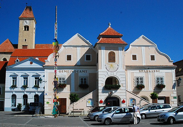
Зигмундсхерберг (Sigmundsherberg, Sigmundsherberg)
 Hiking in Зигмундсхерберг
Sigmundsherberg is a picturesque area located in Lower Austria, known for its beautiful landscapes and hiking opportunities. It offers a variety of trails that cater to different skill levels, making it an excellent destination for both novice and experienced hikers.
Key Features:
-
Diverse Trails: There’s a network of marked hiking trails that lead through forests, meadows, and along scenic viewpoints. The trails range from easy walks to more challenging hikes, so you can choose the one that fits your fitness level and experience.
-
Natural Beauty: The region is characterized by lush greenery, rolling hills, and the charm of the surrounding countryside. Hikers can enjoy the tranquility of nature, with opportunities to observe local wildlife and various flora.
-
Historical Sites: Some trails might take you past historical and cultural landmarks, adding an educational aspect to your hike. There may also be local events or festivals depending on the time of year.
-
Accessibility: Sigmundsherberg is generally accessible, making it a convenient spot for day hikes. There are often public transport options available for those who wish to visit without driving.
Tips for Hiking in Sigmundsherberg:
- Weather Check: Always check the weather forecast before heading out, as conditions can change.
- Proper Gear: Wear sturdy hiking boots and dress in layers. Bring a backpack with water, snacks, and a first-aid kit.
- Trail Maps: Familiarize yourself with the trail maps available at visitor centers or online, and always stay on marked paths for safety.
- Respect Nature: Follow Leave No Trace principles – pack out what you pack in, and avoid disturbing wildlife.
Nearby Attractions:
If you’re looking to extend your visit, consider exploring nearby attractions such as local vineyards, cultural sites, or other natural parks in the region. Make sure to check local tourism websites for up-to-date information on trails, maps, and any regulations or guidelines.
Enjoy your hike in Sigmundsherberg!
- Страна:

- Почтовый код: 3751
- Телефонный код: 02983
- Код автомобильного номера: HO
- Координаты: 48° 41' 10" N, 15° 44' 47" E


- GPS треки (wikiloc): [Ссылка]
- Высота над уровнем моря: 429 м m
- Площадь: 47.95 кв.км
- Население: 1651
- Веб сайт: http://www.sigmundsherberg.gv.at
- Википедия русская: wiki(ru)
- Википедия английская: wiki(en)
- Википедия национальная: wiki(de)
- Хранилище Wikidata: Wikidata: Q676929
- Катеория в википедии: [Ссылка]
- код Freebase: [/m/03grpv7]
- код GeoNames: Альт: [7871782]
- код VIAF: Альт: [147774139]
- идентификатор местоположения ArchINFORM: [15822]
- код LCNAF: Альт: [n82152092]
- WOEID: [543847]
- код австрийского муниципалитета: [31124]
Граничит с регионами:

Хорн
- муниципалитет в Австрии, Нижняя Австрия, Хорн
Hiking in Хорн
Horn, located in the northeastern part of Austria, is a beautiful area rich in natural landscapes and outdoor activities, making it a great destination for hiking enthusiasts. The region is characterized by rolling hills, lush forests, and scenic views of the surrounding countryside....
- Страна:
- Почтовый код: 3580
- Телефонный код: 0 29 82
- Код автомобильного номера: HO
- Координаты: 48° 39' 55" N, 15° 39' 21" E
- GPS треки (wikiloc): [Ссылка]
- Высота над уровнем моря: 311 м m
- Площадь: 39.23 кв.км
- Население: 6520
- Веб сайт: [Ссылка]
Вайтерсфельд
Hiking in Вайтерсфельд
Weitersfeld, located in Lower Austria, is a picturesque area that offers a variety of hiking opportunities. The region is known for its beautiful landscapes, including rolling hills, forests, and vineyards. Here are some aspects to consider if you're planning to hike in Weitersfeld:...
- Страна:
- Почтовый код: 2084
- Телефонный код: 02948
- Код автомобильного номера: HO
- Координаты: 48° 46' 56" N, 15° 48' 40" E
- GPS треки (wikiloc): [Ссылка]
- Высота над уровнем моря: 441 м m
- Площадь: 87.2 кв.км
- Население: 1576
- Веб сайт: [Ссылка]

Герас
Hiking in Герас
Geras, located in the Waldviertel region of Austria, is surrounded by beautiful landscapes that offer a variety of hiking opportunities. The picturesque countryside, with its rolling hills, dense forests, and charming villages, provides an excellent backdrop for outdoor enthusiasts....
- Страна:
- Телефонный код: 02912
- Код автомобильного номера: HO
- Координаты: 48° 47' 56" N, 15° 40' 28" E
- GPS треки (wikiloc): [Ссылка]
- Высота над уровнем моря: 460 м m
- Площадь: 67.66 кв.км
- Население: 1325
- Веб сайт: [Ссылка]

Майзельдорф
Hiking in Майзельдорф
Meiseldorf is a beautiful village located in the Lower Austria region of Austria. While it may not be as widely recognized as some of the larger hiking areas in the Alps, it offers serene trails and scenic views that are perfect for outdoor enthusiasts....
- Страна:
- Почтовый код: 3744
- Телефонный код: 02983
- Код автомобильного номера: HO
- Координаты: 48° 39' 53" N, 15° 45' 6" E
- GPS треки (wikiloc): [Ссылка]
- Высота над уровнем моря: 398 м m
- Площадь: 35.45 кв.км
- Население: 876
- Веб сайт: [Ссылка]

Пернег
Hiking in Пернег
Pernegg is a beautiful area located in Austria, known for its picturesque landscapes and hiking opportunities. Nestled in the Styrian region, it offers a variety of trails suitable for different skill levels, making it a great destination for both novice hikers and seasoned trekkers....
- Страна:
- Почтовый код: 3753
- Телефонный код: 02913
- Код автомобильного номера: HO
- Координаты: 48° 44' 21" N, 15° 37' 38" E
- GPS треки (wikiloc): [Ссылка]
- Высота над уровнем моря: 530 м m
- Площадь: 36.59 кв.км
- Население: 701
- Веб сайт: [Ссылка]
Пулькау
Hiking in Пулькау
Pulkau is a charming village located in the heart of Lower Austria, known for its picturesque landscapes, vineyards, and historic sites. Hiking in and around Pulkau is a delightful experience, offering a mix of scenic views, natural beauty, and cultural exploration....
- Страна:
- Почтовый код: 3741
- Телефонный код: 02946
- Код автомобильного номера: HL
- Координаты: 48° 42' 0" N, 15° 51' 0" E
- GPS треки (wikiloc): [Ссылка]
- Высота над уровнем моря: 289 м m
- Площадь: 36.66 кв.км
- Население: 1560
- Веб сайт: [Ссылка]