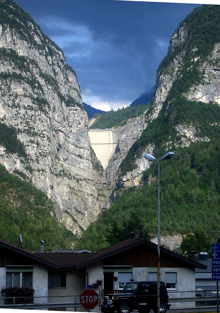
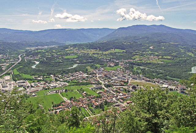
Соверцене (Soverzene, Soverzene)
.svg)
- коммуна Италии
 Hiking in Соверцене
Soverzene, located in the Friuli Venezia Giulia region of Italy, offers stunning landscapes and a variety of hiking opportunities. Situated in the foothills of the Julian Alps, this area is known for its beautiful natural scenery, including dense forests, pristine rivers, and panoramic views of the surrounding mountains.
Popular Hiking Trails
-
Sentiero dell'Acqua: This trail follows the river and showcases the local flora and fauna. It's relatively easy and suitable for families.
-
Altopiano di Sauris: A more challenging hike that leads you to the high plateau, offering breathtaking views and the chance to experience traditional mountain culture.
-
Monte Tersadia: A moderately difficult hike that rewards adventurers with spectacular views of the surrounding ranges.
-
Ciaspolata routes in winter: If you visit during the winter months, there are designated routes for snowshoeing which can be a unique way to experience the winter wonderland.
Considerations
-
Trail Conditions: Always check local trail conditions before heading out, as weather can change rapidly in mountainous areas.
-
Equipment: Good hiking boots, weather-appropriate clothing, and hiking poles can greatly enhance your experience.
-
Safety: Bring along sufficient water, snacks, a map or GPS device, and inform someone of your hiking plans.
-
Wildlife: Be mindful of local wildlife and maintain a respectful distance.
With its striking landscapes and varied trails, Soverzene is a wonderful destination for both novice and experienced hikers. Enjoy exploring this hidden gem!
- Страна:

- Почтовый код: 32010
- Телефонный код: 0437
- Код автомобильного номера: BL
- Координаты: 46° 12' 15" N, 12° 18' 11" E


- GPS треки (wikiloc): [Ссылка]
- Высота над уровнем моря: 424 м m
- Площадь: 14.79 кв.км
- Население: 380
- Веб сайт: http://www.clz.bl.it/web/soverzene
- Википедия русская: wiki(ru)
- Википедия английская: wiki(en)
- Википедия национальная: wiki(it)
- Хранилище Wikidata: Wikidata: Q40189
- Катеория в википедии: [Ссылка]
- код Freebase: [/m/0gk2bh]
- код GeoNames: Альт: [6536635]
- ID отношения в OpenStreetMap: [47040]
- код ISTAT: 025057
- кадастровый код Италии: I876
Граничит с регионами:

Лонгароне
- коммуна Италии
Hiking in Лонгароне
Longarone, located in the Dolomite region of northern Italy, offers spectacular hiking opportunities amidst stunning landscapes characterized by dramatic mountains, lush valleys, and flowing rivers. Here are some highlights and tips for hiking in and around Longarone:...
- Страна:
- Почтовый код: 32013
- Телефонный код: 0437
- Код автомобильного номера: BL
- Координаты: 46° 16' 0" N, 12° 18' 0" E
- GPS треки (wikiloc): [Ссылка]
- Высота над уровнем моря: 473 м m
- Площадь: 122.36 кв.км
- Население: 5254
- Веб сайт: [Ссылка]

Понте-нелле-Альпи
- коммуна Италии
Hiking in Понте-нелле-Альпи
Ponte nelle Alpi, located in the Dolomites region of northern Italy, offers a fantastic environment for hiking enthusiasts. With its breathtaking landscapes, diverse trails, and proximity to nature, it is an ideal destination for both beginner and experienced hikers....
- Страна:
- Почтовый код: 32014
- Телефонный код: 0437
- Код автомобильного номера: BL
- Координаты: 46° 10' 59" N, 12° 16' 45" E
- GPS треки (wikiloc): [Ссылка]
- Высота над уровнем моря: 397 м m
- Площадь: 58.14 кв.км
- Население: 8250
- Веб сайт: [Ссылка]


Эрто-е-Кассо
- коммуна Италии
Hiking in Эрто-е-Кассо
Erto e Casso is a picturesque municipality in the Friuli Venezia Giulia region of Italy, known for its stunning landscapes, rich history, and outdoor activities. It is situated near the Dolomites and the Friulian Alps, making it a great destination for hiking enthusiasts....
- Страна:
- Почтовый код: 33080
- Телефонный код: 0427
- Код автомобильного номера: PN
- Координаты: 46° 16' 35" N, 12° 22' 17" E
- GPS треки (wikiloc): [Ссылка]
- Высота над уровнем моря: 775 м m
- Площадь: 52.43 кв.км
- Население: 371
- Веб сайт: [Ссылка]