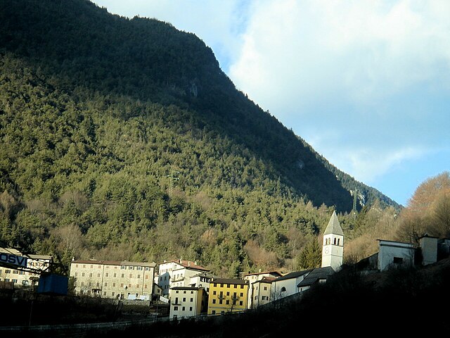
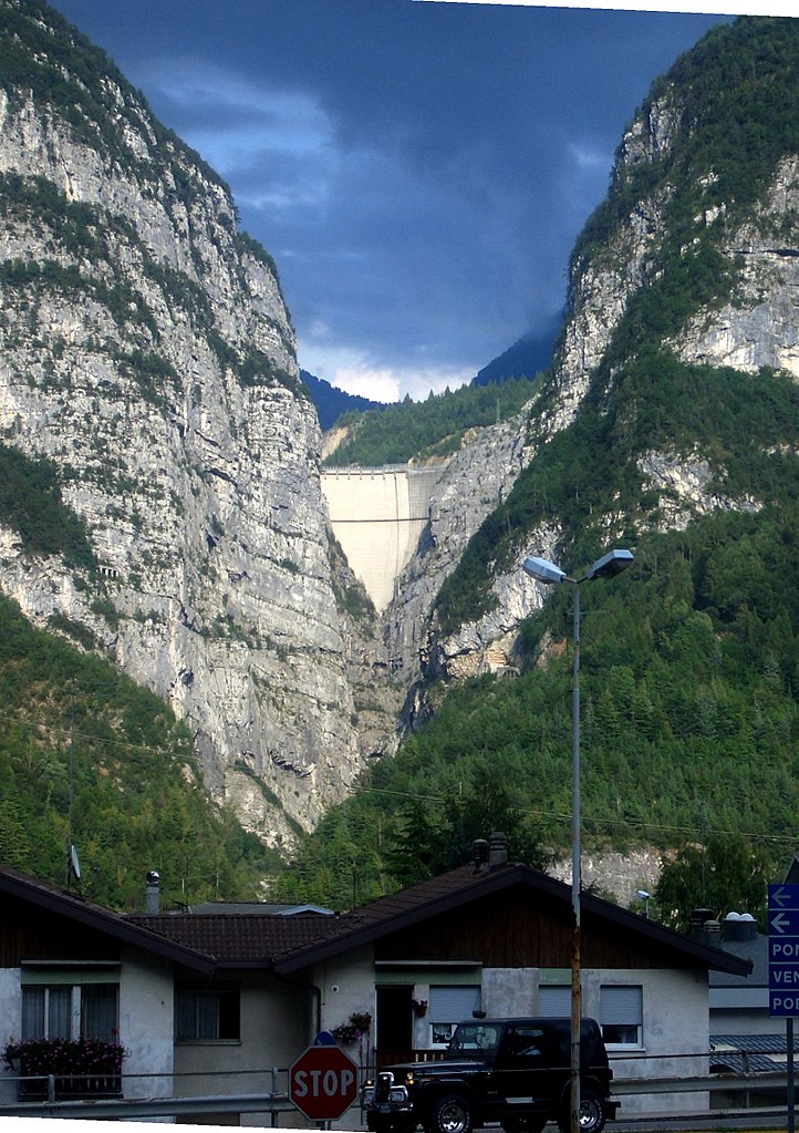
Эрто-е-Кассо (Erto e Casso, Erto e Casso)
.svg)
- коммуна Италии
 Hiking in Эрто-е-Кассо
Erto e Casso is a picturesque municipality in the Friuli Venezia Giulia region of Italy, known for its stunning landscapes, rich history, and outdoor activities. It is situated near the Dolomites and the Friulian Alps, making it a great destination for hiking enthusiasts.
Hiking Highlights in Erto e Casso:
-
Scenic Trails: The region offers a variety of hiking trails that cater to different skill levels, from easy walks through the valleys to more challenging high-altitude hikes. The trails often lead through lush forests, past waterfalls, and alongside rivers, providing breathtaking views of the surrounding mountains.
-
Panoramic Views: Hiking in Erto e Casso allows you to experience some incredible panoramic views of the Piave River Valley and the peaks of the Dolomites. The viewpoints along the trails offer ideal spots for photography and appreciating the natural beauty of the area.
-
Historical Sites: The region is rich in history, with ancient ruins and historical landmarks. Some hiking routes may lead you to fascinating sites, including remnants of World War I, historic villages, and traditional architecture.
-
Flora and Fauna: The diverse ecosystems in Erto e Casso are home to a wide range of flora and fauna. You may encounter various plant species, wildlife, and unique geological formations, adding to the richness of your hiking experience.
-
Cultural Aspects: As you hike through the area, immerse yourself in the local culture. You can explore the charming villages, enjoy authentic Friulian cuisine, and learn about the traditions of the region.
Popular Hiking Routes:
-
Sentiero degli Alpini: This well-known trail takes you through the alpine landscapes and provides insights into the history of the area, particularly relating to the alpine troops in World War I.
-
Sentiero del Casso: A scenic trail that offers beautiful views and connects the town of Casso to surrounding areas.
-
The Val di Zoldo Loop: A longer but rewarding hike that showcases the region’s natural beauty.
Preparation Tips:
-
Equipment: Wear sturdy hiking boots, and bring a backpack with water, snacks, and a map or GPS device.
-
Weather: Check local weather conditions before you set out, as conditions in the mountains can change rapidly.
-
Local Regulations: Be respectful of nature and local communities. Always stick to marked paths and follow any regulations regarding wildlife and conservation.
Accessibility:
The area is accessible by car, and there are parking areas near many trailheads. Public transportation may also be available from larger towns nearby.
Hiking in Erto e Casso offers an exceptional way to connect with nature while enjoying the uniqueness of this beautiful Italian region!
- Страна:

- Почтовый код: 33080
- Телефонный код: 0427
- Код автомобильного номера: PN
- Координаты: 46° 16' 35" N, 12° 22' 17" E


- GPS треки (wikiloc): [Ссылка]
- Высота над уровнем моря: 775 м m
- Площадь: 52.43 кв.км
- Население: 371
- Веб сайт: http://www.comune.ertoecasso.pn.it
- Википедия русская: wiki(ru)
- Википедия английская: wiki(en)
- Википедия национальная: wiki(it)
- Хранилище Wikidata: Wikidata: Q53167
- Катеория в википедии: [Ссылка]
- код Freebase: [/m/0gqz9g]
- код GeoNames: Альт: [6542201]
- код VIAF: Альт: [242335945]
- ID отношения в OpenStreetMap: [79190]
- код ISTAT: 093019
- кадастровый код Италии: D426
Граничит с регионами:


Перароло-ди-Кадоре
- коммуна Италии
Hiking in Перароло-ди-Кадоре
Perarolo di Cadore is a charming village located in the Belluno province of the Veneto region in Italy, surrounded by the stunning Dolomite mountains. This area is known for its breathtaking scenery, rich natural heritage, and a variety of hiking trails that cater to different skill levels. Here’s what you should know if you're considering hiking in Perarolo di Cadore:...
- Страна:
- Почтовый код: 32010
- Телефонный код: 0435
- Код автомобильного номера: BL
- Координаты: 46° 23' 44" N, 12° 21' 23" E
- GPS треки (wikiloc): [Ссылка]
- Высота над уровнем моря: 532 м m
- Площадь: 43.94 кв.км
- Население: 372
- Веб сайт: [Ссылка]

Оспитале-ди-Кадоре
- коммуна Италии
Hiking in Оспитале-ди-Кадоре
Ospitale di Cadore is a picturesque village located in the Dolomite region of northern Italy. Renowned for its stunning natural landscapes, Ospitale di Cadore serves as an excellent base for hiking enthusiasts looking to explore the Dolomites' breathtaking scenery....
- Страна:
- Почтовый код: 32010
- Телефонный код: 0437
- Код автомобильного номера: BL
- Координаты: 46° 19' 45" N, 12° 19' 27" E
- GPS треки (wikiloc): [Ссылка]
- Высота над уровнем моря: 490 м m
- Площадь: 39.78 кв.км
- Население: 281
- Веб сайт: [Ссылка]

Лонгароне
- коммуна Италии
Hiking in Лонгароне
Longarone, located in the Dolomite region of northern Italy, offers spectacular hiking opportunities amidst stunning landscapes characterized by dramatic mountains, lush valleys, and flowing rivers. Here are some highlights and tips for hiking in and around Longarone:...
- Страна:
- Почтовый код: 32013
- Телефонный код: 0437
- Код автомобильного номера: BL
- Координаты: 46° 16' 0" N, 12° 18' 0" E
- GPS треки (wikiloc): [Ссылка]
- Высота над уровнем моря: 473 м m
- Площадь: 122.36 кв.км
- Население: 5254
- Веб сайт: [Ссылка]


Соверцене
- коммуна Италии
Hiking in Соверцене
Soverzene, located in the Friuli Venezia Giulia region of Italy, offers stunning landscapes and a variety of hiking opportunities. Situated in the foothills of the Julian Alps, this area is known for its beautiful natural scenery, including dense forests, pristine rivers, and panoramic views of the surrounding mountains....
- Страна:
- Почтовый код: 32010
- Телефонный код: 0437
- Код автомобильного номера: BL
- Координаты: 46° 12' 15" N, 12° 18' 11" E
- GPS треки (wikiloc): [Ссылка]
- Высота над уровнем моря: 424 м m
- Площадь: 14.79 кв.км
- Население: 380
- Веб сайт: [Ссылка]


Чимолайс
- коммуна Италии
Hiking in Чимолайс
Cimolais, located in the beautiful Friuli Venezia Giulia region of Italy, is a stunning destination for hikers. Nestled in the Dolomites, it offers breathtaking landscapes, diverse trails, and a rich natural environment. Here are some highlights about hiking in and around Cimolais:...
- Страна:
- Почтовый код: 33080
- Телефонный код: 0427
- Код автомобильного номера: PN
- Координаты: 46° 17' 0" N, 12° 26' 0" E
- GPS треки (wikiloc): [Ссылка]
- Высота над уровнем моря: 652 м m
- Площадь: 100.86 кв.км
- Население: 363
- Веб сайт: [Ссылка]


Клаут
- коммуна Италии
Hiking in Клаут
Claut is a picturesque village located in the Friuli Venezia Giulia region of northeastern Italy. Nestled in the heart of the Carnic Alps, it offers excellent hiking opportunities for both beginners and experienced hikers. Here are some aspects to consider when hiking in Claut:...
- Страна:
- Почтовый код: 33080
- Телефонный код: 0427
- Код автомобильного номера: PN
- Координаты: 46° 16' 0" N, 12° 31' 0" E
- GPS треки (wikiloc): [Ссылка]
- Высота над уровнем моря: 613 м m
- Площадь: 165.91 кв.км
- Население: 946
- Веб сайт: [Ссылка]