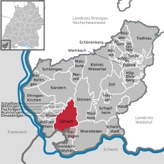
Штайнен (Steinen, Steinen)

 Hiking in Штайнен
Steinen, located in the scenic region of Baden-Württemberg, Germany, offers beautiful hiking opportunities with a variety of trails suitable for different skill levels. The area is known for its lush landscapes, rolling hills, and picturesque views of the surrounding countryside.
Popular Hiking Trails:
-
The Panorama Trail (Panoramaweg):
- This is a popular trail that provides breathtaking views of the Rhine Valley and the Black Forest mountains. It generally spans around 10-15 kilometers and is suitable for hikers of all skill levels.
-
The Weg der Sinne:
- This nature trail aims to engage all the senses, providing information about local flora and fauna along the way. It usually covers a shorter distance, making it family-friendly and accessible.
-
The Nature Reserve Trails:
- Steinen is close to several nature reserves that feature well-marked hiking routes. Here, hikers can enjoy diverse ecosystems, unique wildlife, and tranquil surroundings.
Additional Tips for Hiking in Steinen:
-
Seasonal Considerations:
- Spring and autumn are ideal for hiking due to moderate temperatures and less crowded trails. However, summer months also offer a vibrant experience with wildflowers and lush greenery.
-
Equipment:
- Good hiking shoes are essential, as some trails can be rocky or uneven. It’s also wise to bring water, snacks, and weather-appropriate clothing.
-
Local Attractions:
- While hiking, you might want to explore local attractions such as the nearby towns with traditional architecture or take part in regional festivities, which can enhance your experience.
-
Safety:
- Always inform someone about your hiking plans, especially if you're going on less trafficked trails, and carry a map or GPS device for navigation.
Whether you're a seasoned hiker or just looking to enjoy a leisurely walk in nature, Steinen offers a peaceful and captivating hiking experience. Enjoy the journey!
- Страна:

- Почтовый код: 79585
- Телефонный код: 07627
- Координаты: 47° 38' 43" N, 7° 44' 25" E


- GPS треки (wikiloc): [Ссылка]
- Высота над уровнем моря: 338 м m
- Площадь: 46.86 кв.км
- Население: 9790
- Веб сайт: https://www.steinen.de/
- Википедия русская: wiki(ru)
- Википедия английская: wiki(en)
- Википедия национальная: wiki(de)
- Хранилище Wikidata: Wikidata: Q62014
- Катеория в википедии: [Ссылка]
- код Freebase: [/m/0f5d8d]
- код GeoNames: Альт: [6555894]
- ID отношения в OpenStreetMap: [1130275]
- код GND: Альт: [4381135-8]
- идентификатор местоположения ArchINFORM: [43925]
- идентификатор муниципалитетов в Германии: 08336084
Граничит с регионами:

Лёррах
Hiking in Лёррах
Lörrach, located in the southwestern part of Germany near the border with Switzerland, offers a variety of hiking opportunities that showcase the region's beautiful landscapes and natural features. Here are some highlights and tips for hiking in and around Lörrach:...
- Страна:
- Почтовый код: 79539–79541
- Телефонный код: 07621
- Координаты: 47° 36' 56" N, 7° 39' 41" E
- GPS треки (wikiloc): [Ссылка]
- Высота над уровнем моря: 294 м m
- Площадь: 39.42 кв.км
- Население: 48601
- Веб сайт: [Ссылка]