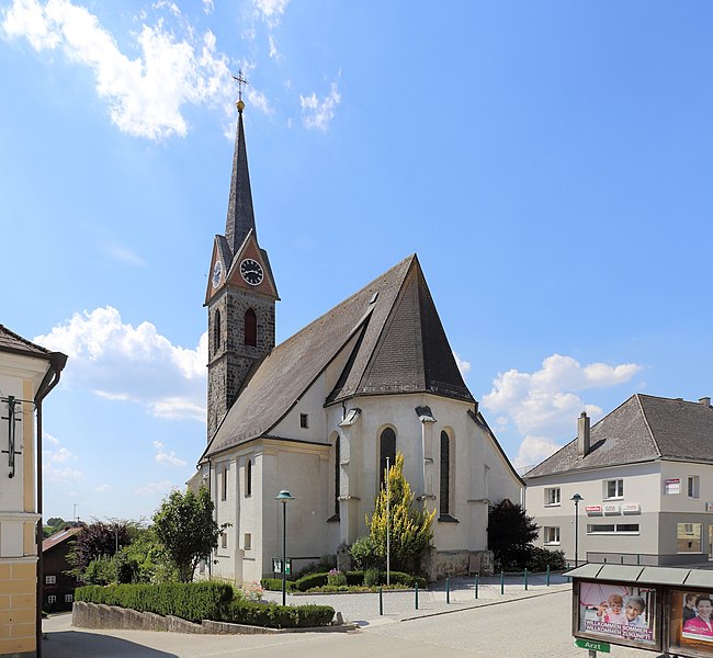
Тауфкирхен-на-Праме (Taufkirchen an der Pram, Taufkirchen an der Pram)
 Hiking in Тауфкирхен-на-Праме
Taufkirchen an der Pram is a picturesque village located in the Upper Austria region, known for its beautiful landscapes and rural charm. When it comes to hiking in the area, you'll find a variety of trails that showcase the natural beauty of the surrounding countryside. Here are some aspects to consider for hiking in Taufkirchen an der Pram:
Trails and Nature
-
Scenic Routes: The region offers a network of hiking trails that pass through lush forests, rolling hills, and quaint farmland. Many trails are well-marked and range from easy walks to more challenging hikes.
-
Pram River: Hiking along the banks of the Pram River is particularly rewarding, as it provides opportunities for bird watching and enjoying the serene environment.
-
Nearby Nature Reserves: Explore the nearby nature reserves or protected areas, which often feature diverse flora and fauna, making for an enriching hiking experience.
Suitable for All Levels
-
Family-Friendly Trails: There are several easy, family-friendly trails suitable for hikers of all ages. These paths often have gentle inclines and offer beautiful views, making them great for a leisurely hike.
-
Challenging Options: For more seasoned hikers, there are opportunities for longer and more strenuous hikes that may involve steeper terrain and longer distances.
Hiking Tips
-
Weather Considerations: Be sure to check the weather before setting out, as conditions can change quickly in this region.
-
Proper Gear: Wear appropriate hiking shoes and bring along enough water, snacks, and a first-aid kit.
-
Local Maps: It's advisable to have a local hiking map or use a reliable GPS app to navigate the trails, as some may not be well-signposted.
-
Respect Nature: Always practice Leave No Trace principles to preserve the pristine beauty of the area for future generations.
Cultural Aspects
- Along your hiking adventure, take the time to appreciate the local culture. You might encounter small villages and farms, providing insight into rural life in Austria.
Hiking in Taufkirchen an der Pram is not only about enjoying the physical activity but also embracing the tranquility and beauty of the Austrian landscape. Enjoy your hike!
- Страна:

- Почтовый код: 4775
- Телефонный код: 07719
- Код автомобильного номера: SD
- Координаты: 48° 25' 0" N, 13° 32' 0" E


- GPS треки (wikiloc): [Ссылка]
- Высота над уровнем моря: 338 м m
- Площадь: 29.15 кв.км
- Население: 2925
- Веб сайт: http://www.taufkirchen-pram.at
- Википедия русская: wiki(ru)
- Википедия английская: wiki(en)
- Википедия национальная: wiki(de)
- Хранилище Wikidata: Wikidata: Q205733
- Катеория в википедии: [Ссылка]
- код Freebase: [/m/03gvbw0]
- код GeoNames: Альт: [7873219]
- код VIAF: Альт: [236095669]
- идентификатор местоположения ArchINFORM: [10604]
- код места в Facebook: [114554398558177]
- код австрийского муниципалитета: [41426]
Граничит с регионами:

Андорф
- муниципалитет в Австрии
Hiking in Андорф
Andorf, located in the Innviertel region of Austria, offers a charming setting for hiking enthusiasts. The area is characterized by rolling hills, picturesque landscapes, and a mix of forests and open fields, making it suitable for various hiking levels....
- Страна:
- Почтовый код: 4770
- Телефонный код: 07766
- Код автомобильного номера: SD
- Координаты: 48° 22' 0" N, 13° 34' 0" E
- GPS треки (wikiloc): [Ссылка]
- Высота над уровнем моря: 346 м m
- Площадь: 38 кв.км
- Население: 5174
- Веб сайт: [Ссылка]

Санкт-Флориан-на-Инне
Hiking in Санкт-Флориан-на-Инне
Sankt Florian am Inn is a picturesque village located in the Innviertel region of Upper Austria, right along the banks of the River Inn. The area is known for its natural beauty, rolling hills, and varied landscapes, making it a fantastic destination for hikers of all levels. Here are some highlights to consider:...
- Страна:
- Почтовый код: 4782
- Код автомобильного номера: SD
- Координаты: 48° 26' 0" N, 13° 36' 0" E
- GPS треки (wikiloc): [Ссылка]
- Высота над уровнем моря: 321 м m
- Площадь: 24 кв.км
- Население: 3150
- Веб сайт: [Ссылка]

Райнбах
Hiking in Райнбах
Rainbach im Innkreis is a charming area located in the Upper Austria region, surrounded by beautiful natural landscapes that are perfect for hiking enthusiasts. The region features rolling hills, lush forests, and scenic views, making it an inviting destination for both casual walkers and experienced trekkers....
- Страна:
- Телефонный код: 07716
- Код автомобильного номера: SD
- Координаты: 48° 27' 0" N, 13° 32' 0" E
- GPS треки (wikiloc): [Ссылка]
- Высота над уровнем моря: 371 м m
- Площадь: 25 кв.км
- Население: 1478
- Веб сайт: [Ссылка]

Санкт-Мариенкирхен-Шердинг
Hiking in Санкт-Мариенкирхен-Шердинг
Sankt Marienkirchen bei Schärding, located in Austria, offers a beautiful backdrop for hiking enthusiasts. Nestled in the scenic Innviertel region, it features a mix of gentle hills, lush green landscapes, and stunning views of the surrounding countryside, including the nearby River Inn....
- Страна:
- Почтовый код: 4774
- Телефонный код: 07711
- Код автомобильного номера: SD
- Координаты: 48° 23' 0" N, 13° 27' 0" E
- GPS треки (wikiloc): [Ссылка]
- Высота над уровнем моря: 338 м m
- Площадь: 25 кв.км
- Население: 1832
- Веб сайт: [Ссылка]
Эггердинг
Hiking in Эггердинг
Eggerding, a small village located in Austria, is surrounded by beautiful landscapes that offer a range of hiking opportunities. The region is characterized by picturesque alpine scenery, rolling hills, and lush forests, making it a great destination for hikers of all skill levels....
- Страна:
- Почтовый код: 4773
- Телефонный код: 07767
- Код автомобильного номера: SD
- Координаты: 48° 21' 0" N, 13° 29' 0" E
- GPS треки (wikiloc): [Ссылка]
- Высота над уровнем моря: 382 м m
- Площадь: 22 кв.км
- Население: 1320
- Веб сайт: [Ссылка]
Дирсбах
Hiking in Дирсбах
Diersbach, situated in Austria, offers various hiking opportunities for both beginners and experienced hikers due to its picturesque landscapes and diverse terrain. Here are a few highlights you might find enjoyable:...
- Страна:
- Почтовый код: 4776
- Телефонный код: 07719
- Код автомобильного номера: SD
- Координаты: 48° 25' 0" N, 13° 34' 0" E
- GPS треки (wikiloc): [Ссылка]
- Высота над уровнем моря: 335 м m
- Площадь: 28 кв.км
- Население: 1583
- Веб сайт: [Ссылка]