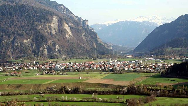
Трин (Trin, Trin)

 Hiking in Трин
Hiking in Trin, a small village in the canton of Graubünden in Switzerland, offers stunning opportunities for outdoor enthusiasts. Known for its breathtaking landscapes, Trin serves as a great base for a variety of hiking trails that cater to different skill levels.
Popular Hiking Trails in Trin:
-
Trin to Flims:
- Distance: Approximately 12 km
- Duration: About 3 to 4 hours
- Difficulty: Moderate
- This scenic route takes you along the Plessur River, with beautiful views of the surrounding mountains and lush landscapes. You can also take a break at one of the spots along the way to enjoy a picnic.
-
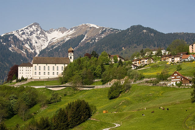
Trin Castle (Trin Schloss):
- Distance: Shorter hiking loop of about 5 km
- Duration: 1 to 2 hours
- Difficulty: Easy to moderate
- This hike is great for families and those looking for a shorter adventure. The trail leads to the historic Trin Castle, offering panoramic views and a bit of cultural exploration.
-
Via Alpina:
- The Via Alpina is a long-distance hiking trail that passes through the Graubünden region. You can explore segments of it starting from Trin, experiencing diverse alpine flora and fauna along the way.
Tips for Hiking in Trin:
- Weather: Always check the weather before heading out as conditions can change quickly in the mountains.
- Gear: Wear appropriate hiking shoes and bring layers, as temperatures can vary. A good backpack with water, food, and first-aid supplies is also advisable.
- Maps and Markers: Utilize local maps and follow trail markers. The hiking paths are generally well-signposted.
- Local Advice: Don’t hesitate to stop by a local tourism office for recommendations, as they can provide updated information on trail conditions.
Best Time to Visit:
The best time for hiking in Trin is late spring to early autumn (May to October). During these months, the weather is most favorable, and trails are usually well-maintained.
Hiking in Trin is a perfect blend of natural beauty and cultural exploration, making it a wonderful destination for all types of hikers. Enjoy the adventure!
- Страна:

- Почтовый код: 7014
- Телефонный код: 081
- Код автомобильного номера: GR
- Координаты: 46° 51' 45" N, 9° 19' 48" E


- GPS треки (wikiloc): [Ссылка]
- Высота над уровнем моря: 1851 м m
- Площадь: 47.17 кв.км
- Население: 1408
- Веб сайт: http://www.trin.ch
- Википедия русская: wiki(ru)
- Википедия английская: wiki(en)
- Википедия национальная: wiki(de)
- Хранилище Wikidata: Wikidata: Q65564
- Катеория в википедии: [Ссылка]
- код Freebase: [/m/0frny8]
- код GeoNames: Альт: [7287336]
- код VIAF: Альт: [269145858083223022213]
- ID отношения в OpenStreetMap: [1684192]
- идентификатор местоположения ArchINFORM: [12018]
- идентификатор HDS: [1519]
- код швейцарского муниципалитета: [3734]
Граничит с регионами:

Бонадуц
Hiking in Бонадуц
Bonaduz, located in the Grisons region of Switzerland, is an excellent destination for hiking enthusiasts. The area is characterized by its stunning natural landscapes, including the surrounding mountains, lush forests, and scenic rivers....
- Страна:
- Почтовый код: 7402
- Телефонный код: 081
- Код автомобильного номера: GR
- Координаты: 46° 48' 19" N, 9° 22' 15" E
- GPS треки (wikiloc): [Ссылка]
- Высота над уровнем моря: 743 м m
- Площадь: 14.40 кв.км
- Население: 3294
- Веб сайт: [Ссылка]


Таминс
Hiking in Таминс
Tamins, a picturesque village located in the Graubünden region of Switzerland, offers a wonderful setting for hiking enthusiasts. Nestled in the Rhine Valley, surrounded by stunning mountain landscapes, it provides various trails suitable for different skill levels....
- Страна:
- Почтовый код: 7015
- Телефонный код: 081
- Код автомобильного номера: GR
- Координаты: 46° 49' 46" N, 9° 24' 24" E
- GPS треки (wikiloc): [Ссылка]
- Высота над уровнем моря: 1430 м m
- Площадь: 40.74 кв.км
- Население: 1213
- Веб сайт: [Ссылка]
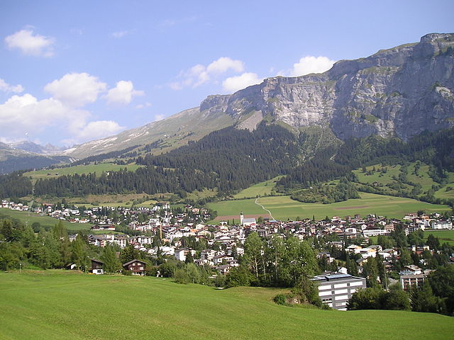

Флимс
Hiking in Флимс
Flims, located in the Swiss canton of Graubünden, is a fantastic destination for hiking enthusiasts. This picturesque region offers stunning scenery, including impressive rock formations, forests, alpine meadows, and beautiful lakes. Here are some highlights and essential information for hiking in Flims:...
- Страна:
- Почтовый код: 7017
- Телефонный код: 081
- Код автомобильного номера: GR
- Координаты: 46° 49' 59" N, 9° 16' 59" E
- GPS треки (wikiloc): [Ссылка]
- Высота над уровнем моря: 1848 м m
- Площадь: 50.46 кв.км
- Население: 2825
- Веб сайт: [Ссылка]

Пфеферс
Hiking in Пфеферс
Pfäfers, located in the canton of St. Gallen in Switzerland, is a stunning destination for hiking enthusiasts. The region is renowned for its dramatic landscapes, featuring the picturesque Rhine Gorge, often referred to as the "Grand Canyon of Switzerland." Here are some highlights and tips for hiking in Pfäfers:...
- Страна:
- Почтовый код: 7312
- Телефонный код: 081
- Код автомобильного номера: SG
- Координаты: 46° 58' 59" N, 9° 29' 59" E
- GPS треки (wikiloc): [Ссылка]
- Высота над уровнем моря: 820 м m
- Площадь: 128.53 кв.км
- Население: 1574
- Веб сайт: [Ссылка]