
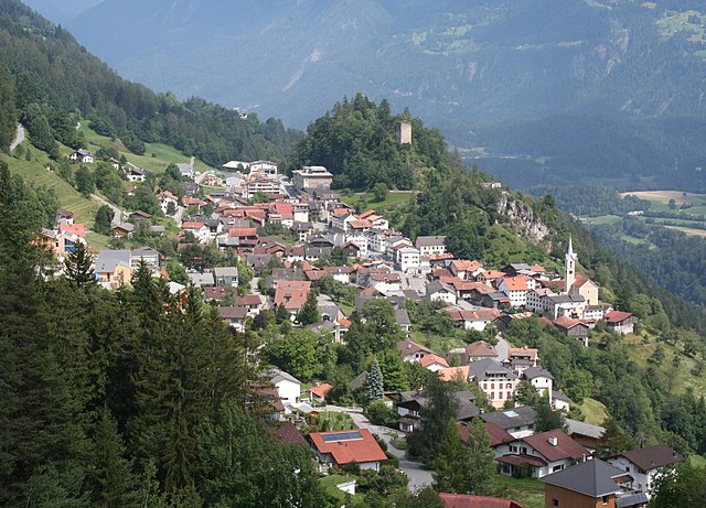
Флимс (Flims, Flims)

 Hiking in Флимс
Flims, located in the Swiss canton of Graubünden, is a fantastic destination for hiking enthusiasts. This picturesque region offers stunning scenery, including impressive rock formations, forests, alpine meadows, and beautiful lakes. Here are some highlights and essential information for hiking in Flims:
1.
Flims boasts a variety of hiking trails suitable for different skill levels, from easy walks to challenging hikes. Popular routes include:
- Flims to Foppa: An easy to moderate trail that allows you to enjoy the scenic views of the surrounding mountains.
- The Rhine Gorge (Grand Canyon of Switzerland): A spectacular hike that offers breathtaking views of the canyon and the Rhine River.
- Lake Cauma: A lovely circular hike around the turquoise waters of Lake Cauma, accessible via a short descent from Flims.
- Flims' Mountain Trails: Explore the higher-altitude trails like the hike from Flims to the summit of Piz Grisch, which offers panoramic views.
2.
The hiking trails in Flims are renowned for their natural beauty. You'll encounter diverse flora, including alpine flowers, and wildlife such as deer and various birds. The dramatic landscapes of the Swiss Alps provide endless opportunities for photography.
3.
The trails can be accessed from the town of Flims and are well-marked with signposts. Public transportation, including buses and cable cars, can also help reach higher trails, making it convenient to plan your hiking routes.
4.
The best time for hiking in Flims typically ranges from late spring (May) to early autumn (September), as the weather is milder and the trails are snow-free. Summer months are particularly popular for hiking, but make sure to check weather conditions before heading out.
5.
- Gear: Wear appropriate hiking shoes, and carry layers for changing weather, along with enough water and snacks.
- Maps: While trails are well-marked, carrying a map or having a digital hiking app can be beneficial.
- Weather: Be mindful of the weather conditions, as they can change rapidly in the mountains.
6.
After a day of hiking, explore the charming village of Flims, where you can enjoy local cuisine and relax at wellness centers that often include spas and massage services.
7.
For those who prefer a guided experience, local hiking guides offer organized hikes, teaching you about the area's flora, fauna, and geological features.
Flims is truly a gem for outdoor enthusiasts, with its rich natural beauty and extensive hiking options. Whether you're a beginner or an experienced hiker, you can find trails that suit your preferences and enjoy the magnificent Swiss landscape!
- Страна:

- Почтовый код: 7017
- Телефонный код: 081
- Код автомобильного номера: GR
- Координаты: 46° 49' 59" N, 9° 16' 59" E


- GPS треки (wikiloc): [Ссылка]
- Высота над уровнем моря: 1848 м m
- Площадь: 50.46 кв.км
- Население: 2825
- Веб сайт: http://www.gemeindeflims.ch
- Википедия русская: wiki(ru)
- Википедия английская: wiki(en)
- Википедия национальная: wiki(de)
- Хранилище Wikidata: Wikidata: Q65049
- Катеория в википедии: [Ссылка]
- код Freebase: [/m/09x0z5]
- код GeoNames: Альт: [7285840]
- код VIAF: Альт: [242066877]
- ID отношения в OpenStreetMap: [1684080]
- код GND: Альт: [4017562-5]
- идентификатор местоположения ArchINFORM: [4294]
- код LCNAF: Альт: [n84168828]
- идентификатор HDS: [1517]
- код швейцарского муниципалитета: [3732]
- LIR: [271]
Граничит с регионами:

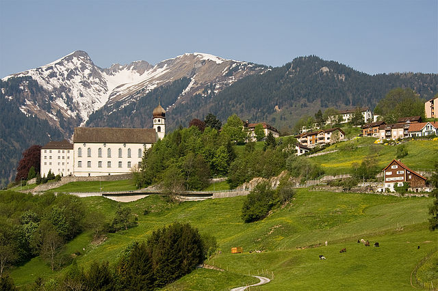
Трин
Hiking in Трин
Hiking in Trin, a small village in the canton of Graubünden in Switzerland, offers stunning opportunities for outdoor enthusiasts. Known for its breathtaking landscapes, Trin serves as a great base for a variety of hiking trails that cater to different skill levels....
- Страна:
- Почтовый код: 7014
- Телефонный код: 081
- Код автомобильного номера: GR
- Координаты: 46° 51' 45" N, 9° 19' 48" E
- GPS треки (wikiloc): [Ссылка]
- Высота над уровнем моря: 1851 м m
- Площадь: 47.17 кв.км
- Население: 1408
- Веб сайт: [Ссылка]


Сагонь
Hiking in Сагонь
Sagogn is a charming village located in the Swiss canton of Graubünden, nestled amid stunning alpine scenery. It's an excellent destination for hiking enthusiasts, offering a variety of trails suitable for different skill levels. Here are some key points to consider when hiking in and around Sagogn:...
- Страна:
- Почтовый код: 7152
- Телефонный код: 081
- Код автомобильного номера: GR
- Координаты: 46° 47' 32" N, 9° 15' 21" E
- GPS треки (wikiloc): [Ссылка]
- Высота над уровнем моря: 809 м m
- Площадь: 6.92 кв.км
- Население: 686
- Веб сайт: [Ссылка]

Пфеферс
Hiking in Пфеферс
Pfäfers, located in the canton of St. Gallen in Switzerland, is a stunning destination for hiking enthusiasts. The region is renowned for its dramatic landscapes, featuring the picturesque Rhine Gorge, often referred to as the "Grand Canyon of Switzerland." Here are some highlights and tips for hiking in Pfäfers:...
- Страна:
- Почтовый код: 7312
- Телефонный код: 081
- Код автомобильного номера: SG
- Координаты: 46° 58' 59" N, 9° 29' 59" E
- GPS треки (wikiloc): [Ссылка]
- Высота над уровнем моря: 820 м m
- Площадь: 128.53 кв.км
- Население: 1574
- Веб сайт: [Ссылка]


Лакс
Hiking in Лакс
Laax, located in the Swiss Alps in the canton of Graubünden, is a fantastic destination for hiking enthusiasts. Known for its breathtaking landscapes, diverse trails, and stunning alpine scenery, Laax offers hiking options for all skill levels. Here are some key aspects to consider if you're planning to hike in Laax:...
- Страна:
- Почтовый код: 7031
- Телефонный код: 081
- Код автомобильного номера: GR
- Координаты: 46° 50' 45" N, 9° 13' 40" E
- GPS треки (wikiloc): [Ссылка]
- Высота над уровнем моря: 1685 м m
- Площадь: 31.68 кв.км
- Население: 1755
- Веб сайт: [Ссылка]

Glarus Süd
Hiking in Glarus Süd
Glarus Süd, located in the canton of Glarus in Switzerland, is a fantastic destination for hiking enthusiasts. This region boasts stunning landscapes, ranging from lush valleys to rugged mountain terrains. Here are some key points about hiking in Glarus Süd:...
- Страна:
- Почтовый код: 8756, 8762, 8765, 8766, 8767, 8772, 8773, 8774, 8775, 8777, 8782, 8783, 8784
- Телефонный код: 055
- Код автомобильного номера: GL
- Координаты: 46° 59' 40" N, 9° 4' 27" E
- GPS треки (wikiloc): [Ссылка]
- Высота над уровнем моря: 521 м m
- Площадь: 430.2 кв.км
- Население: 9581
- Веб сайт: [Ссылка]