Удлигенсвиль (Udligenswil, Udligenswil)

 Hiking in Удлигенсвиль
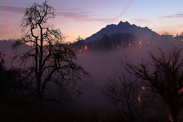
Udligenswil is a charming municipality located in the canton of Lucerne, Switzerland, surrounded by beautiful landscapes and scenic views. Hiking in this region can be a delightful experience, as it offers a mix of easy walks and more challenging trails suitable for various skill levels.
Popular Hiking Trails in Udligenswil:
-
Lake Lucerne Trail:
- This relatively easy trail takes you along the shores of Lake Lucerne, providing stunning views of the lake and surrounding mountains. The path is suitable for families and offers numerous spots for picnicking.
-
Hiking to the Meggenhorn:
- A moderately challenging hike that ascends to the Meggenhorn, offering panoramic views of Lake Lucerne, the city of Lucerne, and the surrounding mountains. This trail can be enjoyed year-round, though it's best in spring and autumn.
-
Uelin Trail:
- This is a well-marked circular route that allows you to explore the natural beauty around Udligenswil. Expect a mix of forest paths and open fields, with opportunities to spot local wildlife.
Tips for Hiking in Udligenswil:
- Weather: Always check the weather forecast before your hike. The Swiss weather can change rapidly, especially in mountainous areas.
- Gear: Wear appropriate hiking shoes and dress in layers to accommodate changing temperatures.
- Navigation: Familiarize yourself with the area using local maps or hiking apps. Signage along the trails is generally clear, but it's good to be prepared.
- Hydration and Snacks: Bring plenty of water and snacks to keep your energy up during the hike.
- Respect Nature: Stay on marked trails to minimize your impact on the environment, and carry out any trash you bring with you.
Accessibility:
Udligenswil has good public transportation connections, making it easy to reach starting points for hikes. Consider combining your hike with a visit to the nearby city of Lucerne, where you can explore its cultural offerings.
Whether you're a novice or an experienced hiker, Udligenswil offers beautiful trails that capture the essence of Swiss nature. Enjoy your hiking adventure!
- Страна:

- Почтовый код: 6044
- Телефонный код: 041
- Код автомобильного номера: LU
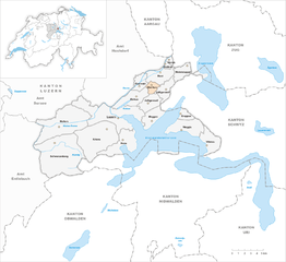
- Координаты: 47° 5' 28" N, 8° 23' 59" E


- GPS треки (wikiloc): [Ссылка]
- Высота над уровнем моря: 624 м m
- Площадь: 6.25 кв.км
- Население: 2279
- Веб сайт: http://www.udligenswil.ch
- Википедия русская: wiki(ru)
- Википедия английская: wiki(en)
- Википедия национальная: wiki(de)
- Хранилище Wikidata: Wikidata: Q14577
- Катеория в википедии: [Ссылка]
- код Freebase: [/m/0fn6wf]
- код GeoNames: Альт: [7287357]
- код VIAF: Альт: [137389009]
- ID отношения в OpenStreetMap: [1682925]
- идентификатор HDS: [630]
- код швейцарского муниципалитета: [1067]
Граничит с регионами:

Адлигенсвиль
Hiking in Адлигенсвиль
Adligenswil is a charming municipality located near Lucerne, Switzerland, and offers a variety of hiking opportunities that cater to different skill levels. The region is characterized by its stunning natural landscapes, including rolling hills, forests, and views of Lake Lucerne and the surrounding mountains....
- Страна:
- Почтовый код: 6043
- Телефонный код: 041
- Код автомобильного номера: LU
- Координаты: 47° 4' 20" N, 8° 22' 6" E
- GPS треки (wikiloc): [Ссылка]
- Высота над уровнем моря: 569 м m
- Площадь: 6.99 кв.км
- Население: 5343
- Веб сайт: [Ссылка]

Дирикон
Hiking in Дирикон
Dierikon is a small community located in the canton of Lucerne in Switzerland, surrounded by beautiful natural scenery, making it an excellent destination for hiking enthusiasts. Here are some things you can expect when hiking in and around Dierikon:...
- Страна:
- Почтовый код: 6036
- Телефонный код: 041
- Код автомобильного номера: LU
- Координаты: 47° 5' 49" N, 8° 22' 17" E
- GPS треки (wikiloc): [Ссылка]
- Высота над уровнем моря: 429 м m
- Площадь: 2.78 кв.км
- Население: 1503
- Веб сайт: [Ссылка]


Майерскаппель
Hiking in Майерскаппель
Meierskappel is a picturesque village located in the canton of Lucerne, Switzerland, which offers a variety of hiking opportunities amidst beautiful landscapes. The area is characterized by its rolling hills, lush forests, and stunning views of the surrounding mountains and the nearby Lake Lucerne....
- Страна:
- Почтовый код: 6344
- Телефонный код: 041
- Код автомобильного номера: LU
- Координаты: 47° 7' 32" N, 8° 26' 39" E
- GPS треки (wikiloc): [Ссылка]
- Высота над уровнем моря: 487 м m
- Площадь: 9.23 кв.км
- Население: 1369
- Веб сайт: [Ссылка]


Рот
- община швейцарии в Швейцарии, Люцерн
Hiking in Рот
Root, Switzerland, is located in the canton of Luzern and offers beautiful hiking opportunities, characterized by scenic views, lush landscapes, and a variety of trails suitable for different skill levels. Here are some highlights for hiking in and around Root:...
- Страна:
- Почтовый код: 6037
- Телефонный код: 041
- Код автомобильного номера: LU
- Координаты: 47° 6' 57" N, 8° 23' 29" E
- GPS треки (wikiloc): [Ссылка]
- Высота над уровнем моря: 422 м m
- Площадь: 8.65 кв.км
- Население: 4995
- Веб сайт: [Ссылка]


Кюснахт-ам-Риги
Hiking in Кюснахт-ам-Риги
Küssnacht, located in the picturesque Swiss region of Central Switzerland, offers a variety of hiking trails that cater to different skill levels, making it a great destination for hikers. Nestled along the shores of Lake Zug and near Mount Rigi, the area provides stunning views and diverse landscapes. Here are some highlights of hiking in and around Küssnacht:...
- Страна:
- Почтовый код: 6403
- Телефонный код: 041
- Код автомобильного номера: SZ
- Координаты: 47° 4' 58" N, 8° 26' 27" E
- GPS треки (wikiloc): [Ссылка]
- Высота над уровнем моря: 445 м m
- Площадь: 36.2 кв.км
- Население: 12845
- Веб сайт: [Ссылка]