Вальбонн (Valbonne, Valbonne)

- коммуна в департаменте Приморские Альпы, регион Прованс — Альпы — Лазурный Берег, Франция
 Hiking in Вальбонн
Valbonne, located in the Alpes-Maritimes department in the Provence-Alpes-Côte d'Azur region of France, is known for its picturesque ambiance and lush surroundings, making it a lovely destination for hiking enthusiasts.
Key Highlights for Hiking in Valbonne:
-
Scenic Trails: The area around Valbonne features a variety of trails that wind through beautiful landscapes, including wooded areas, hills, and valleys. These trails often offer views of the surrounding countryside and the French Riviera.
-
Parc de la Brague: One of the prime spots for hiking near Valbonne is the Parc de la Brague. This park has well-marked trails that follow the Brague River, presenting a serene hiking experience amidst nature. The paths are suitable for hikers of all levels and offer opportunities for wildlife watching.
-
Cultural and Historical Sites: Some trails may lead you to charming villages and historical sites, allowing you to combine hiking with cultural exploration. The medieval village of Valbonne itself is a great place to start your adventures, with its cobblestone streets and quaint architecture.
-
Nearby Natural Parks: Valbonne is close to the Greater Cannes area and several regional natural parks, such as the Parc Natural Régional des Préalpes d'Azur. These areas offer even more hiking opportunities, including challenging routes for experienced hikers.
-
Seasonal Considerations: The best times to hike in Valbonne are during the spring and fall when the weather is mild and the flora is vibrant. Summer can also be enjoyable, but it's essential to stay hydrated and protect yourself from the sun.
Tips for Hiking in Valbonne:
- Trail Maps: Make sure to pick up trail maps at local tourist offices or download maps online for easier navigation.
- Appropriate Gear: Wear sturdy hiking shoes, and consider bringing trekking poles, especially if you plan on tackling steeper trails.
- Pack Essentials: Carry sufficient water, snacks, and a first-aid kit. Depending on the length of your hike, a light backpack can be useful for carrying these items.
- Respect Nature: Always follow the Leave No Trace principles to keep the environment intact for others.
Conclusion
Hiking in Valbonne allows you to enjoy both natural beauty and cultural richness. Whether you're a novice or an experienced hiker, there's something for everyone in this idyllic region of southern France. Always check local guidelines and weather conditions before heading out, and enjoy your adventures in Valbonne!
- Страна:

- Почтовый код: 06560
- Координаты: 43° 38' 29" N, 7° 0' 32" E


- GPS треки (wikiloc): [Ссылка]
- Площадь: 18.97 кв.км
- Население: 13183
- Википедия русская: wiki(ru)
- Википедия английская: wiki(en)
- Википедия национальная: wiki(fr)
- Хранилище Wikidata: Wikidata: Q383436
- Катеория в википедии: [Ссылка]
- код Freebase: [/m/08h51h]
- код Freebase: [/m/08h51h]
- код GeoNames: Альт: [6425693]
- код GeoNames: Альт: [6425693]
- номер SIREN: [210601522]
- номер SIREN: [210601522]
- код VIAF: Альт: [132544279]
- код VIAF: Альт: [132544279]
- код LCNAF: Альт: [n82062852]
- код LCNAF: Альт: [n82062852]
- место в MusicBrainz: [47b21c46-406b-4180-9d51-c8e060609abd]
- место в MusicBrainz: [47b21c46-406b-4180-9d51-c8e060609abd]
- код темы Quora: [Valbonne]
- код темы Quora: [Valbonne]
- код муниципалитета INSEE: 06152
- код муниципалитета INSEE: 06152
- код US National Archives: 10044574
- код US National Archives: 10044574
Граничит с регионами:


Антиб
- коммуна в департаменте Приморские Альпы, регион Прованс — Альпы — Лазурный Берег, Франция
- Страна:
- Почтовый код: 06160
- Координаты: 43° 34' 48" N, 7° 7' 23" E
- GPS треки (wikiloc): [Ссылка]
- Высота над уровнем моря: 0 м m
- Площадь: 26.48 кв.км
- Население: 74875
- Веб сайт: [Ссылка]
Мужен
- коммуна в департаменте Приморские Альпы, регион Прованс — Альпы — Лазурный Берег, Франция
- Страна:
- Почтовый код: 06250
- Координаты: 43° 36' 0" N, 6° 59' 41" E
- GPS треки (wikiloc): [Ссылка]
- Площадь: 25.64 кв.км
- Население: 18476
- Веб сайт: [Ссылка]

Валлорис
- коммуна в департаменте Приморские Альпы, регион Прованс — Альпы — Лазурный Берег, Франция
- Страна:
- Почтовый код: 06220
- Координаты: 43° 34' 47" N, 7° 3' 12" E
- GPS треки (wikiloc): [Ссылка]
- Площадь: 13.04 кв.км
- Население: 25966
- Веб сайт: [Ссылка]


Биот
- коммуна в департаменте Приморские Альпы, регион Прованс — Альпы — Лазурный Берег, Франция
- Страна:
- Почтовый код: 06410
- Координаты: 43° 37' 43" N, 7° 5' 44" E
- GPS треки (wikiloc): [Ссылка]
- Площадь: 15.54 кв.км
- Население: 9876
- Веб сайт: [Ссылка]

Вильнёв-Лубе
- коммуна в департаменте Приморские Альпы, регион Прованс — Альпы — Лазурный Берег, Франция
Hiking in Вильнёв-Лубе
Villeneuve-Loubet is a charming commune in the Alpes-Maritimes department in the Provence-Alpes-Côte d'Azur region of France. It's located between Nice and Antibes, which makes it an appealing base for hikers looking to explore both coastal and inland trails....
- Страна:
- Почтовый код: 06270
- Координаты: 43° 39' 29" N, 7° 7' 17" E
- GPS треки (wikiloc): [Ссылка]
- Площадь: 19.6 кв.км
- Население: 14266
- Веб сайт: [Ссылка]

Муан-Сарту
- коммуна в департаменте Приморские Альпы, регион Прованс — Альпы — Лазурный Берег, Франция
Hiking in Муан-Сарту
Mouans-Sartoux is a charming village located in the Alpes-Maritimes department in the Provence-Alpes-Côte d'Azur region of France. It offers attractive hiking opportunities, primarily through its beautiful surroundings and proximity to natural parks and the Mediterranean coastline....
- Страна:
- Почтовый код: 06370
- Координаты: 43° 37' 12" N, 6° 58' 19" E
- GPS треки (wikiloc): [Ссылка]
- Площадь: 13.52 кв.км
- Население: 9510
- Веб сайт: [Ссылка]

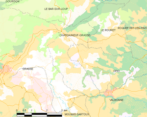
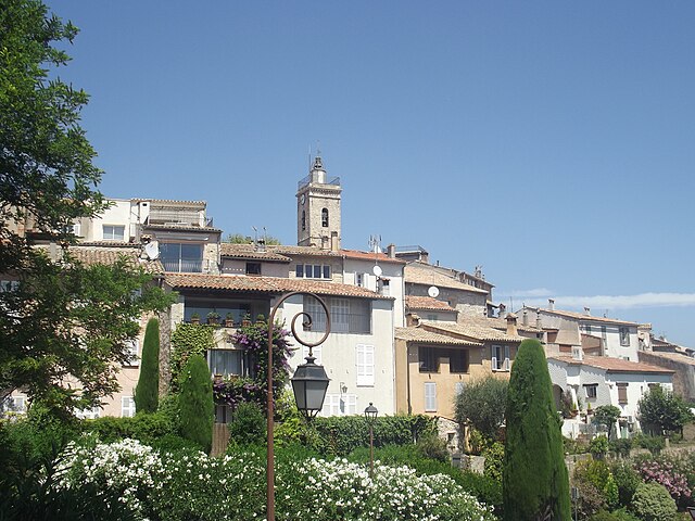
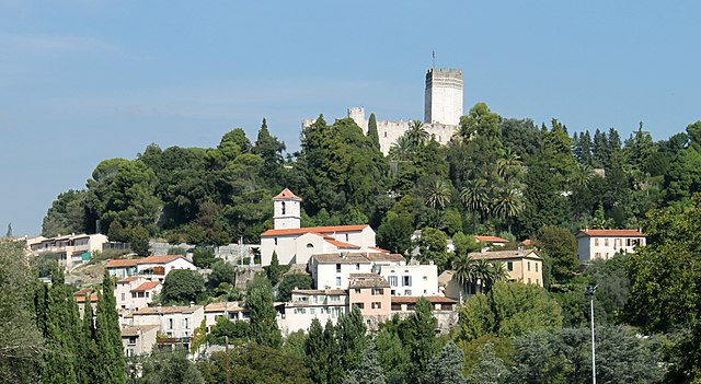
Шатонёф-Грас
- коммуна в департаменте Приморские Альпы, регион Прованс — Альпы — Лазурный Берег, Франция
Hiking in Шатонёф-Грас
Châteauneuf-Grasse, located in the Alpes-Maritimes department of the Provence-Alpes-Côte d'Azur region in France, offers a picturesque backdrop for hiking enthusiasts. The area is characterized by its stunning landscapes, charming villages, and a mild Mediterranean climate, making it an ideal destination for outdoor activities....
- Страна:
- Почтовый код: 06740
- Координаты: 43° 40' 30" N, 6° 58' 30" E
- GPS треки (wikiloc): [Ссылка]
- Площадь: 8.95 кв.км
- Население: 3219
- Веб сайт: [Ссылка]

Рокфор-ле-Пен
- коммуна в департаменте Приморские Альпы, регион Прованс — Альпы — Лазурный Берег, Франция
Hiking in Рокфор-ле-Пен
Roquefort-les-Pins is a charming village located in the Alpes-Maritimes department in the Provence-Alpes-Côte d'Azur region of France. It offers a variety of hiking opportunities that allow you to explore the beautiful natural surroundings, including forests, hills, and stunning views of the French Riviera....
- Страна:
- Почтовый код: 06330
- Координаты: 43° 39' 56" N, 7° 3' 3" E
- GPS треки (wikiloc): [Ссылка]
- Высота над уровнем моря: 250 м m
- Площадь: 21.53 кв.км
- Население: 6628
- Веб сайт: [Ссылка]

Опьо
- коммуна в департаменте Приморские Альпы, регион Прованс — Альпы — Лазурный Берег, Франция
Hiking in Опьо
Hiking in Opio, located in the Alpes-Maritimes region of France, offers a wonderful mix of beautiful landscapes, charming villages, and moderate hiking trails suited for different skill levels....
- Страна:
- Почтовый код: 06650
- Координаты: 43° 40' 6" N, 6° 58' 54" E
- GPS треки (wikiloc): [Ссылка]
- Площадь: 9.47 кв.км
- Население: 2212