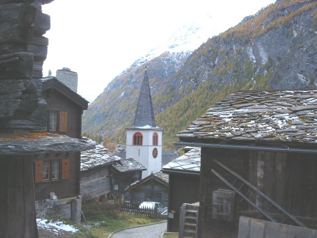
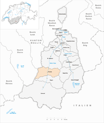
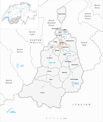
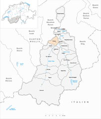
Висп (Visp District, Bezirk Visp)

 Hiking in Висп
The Visp District, located in the Valais canton of Switzerland, is an excellent destination for hiking enthusiasts. Surrounded by stunning Alpine scenery, it offers a variety of trails suitable for different skill levels, from beginners to experienced hikers. Here are some highlights and key points regarding hiking in the Visp District:
Scenic Trails
-
Matterhorn Glacier Trail: Although it starts higher up from Zermatt, this trail offers breathtaking views of the Matterhorn and the surrounding glaciers. It's a moderate trek, but the views make it worth the effort.
-
Gornergrat: Accessible from Zermatt, this is one of the most popular hiking trails in the area. The route features stunning panoramic vistas of some of the highest peaks in the Alps, including the Matterhorn.
-
Randa to Zermatt: A picturesque route that provides a unique perspective of the Matterhorn as you make your way to Zermatt. Expect varied terrain, lush meadows, and charming villages along the way.
-
Visperterminen: Known for its vineyards, this area offers gentler hikes with panoramic views over the Rhone Valley. The route leads you through terraced vineyards and offers a chance to sample local wines.
Difficulty Levels
- Easy: Many family-friendly paths in the valley and around the villages.
- Moderate: Trails with some elevation gain, suitable for those with a reasonable level of fitness.
- Challenging: High mountain trails ideal for experienced hikers, requiring good physical condition and sometimes technical skills.
Best Time to Hike
- Summer (June to September): This is the prime hiking season, with most trails fully accessible and weather conditions usually favorable.
- Autumn (October): Offers beautiful fall foliage and fewer crowds, although the weather can be unpredictable and trails at higher altitudes may start to close.
Safety and Preparedness
- Always check trail conditions and weather forecasts before heading out.
- Bring plenty of water, snacks, and appropriate gear, including sturdy hiking boots and clothing suited for changing weather.
- Consider using hiking apps or maps to stay oriented, especially on less marked trails.
Local Tips
- Connect with local guides or join organized hikes if you're unfamiliar with the area.
- Don’t miss the local cuisine; stopping in alpine huts for traditional Swiss dishes can be a rewarding part of the hiking experience.
Conclusion
Hiking in the Visp District promises a remarkable experience, combining stunning landscapes, diverse trails, and rich culture. Whether you're looking for leisurely strolls or challenging hikes, you'll find plenty to explore. Make sure to respect the natural environment and follow local guidelines to preserve the beauty of this Alpine region. Enjoy your adventure!
- Страна:

- Столица: Фисп
- Код автомобильного номера: VS
- Координаты: 46° 17' 0" N, 7° 52' 0" E


- GPS треки (wikiloc): [Ссылка]
- Высота над уровнем моря: 2758 м m
- Площадь: 863.8 кв.км
- Википедия русская: wiki(ru)
- Википедия английская: wiki(en)
- Википедия национальная: wiki(de)
- Хранилище Wikidata: Wikidata: Q660348
- Катеория в википедии: [Ссылка]
- код Freebase: [/m/0c24_c]
- код GeoNames: Альт: [6458844]
- идентификатор местоположения ArchINFORM: [45102]
- идентификатор HDS: [8405]
- код BabelNet: [03197143n]
Включает регионы:


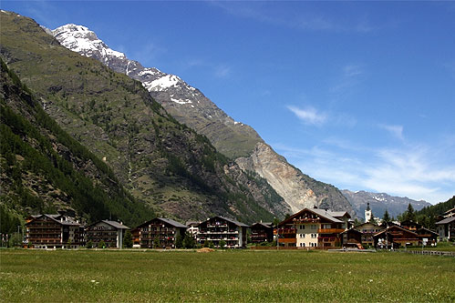
Церматт
Hiking in Церматт
Zermatt, located in the Swiss Alps, is a stunning destination for hiking enthusiasts. This charming car-free village, nestled at the foot of the iconic Matterhorn, offers a range of hiking trails for all skill levels, providing breathtaking views and a chance to explore the unique Alpine landscape....
- Страна:
- Почтовый код: 3920
- Телефонный код: 027
- Код автомобильного номера: VS
- Координаты: 45° 59' 23" N, 7° 45' 10" E
- GPS треки (wikiloc): [Ссылка]
- Высота над уровнем моря: 2621 м m
- Площадь: 242.67 кв.км
- Население: 5643
- Веб сайт: [Ссылка]


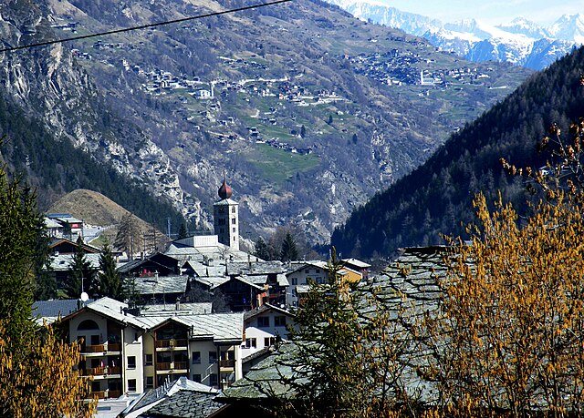
Фисп
- община Швейцарии
Hiking in Фисп
Visp, located in the Valais region of Switzerland, is a fantastic starting point for hiking enthusiasts. The area boasts breathtaking landscapes, from lush valleys to impressive mountain peaks, making it a prime location for both casual hikers and more experienced trekkers....
- Страна:
- Почтовый код: 3930
- Телефонный код: 027
- Код автомобильного номера: VS
- Координаты: 46° 17' 32" N, 7° 52' 58" E
- GPS треки (wikiloc): [Ссылка]
- Высота над уровнем моря: 658 м m
- Площадь: 13.17 кв.км
- Население: 7891
- Веб сайт: [Ссылка]


Eisten
Hiking in Eisten
Eisten, a charming village in the Valais region of Switzerland, offers several delightful hiking opportunities that showcase the stunning landscapes of the area. Here are some key points about hiking in and around Eisten:...
- Страна:
- Почтовый код: 3909
- Телефонный код: 027
- Код автомобильного номера: VS
- Координаты: 46° 12' 0" N, 7° 54' 0" E
- GPS треки (wikiloc): [Ссылка]
- Высота над уровнем моря: 1101 м m
- Площадь: 37.97 кв.км
- Население: 197
- Веб сайт: [Ссылка]
Randa
Hiking in Randa
Randa, a charming village located in the Zermatt region of Switzerland, is an excellent starting point for hiking enthusiasts. Nestled at the foot of the iconic Matterhorn and surrounded by stunning alpine scenery, Randa offers a range of hiking options suitable for all levels of hikers....
- Страна:
- Почтовый код: 3928
- Телефонный код: 027
- Код автомобильного номера: VS
- Координаты: 46° 6' 0" N, 7° 47' 0" E
- GPS треки (wikiloc): [Ссылка]
- Высота над уровнем моря: 1436 м m
- Площадь: 54.49 кв.км
- Население: 444
- Веб сайт: [Ссылка]


Embd
Hiking in Embd
Embd is a quaint village located in the Valais region of Switzerland, known for its stunning landscapes and opportunities for outdoor activities, including hiking. Here are some highlights and tips for hiking in and around Embd:...
- Страна:
- Почтовый код: 3926
- Телефонный код: 027
- Код автомобильного номера: VS
- Координаты: 46° 13' 0" N, 7° 49' 0" E
- GPS треки (wikiloc): [Ссылка]
- Высота над уровнем моря: 1293 м m
- Площадь: 13.37 кв.км
- Население: 301
- Веб сайт: [Ссылка]


Saas-Almagell
Hiking in Saas-Almagell
Saas-Almagell is a picturesque village in the Swiss Alps, situated in the Valais region, and is part of the larger Saas Valley. It's known for its stunning landscapes, diverse hiking trails, and a wide range of outdoor activities. Here are some key highlights and tips for hiking in Saas-Almagell:...
- Страна:
- Почтовый код: 3905
- Телефонный код: 027
- Код автомобильного номера: VS
- Координаты: 46° 5' 40" N, 7° 57' 26" E
- GPS треки (wikiloc): [Ссылка]
- Высота над уровнем моря: 1672 м m
- Площадь: 110.28 кв.км
- Население: 377
- Веб сайт: [Ссылка]

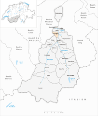
Stalden
Hiking in Stalden
Stalden, a picturesque village located in the Swiss canton of Valais, serves as an excellent starting point for various hiking trails that cater to different skill levels. The region offers stunning landscapes, including views of the iconic Matterhorn, lush valleys, and the Rhone River....
- Страна:
- Почтовый код: 3922
- Телефонный код: 027
- Код автомобильного номера: VS
- Координаты: 46° 14' 0" N, 7° 52' 0" E
- GPS треки (wikiloc): [Ссылка]
- Высота над уровнем моря: 777 м m
- Площадь: 10.48 кв.км
- Население: 1101
- Веб сайт: [Ссылка]

St. Niklaus
Hiking in St. Niklaus
St. Niklaus, located in the Swiss canton of Valais, serves as a picturesque gateway to an array of stunning hiking trails that showcase the Swiss Alps' natural beauty. Surrounded by majestic peaks and offering access to the Matterhorn region, it provides a fantastic base for both novice and experienced hikers. Here are some highlights and tips for hiking in and around St. Niklaus:...
- Страна:
- Почтовый код: 3924
- Телефонный код: 027
- Код автомобильного номера: VS
- Координаты: 46° 11' 0" N, 7° 48' 0" E
- GPS треки (wikiloc): [Ссылка]
- Высота над уровнем моря: 1120 м m
- Площадь: 89.37 кв.км
- Население: 2227
- Веб сайт: [Ссылка]

Törbel
Hiking in Törbel
Törbel is a charming village located in the Valais region of Switzerland, known for its stunning alpine scenery and excellent hiking opportunities. Nestled at an elevation of around 1,500 meters (4,920 feet), Törbel offers access to various hiking trails that cater to different skill levels, making it an appealing destination for both casual walkers and seasoned hikers....
- Страна:
- Почтовый код: 3923
- Телефонный код: 027
- Код автомобильного номера: VS
- Координаты: 46° 14' 18" N, 7° 51' 5" E
- GPS треки (wikiloc): [Ссылка]
- Высота над уровнем моря: 1849 м m
- Площадь: 17.31 кв.км
- Население: 470
- Веб сайт: [Ссылка]
Täsch
Hiking in Täsch
Täsch is a picturesque village in the Swiss Alps, located near Zermatt in the canton of Valais. It serves as a gateway for visitors heading to the iconic Matterhorn and offers a variety of hiking opportunities for all skill levels. Here are some highlights for hiking in and around Täsch:...
- Страна:
- Почтовый код: 3929
- Телефонный код: 027
- Код автомобильного номера: VS
- Координаты: 46° 3' 15" N, 7° 48' 40" E
- GPS треки (wikiloc): [Ссылка]
- Высота над уровнем моря: 2342 м m
- Площадь: 58.72 кв.км
- Население: 1295
- Веб сайт: [Ссылка]


Зас-Фе
- посёлок в кантоне Вале
Hiking in Зас-Фе
Saas-Fee, a picturesque village in the Swiss Alps, is renowned for its stunning landscapes and extensive hiking opportunities. Nestled at an altitude of about 1,800 meters, the village is surrounded by impressive peaks, including the Dom and Weissmies, and offers a blend of natural beauty and outdoor activities....
- Страна:
- Почтовый код: 3906
- Телефонный код: 027
- Код автомобильного номера: VS
- Координаты: 46° 6' 35" N, 7° 55' 45" E
- GPS треки (wikiloc): [Ссылка]
- Высота над уровнем моря: 1798 м m
- Площадь: 40.6 кв.км
- Население: 1597
- Веб сайт: [Ссылка]


Саас-Грунд
- община в Швейцарии
Hiking in Саас-Грунд
Saas-Grund is a picturesque village located in the Swiss Alps, known for its stunning landscapes, majestic mountains, and a variety of hiking trails suitable for different skill levels. Here's an overview of what you can expect when you go hiking in Saas-Grund:...
- Страна:
- Почтовый код: 3910
- Телефонный код: 027
- Код автомобильного номера: VS
- Координаты: 46° 7' 0" N, 7° 56' 0" E
- GPS треки (wikiloc): [Ссылка]
- Высота над уровнем моря: 1559 м m
- Площадь: 40.57 кв.км
- Население: 1027
- Веб сайт: [Ссылка]


Grächen
Hiking in Grächen
Grächen is a picturesque village located in the Swiss Alps, within the Valais region, and is a fantastic destination for hiking enthusiasts of all levels. Here's what you should know about hiking in Grächen:...
- Страна:
- Почтовый код: 3925
- Телефонный код: 027
- Код автомобильного номера: VS
- Координаты: 46° 10' 0" N, 7° 49' 0" E
- GPS треки (wikiloc): [Ссылка]
- Высота над уровнем моря: 1807 м m
- Площадь: 14.0 кв.км
- Население: 1293
- Веб сайт: [Ссылка]


Baltschieder
Hiking in Baltschieder
Baltschieder, located in the canton of Valais in Switzerland, is a stunning area known for its beautiful landscapes and impressive mountain scenery. The region offers a range of hiking opportunities suitable for various skill levels, from easy strolls to challenging alpine routes....
- Страна:
- Телефонный код: 027
- Код автомобильного номера: VS
- Координаты: 46° 22' 33" N, 7° 52' 50" E
- GPS треки (wikiloc): [Ссылка]
- Высота над уровнем моря: 2523 м m
- Площадь: 31.4 кв.км
- Население: 1324
- Веб сайт: [Ссылка]
Lalden
Hiking in Lalden
Lalden is a small village located in the Valais canton of Switzerland. The region around Lalden is known for its stunning natural beauty, including the majestic Alps, lush valleys, and pristine streams. Hiking in and around Lalden offers a variety of trails suitable for different skill levels, ranging from easy walks to more challenging hikes....
- Страна:
- Почтовый код: 3931
- Телефонный код: 027
- Код автомобильного номера: VS
- Координаты: 46° 17' 0" N, 7° 54' 0" E
- GPS треки (wikiloc): [Ссылка]
- Высота над уровнем моря: 650 м m
- Площадь: 1.37 кв.км
- Население: 669
- Веб сайт: [Ссылка]


Saas-Balen
Hiking in Saas-Balen
Saas-Balen is a picturesque village in the Swiss Alps, located near the famous Saas-Fee in the Valais region. It offers stunning mountain landscapes, a variety of hiking trails, and a peaceful atmosphere, making it an excellent destination for hikers of all levels....
- Страна:
- Почтовый код: 3908
- Телефонный код: 027
- Код автомобильного номера: VS
- Координаты: 46° 8' 0" N, 7° 55' 0" E
- GPS треки (wikiloc): [Ссылка]
- Высота над уровнем моря: 1486 м m
- Площадь: 30.22 кв.км
- Население: 349
- Веб сайт: [Ссылка]


Staldenried
Hiking in Staldenried
Staldenried is a charming village nestled in the Swiss Alps, known for its stunning landscapes and excellent hiking opportunities. Here are some key highlights and considerations for hiking in and around Staldenried:...
- Страна:
- Почтовый код: 3933
- Телефонный код: 027
- Код автомобильного номера: VS
- Координаты: 46° 13' 3" N, 7° 54' 37" E
- GPS треки (wikiloc): [Ссылка]
- Высота над уровнем моря: 2052 м m
- Площадь: 14.30 кв.км
- Население: 543
- Веб сайт: [Ссылка]

Zeneggen
Hiking in Zeneggen
Zeneggen is a charming village located in the Valais region of Switzerland, known for its stunning natural beauty and hiking opportunities. Nestled at an altitude of about 1,200 meters, it offers a serene environment surrounded by breathtaking views of the mountains and valleys....
- Страна:
- Почтовый код: 3934
- Телефонный код: 027
- Код автомобильного номера: VS
- Координаты: 46° 16' 0" N, 7° 50' 0" E
- GPS треки (wikiloc): [Ссылка]
- Высота над уровнем моря: 1370 м m
- Площадь: 7.51 кв.км
- Население: 282
- Веб сайт: [Ссылка]


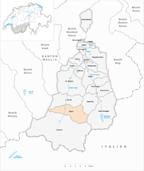
Visperterminen
Hiking in Visperterminen
Visperterminen is a beautiful village located in the Valais region of Switzerland, known for its stunning landscapes and extensive hiking opportunities. Here are some key points about hiking in Visperterminen:...
- Страна:
- Почтовый код: 3932
- Телефонный код: 027
- Код автомобильного номера: VS
- Координаты: 46° 15' 29" N, 7° 54' 7" E
- GPS треки (wikiloc): [Ссылка]
- Высота над уровнем моря: 1328 м m
- Площадь: 51.55 кв.км
- Население: 1351
- Веб сайт: [Ссылка]
Граничит с регионами:


Hérens District
Hiking in Hérens District
The Hérens District, located in the Valais Canton of Switzerland, is known for its stunning landscapes, diverse terrain, and rich cultural heritage, making it a fantastic destination for hiking enthusiasts. Here are some key points to consider when hiking in the Hérens District:...
- Страна:
- Столица: Vex
- Код автомобильного номера: VS
- Координаты: 46° 11' 38" N, 7° 25' 26" E
- GPS треки (wikiloc): [Ссылка]
- Высота над уровнем моря: 1098 м m
- Площадь: 443.5 кв.км


Sierre District
Hiking in Sierre District
The Sierre District is located in the Valais (Wallis) region of Switzerland, and it's known for its stunning landscapes, diverse terrain, and a variety of hiking trails suitable for all levels of hikers. Here are some key highlights about hiking in the Sierre District:...
- Страна:
- Столица: Сьер
- Код автомобильного номера: VS
- Координаты: 46° 16' 14" N, 7° 30' 57" E
- GPS треки (wikiloc): [Ссылка]
- Высота над уровнем моря: 515 м m
- Площадь: 397.0 кв.км


Brig District
Hiking in Brig District
The Brig District, located in the Valais canton of Switzerland, is a picturesque region known for its stunning landscapes, rich history, and a variety of hiking opportunities. Here’s what you need to know about hiking in this beautiful area:...
- Страна:
- Столица: Бриг
- Координаты: 46° 18' 42" N, 7° 59' 6" E
- GPS треки (wikiloc): [Ссылка]
- Высота над уровнем моря: 1478 м m
- Площадь: 434.5 кв.км

Westlich Raron District
Hiking in Westlich Raron District
Westlich Raron is a beautiful area located in the Swiss Alps, specifically in the Valais region of Switzerland. It's known for its stunning landscapes, diverse trails, and the picturesque views of the surrounding mountains. Here are some key points to consider if you're planning to hike in this region:...
- Страна:
- Столица: Raron
- Код автомобильного номера: VS
- Координаты: 46° 18' 0" N, 8° 48' 0" E
- GPS треки (wikiloc): [Ссылка]
- Площадь: 270.87 кв.км


Лойк
Hiking in Лойк
The Leuk District, located in the Valais canton of Switzerland, is a stunning hiking destination known for its diverse landscapes, charming villages, and a variety of trails suitable for all skill levels. Here are some key highlights to consider when planning a hiking trip in this region:...
- Страна:
- Столица: Leuk
- Код автомобильного номера: VS
- Координаты: 46° 19' 5" N, 7° 38' 4" E
- GPS треки (wikiloc): [Ссылка]
- Высота над уровнем моря: 957 м m
- Площадь: 335.9 кв.км