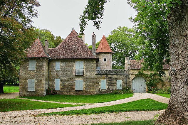
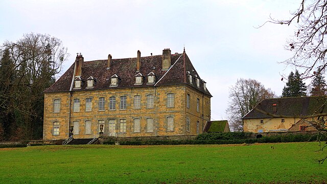
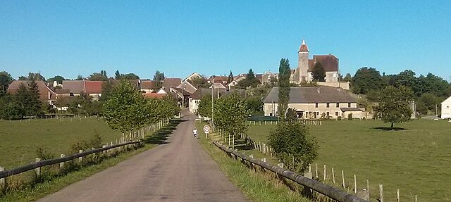
Воре-сюр-л’Оньон (Voray-sur-l'Ognon, Voray-sur-l'Ognon)

- коммуна во Франции
 Hiking in Воре-сюр-л’Оньон
Voray-sur-l'Ognon is a small commune located in the Doubs department in the Bourgogne-Franche-Comté region of eastern France. While not as widely known as some larger hiking destinations, it offers a charming experience for those who enjoy exploring the outdoors.
Hiking Opportunities:
-
Surrounding Nature: The area around Voray-sur-l'Ognon features rolling hills, forests, and rivers, providing a picturesque backdrop for hiking. The nearby Doubs River adds scenic views and opportunities for exploration along its banks.
-
Trails: There are several local trails that can be explored, ranging from easy walks suitable for families to more challenging routes for experienced hikers. These trails often lead through lush woodlands, past fields, and sometimes along the river.
-
Cultural Sites: Along the hiking routes, you might come across cultural landmarks, including small chapels, old farms, and traditional stone architecture that reflect the region's rich history.
-
Regional Parks: The nearby Parc Naturel Régional du Haut-Jura offers even more extensive hiking options, with marked trails that take you through diverse landscapes, including mountains, lakes, and picturesque villages.
Tips for Hiking in Voray-sur-l'Ognon:
- Weather: Check the weather forecast before heading out, as conditions can change rapidly.
- Gear: Wear appropriate hiking boots and bring along essentials like water, snacks, a map, and a first-aid kit.
- Respect Nature: Follow Leave No Trace principles to help preserve the area’s natural beauty.
- Local Resources: It may be beneficial to connect with local hiking groups or check in with local tourism offices for updated trail information and tips.
Conclusion:
Hiking in Voray-sur-l'Ognon can be a delightful experience for those looking to get away from the crowded tourist spots and enjoy the tranquility of the French countryside. Make sure to explore the paths, appreciate the local scenery, and immerse yourself in the natural beauty of this lesser-known area in France.
- Страна:

- Почтовый код: 70190
- Координаты: 47° 20' 20" N, 6° 1' 5" E


- GPS треки (wikiloc): [Ссылка]
- Высота над уровнем моря: 222 м m
- Площадь: 6.9 кв.км
- Население: 818
- Википедия русская: wiki(ru)
- Википедия английская: wiki(en)
- Википедия национальная: wiki(fr)
- Хранилище Wikidata: Wikidata: Q902402
- Катеория в википедии: [Ссылка]
- код Freebase: [/m/03nw15h]
- код GeoNames: Альт: [6617509]
- номер SIREN: [217005750]
- код BNF: [15272966j]
- WOEID: [632622]
- код муниципалитета INSEE: 70575
Граничит с регионами:


Бу
- коммуна во Франции
- Страна:
- Почтовый код: 70190
- Координаты: 47° 22' 53" N, 6° 0' 6" E
- GPS треки (wikiloc): [Ссылка]
- Площадь: 14.62 кв.км
- Население: 600


Бютье
- коммуна во Франции, департамент Верхняя Сона
Hiking in Бютье
Buthiers, located in the Haute-Saône department of France, is a great destination for hiking enthusiasts looking to explore the natural beauty of the region. Here are some highlights and tips for hiking in and around Buthiers:...
- Страна:
- Почтовый код: 70190
- Координаты: 47° 20' 48" N, 6° 2' 0" E
- GPS треки (wikiloc): [Ссылка]
- Площадь: 5.69 кв.км
- Население: 302

Chevroz
- коммуна во Франции
Hiking in Chevroz
Chevroz is a charming locality nestled in the heart of the Italian Alps, offering stunning landscapes and a variety of hiking opportunities for all experience levels. Here are some highlights about hiking in Chevroz:...
- Страна:
- Почтовый код: 25870
- Координаты: 47° 20' 0" N, 5° 59' 50" E
- GPS треки (wikiloc): [Ссылка]
- Площадь: 1.98 кв.км
- Население: 127


Bonnay
- коммуна во Франции
Hiking in Bonnay
Bonnay, located in the Doubs department of France, offers some beautiful hiking opportunities amidst the scenic landscapes of the Jura Mountains. Here are a few key points about hiking in this region:...
- Страна:
- Почтовый код: 25870
- Координаты: 47° 20' 3" N, 6° 3' 1" E
- GPS треки (wikiloc): [Ссылка]
- Площадь: 7.66 кв.км
- Население: 845


Devecey
Hiking in Devecey
Devecey is a charming village in the Doubs department in eastern France, surrounded by beautiful natural landscapes that make it a great destination for hiking enthusiasts. The area offers several trails that cater to various skill levels, from easy walks suitable for families to more challenging hikes for experienced trekkers....
- Страна:
- Почтовый код: 25870
- Координаты: 47° 19' 28" N, 6° 0' 53" E
- GPS треки (wikiloc): [Ссылка]
- Площадь: 3.78 кв.км
- Население: 1424

Соран-ле-Брёре
- коммуна во Франции
- Страна:
- Почтовый код: 70190
- Координаты: 47° 23' 49" N, 6° 3' 3" E
- GPS треки (wikiloc): [Ссылка]
- Площадь: 14.37 кв.км
- Население: 432


Перруз
- коммуна во Франции
Hiking in Перруз
Perrouse appears to be a less widely known destination, and there may be some confusion regarding its location. If you meant a specific area, park, or region that's commonly associated with hiking, please clarify....
- Страна:
- Почтовый код: 70190
- Координаты: 47° 21' 42" N, 6° 3' 4" E
- GPS треки (wikiloc): [Ссылка]
- Площадь: 4.39 кв.км
- Население: 261

Бюсьер
- коммуна во Франции, департамент Верхняя Сона
Hiking in Бюсьер
Bussières, located in the Haute-Saône department in the Bourgogne-Franche-Comté region of France, offers a serene hiking experience that allows you to explore the natural beauty of rural France. While the region is less known than some of the larger national parks, it has its own charm, with varied landscapes including forests, hills, and rivers....
- Страна:
- Почтовый код: 70190
- Координаты: 47° 20' 15" N, 5° 58' 27" E
- GPS треки (wikiloc): [Ссылка]
- Площадь: 6.11 кв.км
- Население: 399