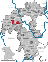
Вальдбрунн (Waldbrunn, Waldbrunn)

 Hiking in Вальдбрунн
Waldbrunn is a charming municipality located in the Bavarian region of Germany, offering a picturesque setting for hiking enthusiasts. Surrounded by lush forests, rolling hills, and scenic landscapes, it serves as an excellent starting point for several hiking trails suitable for all levels of experience.
Popular Hiking Trails
-
Naturpark Frankenhöhe: This nearby nature park features a range of trails that highlight the beautiful flora and fauna of the region. The trails vary in difficulty and length, making it accessible for families and seasoned hikers alike.
-
Local Circular Trails: Waldbrunn has established several circular hiking routes that allow visitors to explore the surrounding areas, including the stunning views of the Franconian countryside. These trails often pass through quaint villages, historical sites, and natural landmarks.
-
Felsenmeer: A bit farther from Waldbrunn, the Felsenmeer (sea of rocks) offers unique geological formations and breathtaking views. This area has marked trails that can range from easy to moderate difficulty.
Tips for Hiking in Waldbrunn
-
Seasonal Considerations: Spring and fall are typically the best times for hiking, as the weather is mild and the scenery is vibrant. Summer can be warm, and winter hikes can be challenging due to snow and ice.
-
Local Facilities: Make sure to check out local accommodations and amenities. Waldbrunn has some guesthouses and restaurants where you can enjoy a meal after a day of hiking.
-
Equipment: Wear comfortable, sturdy hiking boots and dress in layers, as weather can change rapidly in Bavaria. A hiking map or GPS device can be useful, especially for less marked trails.
-
Stay Hydrated: Always carry enough water and snacks, particularly on longer hikes, as some trails can be remote.
Attractions near Waldbrunn
-
Historical Sites: Take the time to explore the cultural heritage of the region, including old churches and castles, which often lie along or near hiking routes.
-
Wildlife Observation: Keep an eye out for local wildlife, as the forests are home to various animals, including deer, foxes, and a variety of bird species.
Conclusion
Waldbrunn, Bavaria, is a hidden gem for hiking enthusiasts, offering tranquil trails and stunning natural beauty. Whether you're looking for a peaceful day hike or a more challenging adventure, you'll find plenty of opportunities to enjoy the great outdoors here. Always remember to respect nature and follow the local guidelines to preserve the area's beauty for future visitors.
- Страна:

- Почтовый код: 97295
- Телефонный код: 09306
- Координаты: 49° 45' 31" N, 9° 48' 13" E


- GPS треки (wikiloc): [Ссылка]
- Высота над уровнем моря: 315 м m
- Площадь: 6.62 кв.км
- Население: 2737
- Веб сайт: http://www.gemeinde-waldbrunn.de
- Википедия русская: wiki(ru)
- Википедия английская: wiki(en)
- Википедия национальная: wiki(de)
- Хранилище Wikidata: Wikidata: Q548995
- Катеория в википедии: [Ссылка]
- код Freebase: [/m/02q95q9]
- код GeoNames: Альт: [2815132]
- код VIAF: Альт: [234313121]
- ID отношения в OpenStreetMap: [180684]
- код GND: Альт: [4398396-0]
- Bavarikon ID: [ODB_A00000541]
- идентификатор муниципалитетов в Германии: 09679204
Граничит с регионами:

Вальдбюттельбрунн
Hiking in Вальдбюттельбрунн
Waldbüttelbrunn is a charming municipality located in the state of Bavaria, Germany, not far from the city of Würzburg. The area is known for its beautiful landscapes, rolling hills, and scenic woodlands, making it an excellent destination for hiking enthusiasts. Here are some highlights and tips for hiking in and around Waldbüttelbrunn:...
- Страна:
- Почтовый код: 97297
- Телефонный код: 0931
- Координаты: 49° 46' 0" N, 9° 50' 0" E
- GPS треки (wikiloc): [Ссылка]
- Высота над уровнем моря: 320 м m
- Площадь: 19.10 кв.км
- Население: 4066
- Веб сайт: [Ссылка]
Айзинген
Hiking in Айзинген
Eisingen, a small village located in Bavaria, Germany, is surrounded by beautiful landscapes that offer opportunities for hiking enthusiasts. Here are some key points about hiking in the area:...
- Страна:
- Почтовый код: 97249
- Телефонный код: 09306
- Координаты: 49° 45' 32" N, 9° 49' 43" E
- GPS треки (wikiloc): [Ссылка]
- Высота над уровнем моря: 316 м m
- Площадь: 5.32 кв.км
- Население: 2492
- Веб сайт: [Ссылка]