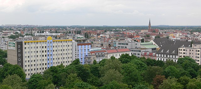
Веддинг (Wedding, Berlin-Wedding)

- район Берлина
 Hiking in Веддинг
Hiking in Wedding, a district in the borough of Mitte, Berlin, might not be the first thing that comes to mind when you think of hiking, as it is primarily an urban area. However, there are several parks and green spaces within and around Wedding where you can enjoy short hikes or leisurely walks.
Local Parks and Green Areas
-
Volkspark Rehberge:
- This large park is a great place for walking, jogging, or cycling. It has well-maintained paths, beautiful landscapes, and plenty of greenery. You can spend a few hours exploring its trails and enjoying the natural surroundings.
-
Pankow’s Northern Green Space:
- Located just north of Wedding, this area includes various parks and greenways that offer more scenic walking options. The paths here can provide a more natural experience compared to the urban environment of Wedding.
-
Plötzensee:
- Though a bit further away, Plötzensee Lake is close enough for a half-day trip. The area around the lake provides lovely walking paths, and you can enjoy the water and various recreational activities.
Hiking in the Vicinity
For more extensive hiking options, you may need to travel a bit outside of Wedding. You can take public transport to surrounding areas:
-
Grunewald:
- Located to the southwest of Berlin, Grunewald is a large forest area with numerous trails that cater to different skill levels. There are wonderful hiking routes that lead to scenic spots, including the famous Teufelsberg.
-
Schorfheide-Chorin Biosphere Reserve:
- A bit further away from Berlin, this is an excellent place for hiking amidst nature, with trails that offer beautiful landscapes and wildlife sightings.
Tips for Hiking in Wedding and Nearby Areas
- Accessibility: Use public transport options like trams, buses, and the U-Bahn to get to nearby parks or hiking areas more easily.
- Equipment: Wear comfortable walking shoes and bring water, especially during summer.
- Duration: Plan your hikes according to the time you have; many parks offer trails that range from 1 to 3 hours.
- Local Guides: Consider joining a local hiking group or guided tour for a more enriching experience, especially if you're new to the area.
While Wedding itself may not offer the same extensive hiking opportunities as some rural areas, there are plenty of ways to enjoy the outdoors and engage in hiking-like activities in the nearby parks and forested areas.
- Страна:

- Почтовый код: 13407; 13359; 13357; 13353; 13351; 13349; 13347
- Координаты: 52° 33' 0" N, 13° 22' 0" E


- GPS треки (wikiloc): [Ссылка]
- Высота над уровнем моря: 41 м m
- Площадь: 9.23 кв.км
- Население: 83612
- Википедия русская: wiki(ru)
- Википедия английская: wiki(en)
- Википедия национальная: wiki(de)
- Хранилище Wikidata: Wikidata: Q675187
- Галерея изображений в википедии: [Ссылка]
- Катеория в википедии: [Ссылка]
- Карты в википедии: [Ссылка]
- код Freebase: [/m/022f6y]
- код GeoNames: Альт: [2813472]
- код VIAF: Альт: [125498659]
- ID отношения в OpenStreetMap: [28267]
- код GND: Альт: [4087349-3]
- идентификатор местоположения ArchINFORM: [3597]
- код LCNAF: Альт: [n81062628]
- FAST ID: [1313065]
Граничит с регионами:


Митте
- район в Берлине в одноимённом округе
Hiking in Митте
Mitte is the central borough of Berlin, Germany, and while it is primarily an urban area known for its historical sites, museums, and vibrant culture, there are still opportunities for outdoor activities, including hiking, especially if you're willing to explore nearby green spaces and parks....
- Страна:
- Почтовый код: 10179; 10178; 10119; 10117; 10115
- Код автомобильного номера: B
- Координаты: 52° 31' 10" N, 13° 24' 24" E
- GPS треки (wikiloc): [Ссылка]
- Высота над уровнем моря: 48 м m
- Площадь: 10.69 кв.км
- Население: 89757

Гезундбруннен
- район в Берлине
Hiking in Гезундбруннен
Gesundbrunnen is a neighborhood in Berlin, known more for its urban environment than traditional hiking trails. However, there are options for those looking to enjoy the outdoors and some nature walks in and around the area. Here are a few recommendations:...
- Страна:
- Почтовый код: 13409; 13359; 13357; 13355; 13353; 13347
- Координаты: 52° 32' 55" N, 13° 23' 25" E
- GPS треки (wikiloc): [Ссылка]
- Высота над уровнем моря: 53 м m
- Площадь: 6.13 кв.км
- Население: 90748

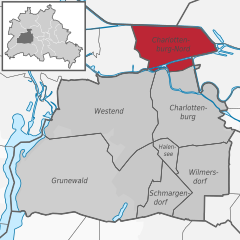
Шарлоттенбург-Норд
- район в Берлине
Hiking in Шарлоттенбург-Норд
Charlottenburg-Nord, located in Berlin, Germany, is primarily an urban area; however, it does offer some opportunities for outdoor activities, including hiking. While it's not known for extensive wilderness trails, you can find some pleasant green spaces and parks where you can enjoy a walk or a leisurely hike....
- Страна:
- Почтовый код: 13627
- Координаты: 52° 32' 20" N, 13° 17' 35" E
- GPS треки (wikiloc): [Ссылка]
- Высота над уровнем моря: 28 м m
- Площадь: 6.20 кв.км
- Население: 18856


Райниккендорф
- район в одноимённом округе Берлина
Hiking in Райниккендорф
Reinickendorf is a district located in the northern part of Berlin, Germany. While it's primarily an urban area, it offers several opportunities for hiking and outdoor activities, particularly in its parks and natural reserves....
- Страна:
- Почтовый код: 13409; 13407; 13403
- Координаты: 52° 34' 0" N, 13° 20' 0" E
- GPS треки (wikiloc): [Ссылка]
- Высота над уровнем моря: 42 м m
- Площадь: 10.5 кв.км
- Население: 80687

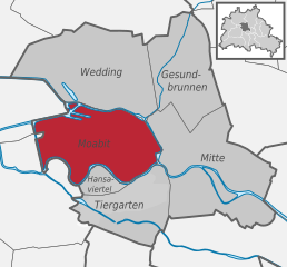
Моабит
- квартал Берлина
Hiking in Моабит
Moabit is a neighborhood in Berlin, Germany, that is known more for its urban landscape than for traditional hiking. However, there are plenty of opportunities for enjoyable walks and exploring green spaces in the area. Here are some suggestions for exploring the outdoors in and around Moabit:...
- Страна:
- Почтовый код: 13353; 10559; 10557; 10555; 10553; 10551
- Координаты: 52° 32' 0" N, 13° 20' 0" E
- GPS треки (wikiloc): [Ссылка]
- Высота над уровнем моря: 40 м m
- Площадь: 7.72 кв.км
- Население: 77344


Тегель
- район в Берлине
Hiking in Тегель
Tegel, located in the northern part of Berlin, Germany, is known for its beautiful natural surroundings, including lakes and forests, making it a great area for hiking and outdoor activities. Here are some highlights and tips for hiking in the Tegel area:...
- Страна:
- Почтовый код: 13509; 13507; 13505; 13503; 13405
- Координаты: 52° 35' 0" N, 13° 17' 0" E
- GPS треки (wikiloc): [Ссылка]
- Высота над уровнем моря: 36 м m
- Площадь: 33.7 кв.км
- Население: 35474