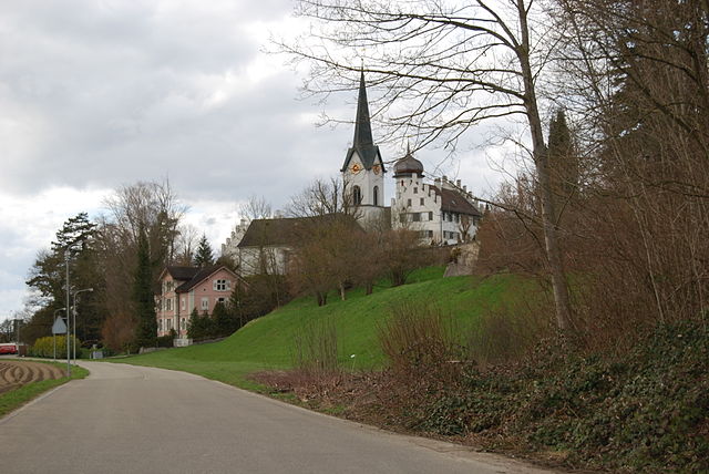
Вайнфельден (Weinfelden, Weinfelden)

- коммуна в кантоне Тургау (Швейцария)
 Hiking in Вайнфельден
Weinfelden, located in the canton of Thurgau in Switzerland, offers a variety of hiking opportunities that showcase the beautiful landscapes of the area, including vineyards, rolling hills, and views of the nearby Bodensee (Lake Constance). Here are some highlights about hiking in Weinfelden:
Trails and Routes:
-
Vineyard Trails: The region is known for its vineyards, and many trails wind through these scenic landscapes, offering the chance to enjoy the local wine culture along the way.
-
Lake Constance Trails: The proximity to Lake Constance means that you can find trails that lead to the waterfront, providing a mix of forest, fields, and lake views.
-
Nature Parks: Nearby nature parks and reserves provide additional hiking options, with trails that highlight the local flora and fauna.
Difficulty Levels:
- Varied Terrain: There are trails suitable for all skill levels, from easy walks to more challenging hikes, allowing everyone from families to seasoned hikers to enjoy the area.
- Signage: Trails are generally well-marked, making navigation easier for those unfamiliar with the area.
Tips for Hiking in Weinfelden:
- Weather: Always check the weather conditions before heading out, as Swiss weather can be unpredictable.
- Footwear: Wear appropriate hiking shoes to ensure comfort and safety on varied terrain.
- Water and Snacks: Carry enough water and snacks, especially on longer hikes, as amenities may not always be available along the trails.
- Local Culture: Consider exploring small towns or villages along the way, as they often have charming cafés or local shops to enjoy.
Accessibility:
Weinfelden is well-connected by public transport, making it easy to reach many trailheads. Public transport services like trains and buses can be great for those who prefer not to drive.
Conclusion:
Whether you are looking for a relaxing day hike with scenic views or a more challenging adventure, Weinfelden has something to offer. Enjoy the stunning Swiss countryside and take advantage of the local culture and hospitality!
- Страна:

- Почтовый код: 8570
- Телефонный код: 071
- Код автомобильного номера: TG
- Координаты: 47° 33' 59" N, 9° 6' 0" E


- GPS треки (wikiloc): [Ссылка]
- Высота над уровнем моря: 432 м m
- Площадь: 15.48 кв.км
- Население: 11388
- Веб сайт: http://www.weinfelden.ch
- Википедия русская: wiki(ru)
- Википедия английская: wiki(en)
- Википедия национальная: wiki(de)
- Хранилище Wikidata: Wikidata: Q68258
- Катеория в википедии: [Ссылка]
- код Freebase: [/m/0bx7m7]
- код GeoNames: Альт: [7287555]
- код VIAF: Альт: [126721447]
- ID отношения в OpenStreetMap: [1684569]
- код GND: Альт: [4119028-2]
- идентификатор местоположения ArchINFORM: [8284]
- место в MusicBrainz: [081a82d2-01ba-4f2b-9e43-816e8c61009f]
- код темы Quora: [Weinfelden]
- идентификатор HDS: [2025]
- EMLO location ID: [4fca55b0-cde4-4d03-8465-2f90360089ae]
- код швейцарского муниципалитета: [4946]
- код Цифрового атласа Римской империи: [43202]
Граничит с регионами:

Мерштеттен
Hiking in Мерштеттен
Märstetten, located in the canton of Thurgau in Switzerland, is surrounded by natural beauty and offers several opportunities for hiking enthusiasts. The region features a mix of rolling hills, farmland, and forested areas, providing diverse and scenic hiking trails....
- Страна:
- Почтовый код: 8560
- Телефонный код: 071
- Код автомобильного номера: TG
- Координаты: 47° 36' 0" N, 9° 3' 59" E
- GPS треки (wikiloc): [Ссылка]
- Высота над уровнем моря: 425 м m
- Площадь: 9.9 кв.км
- Население: 2817
- Веб сайт: [Ссылка]
Бюрглен
Hiking in Бюрглен
Bürglen is a charming village located in the Thurgau canton of Switzerland, known for its picturesque landscapes and scenic views. Hiking in this area offers a wonderful opportunity to experience the natural beauty of the region, including rolling hills, vineyards, and lush forests....
- Страна:
- Почтовый код: 8575
- Телефонный код: 071
- Код автомобильного номера: TG
- Координаты: 47° 32' 59" N, 9° 8' 59" E
- GPS треки (wikiloc): [Ссылка]
- Высота над уровнем моря: 441 м m
- Площадь: 11.7 кв.км
- Население: 3788
- Веб сайт: [Ссылка]


Кемменталь
Hiking in Кемменталь
Kemmental, located in the canton of Thurgau in Switzerland, offers a beautiful setting for hiking enthusiasts. The region is characterized by rolling hills, lush landscapes, and picturesque villages, making it ideal for both leisurely walks and more challenging hikes....
- Страна:
- Почтовый код: 8573
- Телефонный код: 071
- Код автомобильного номера: TG
- Координаты: 47° 36' 59" N, 9° 9' 59" E
- GPS треки (wikiloc): [Ссылка]
- Высота над уровнем моря: 548 м m
- Площадь: 28.4 кв.км
- Население: 2494
- Веб сайт: [Ссылка]

Амликон-Биссег
Hiking in Амликон-Биссег
Amlikon-Bissegg is a picturesque area in Switzerland, known for its beautiful landscapes and tranquil hiking trails. Located in the canton of Thurgau, it offers a wonderful mix of nature, farms, and rural charm, making it an excellent destination for hikers of all levels....
- Страна:
- Почтовый код: 8514
- Телефонный код: 071
- Код автомобильного номера: TG
- Координаты: 47° 33' 59" N, 9° 2' 59" E
- GPS треки (wikiloc): [Ссылка]
- Высота над уровнем моря: 422 м m
- Площадь: 14.4 кв.км
- Население: 1335
- Веб сайт: [Ссылка]

Буснанг
Hiking in Буснанг
Bussnang is a picturesque municipality located in the canton of Thurgau, Switzerland. It is surrounded by beautiful landscapes, making it an ideal destination for hiking enthusiasts. Here are some highlights of hiking in and around Bussnang:...
- Страна:
- Почтовый код: 9565
- Телефонный код: 071
- Код автомобильного номера: TG
- Координаты: 47° 33' 30" N, 9° 5' 2" E
- GPS треки (wikiloc): [Ссылка]
- Высота над уровнем моря: 445 м m
- Площадь: 19.0 кв.км
- Население: 2319
- Веб сайт: [Ссылка]

Берг
- коммуна в Швейцарии, в кантоне Тургау
Hiking in Берг
Berg, located in the Thurgau region of Switzerland, is a charming area that offers a variety of hiking opportunities amid picturesque landscapes. The region is known for its rolling hills, vineyards, and views over Lake Constance. Here are some key aspects to consider:...
- Страна:
- Почтовый код: 8572
- Телефонный код: 071
- Код автомобильного номера: TG
- Координаты: 47° 33' 59" N, 9° 9' 59" E
- GPS треки (wikiloc): [Ссылка]
- Высота над уровнем моря: 540 м m
- Площадь: 13.1 кв.км
- Население: 3328
- Веб сайт: [Ссылка]