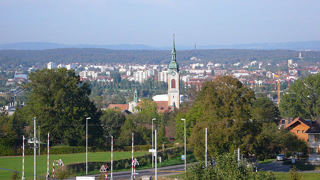
Тургау (Thurgau, Kanton Thurgau)


- кантон в Швейцарии
 Hiking in Тургау
The Canton of Thurgau in Switzerland is an excellent destination for hiking enthusiasts. Known for its picturesque landscapes, rolling hills, lush vineyards, and beautiful lakes, the region offers a variety of trails suitable for all skill levels. Here are some highlights of hiking in Thurgau:
Scenic Trails
-
Lake Constance Trails:
- The shores of Lake Constance provide several scenic hiking paths with stunning views of the lake and surrounding areas. The trail along the lake features charming towns, nature reserves, and cultural sites.
-
Thurgau Vineyards Path:
- This trail takes you through the renowned vineyards of Thurgau, where you can enjoy both the natural beauty and the local wine culture. It’s an excellent way to combine hiking with wine tasting.
-
The Wellenberg Hiking Trail:
- A popular circular route, this trail leads you through the Wellenberg hills, offering panoramic views of both the Alps and Lake Constance. It’s a moderate hike that can be enjoyed year-round.
Nature and Wildlife
- Thurgau’s diverse landscapes host a variety of flora and fauna. Nature reserves such as the Thur Wetlands are great for spotting birds and enjoying the rich biodiversity of the area.
Cultural Experiences
- Many trails pass by historic sites, including castles, churches, and charming villages. Places like Herzogenbuchsee and Frauenfeld offer cultural insights alongside your hiking experience.
Accessibility and Infrastructure
- Thurgau has a well-developed public transport system, making it easy to reach starting points for hikes. The trails are well-marked, and you can find accommodations ranging from simple guesthouses to hotels if you wish to extend your hiking trip.
Seasonal Hiking
- In spring and summer, the region bursts with blooming flowers and lush green hills, perfect for nature lovers. Autumn offers vibrant colors in the vineyards and cooler temperatures. Winter hikes can be enjoyed as well, especially in areas that are accessible year-round.
Recommendations
- Always check the weather before heading out, and consider starting early in the day for a more tranquil experience.
- Bring enough water and snacks, particularly on longer hikes, and wear appropriate footwear for varying terrain.
Overall, the Canton of Thurgau is a delightful destination for hiking, combining the beauty of nature with cultural experiences. Whether you're seeking a casual walk or a challenging hike, Thurgau has something to offer for everyone.
- Страна:

- Столица: Фрауэнфельд
- Код автомобильного номера: TG
- Координаты: 47° 35' 0" N, 9° 4' 0" E


- GPS треки (wikiloc): [Ссылка]
- Высота над уровнем моря: 417 м m
- Площадь: 991.77 кв.км
- Веб сайт: https://www.tg.ch/
- Википедия русская: wiki(ru)
- Википедия английская: wiki(en)
- Википедия национальная: wiki(de)
- Хранилище Wikidata: Wikidata: Q12713
- Галерея изображений в википедии: [Ссылка]
- Катеория в википедии: [Ссылка]
- код Freebase: [/m/01vnh3]
- код GeoNames: Альт: [2658372]
- код BNF: [11956485n]
- код VIAF: Альт: [128413012]
- ID отношения в OpenStreetMap: [28015]
- код GND: Альт: [4119605-3]
- идентификатор местоположения ArchINFORM: [2929]
- код LCNAF: Альт: [n81018171]
- код тезауруса PACTOLS: [pcrtlQcDJRP5SL]
- место в MusicBrainz: [d32929bd-4c78-4afa-8b25-f6a1355f9212]
- код темы Quora: [Canton-of-Thurgau]
- код SUDOC: [02754785X]
- код в энциклопедии «Британника онлайн»: [place/Thurgau]
- идентификатор HDS: [7393]
- код ISNI: Альт: [0000 0001 1522 6414]
- код NUTS: [CH057]
- код статьи Klexikon: [Thurgau]
- идентификатор Ringgold: [183171]
- STW Thesaurus for Economics ID: [16975-2]
- ISO 3166-2: CH-TG
- FIPS 10-4: SZ19
Включает регионы:


Вайнфельден
Hiking in Вайнфельден
Weinfelden District, located in the canton of Thurgau in Switzerland, offers a variety of hiking opportunities that showcase the natural beauty of the region. Here are some highlights for hiking enthusiasts:...
- Страна:
- Столица: Вайнфельден
- Код автомобильного номера: TG
- Координаты: 47° 34' 0" N, 9° 6' 0" E
- GPS треки (wikiloc): [Ссылка]
- Высота над уровнем моря: 447 м m
- Площадь: 227.2 кв.км


Мюнхвилен
Hiking in Мюнхвилен
Münchwilen District, located in the Aargau canton of Switzerland, offers a variety of scenic landscapes and hiking opportunities. The area is characterized by its rolling hills, lush forests, and picturesque villages, making it an ideal spot for both casual and experienced hikers....
- Страна:
- Код автомобильного номера: TG
- Координаты: 47° 29' 0" N, 8° 59' 0" E
- GPS треки (wikiloc): [Ссылка]
- Высота над уровнем моря: 518 м m
- Площадь: 155.86 кв.км


Арбон
Hiking in Арбон
Hiking in the Arbon District, located in the Thurgau Canton of Switzerland, offers a variety of scenic trails that showcase the beautiful landscapes of the region. Here are some key aspects to consider if you're planning to hike in this area:...
- Страна:
- Столица: Арбон
- Код автомобильного номера: TG
- Координаты: 47° 31' 0" N, 9° 26' 0" E
- GPS треки (wikiloc): [Ссылка]
- Высота над уровнем моря: 416 м m
- Площадь: 88.8 кв.км

Кройцлинген
Hiking in Кройцлинген
Kreuzlingen District, located in the canton of Thurgau in Switzerland, offers a variety of scenic hiking opportunities, especially due to its proximity to the beautiful Lake Constance (Bodensee) and the surrounding natural landscapes. Here are some highlights of hiking in the area:...
- Страна:
- Столица: Кройцлинген
- Код автомобильного номера: TG
- Координаты: 47° 38' 0" N, 9° 10' 0" E
- GPS треки (wikiloc): [Ссылка]
- Высота над уровнем моря: 511 м m
- Площадь: 129 кв.км


Фрауэнфельд
Hiking in Фрауэнфельд
Frauenfeld District, located in the canton of Thurgau in Switzerland, offers a beautiful array of hiking opportunities that cater to various skill levels. The region is characterized by its gentle hills, lush green landscapes, and picturesque views, making it an excellent choice for both experienced hikers and those new to the activity....
- Страна:
- Столица: Фрауэнфельд
- Код автомобильного номера: TG
- Координаты: 47° 33' 0" N, 8° 53' 0" E
- GPS треки (wikiloc): [Ссылка]
- Высота над уровнем моря: 652 м m
- Площадь: 279.6 кв.км
Граничит с регионами:

Цюрих
- кантон в Швейцарии
Hiking in Цюрих
The Canton of Zürich offers a rich variety of hiking opportunities, suitable for all skill levels and preferences. Here are some highlights and tips for hiking in this region:...
- Страна:
- Столица: Цюрих
- Код автомобильного номера: ZH
- Координаты: 47° 0' 0" N, 9° 0' 0" E
- GPS треки (wikiloc): [Ссылка]
- Высота над уровнем моря: 408 м m
- Площадь: 1729 кв.км
- Население: 1408575
- Веб сайт: [Ссылка]
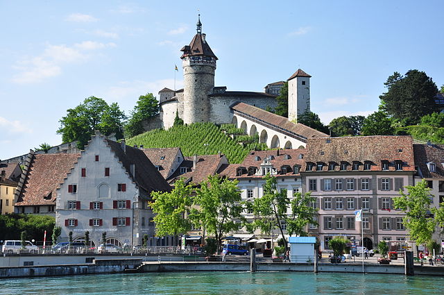

Шаффхаузен
- кантон в Швейцарии
Hiking in Шаффхаузен
The Canton of Schaffhausen, located in the northern part of Switzerland, is a wonderful destination for hiking enthusiasts. This region offers a mix of stunning landscapes, historical sites, and vibrant nature that can cater to hikers of all levels....
- Страна:
- Столица: Шаффхаузен
- Код автомобильного номера: SH
- Координаты: 47° 43' 0" N, 8° 34' 0" E
- GPS треки (wikiloc): [Ссылка]
- Высота над уровнем моря: 392 м m
- Площадь: 298.42 кв.км
- Население: 73400
- Веб сайт: [Ссылка]


Санкт-Галлен
- кантон в Швейцарии
Hiking in Санкт-Галлен
The Canton of St. Gallen, located in eastern Switzerland, is a fantastic destination for hiking enthusiasts, boasting a diverse range of trails that cater to various skill levels and interests. Here's an overview of what you can expect:...
- Страна:
- Столица: Санкт-Галлен
- Код автомобильного номера: SG
- Координаты: 47° 20' 0" N, 9° 10' 0" E
- GPS треки (wikiloc): [Ссылка]
- Высота над уровнем моря: 668 м m
- Площадь: 2030.75 кв.км
- Население: 75538
- Веб сайт: [Ссылка]


Баден-Вюртемберг
- федеральная земля Германии
Hiking in Баден-Вюртемберг
Baden-Württemberg, located in southwestern Germany, is a fantastic region for hiking enthusiasts. With its diverse landscapes, from the Black Forest to the Swabian Jura and picturesque vineyards along the Rhine River, the area offers a variety of trails suitable for all skill levels. Here are some highlights:...
- Страна:

- Столица: Штутгарт
- Координаты: 48° 32' 16" N, 9° 2' 28" E
- GPS треки (wikiloc): [Ссылка]
- Высота над уровнем моря: 327 м m
- Площадь: 35751.65 кв.км
- Население: 10703000
- Веб сайт: [Ссылка]