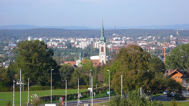
Кемменталь (Kemmental, Kemmental)

 Hiking in Кемменталь
Kemmental, located in the canton of Thurgau in Switzerland, offers a beautiful setting for hiking enthusiasts. The region is characterized by rolling hills, lush landscapes, and picturesque villages, making it ideal for both leisurely walks and more challenging hikes.
Key Highlights of Hiking in Kemmental:
-
Scenic Trails: Kemmental features various well-marked hiking trails that cater to different skill levels. You can choose from easy walks through the countryside to more demanding hikes that offer panoramic views of the surrounding Alps.
-
Nature and Wildlife: The area is home to diverse flora and fauna, providing opportunities for nature enthusiasts to observe wildlife and enjoy the tranquility of nature. The combination of forests, meadows, and agricultural land creates a rich ecosystem.
-
Cultural Highlights: Many trails pass by charming villages and historical landmarks, allowing hikers to explore local culture and traditions. Don’t miss the opportunity to visit small farms, local shops, and traditional Swiss cuisine in the area.
-
Connectivity: Kemmental is well-connected by public transport, making it easy to access the hiking trails. You can begin your adventure from various starting points, often combining hikes with train journeys for an enjoyable day out.
-
Seasonal Attractions: Each season offers a unique experience. In spring and summer, the landscapes are vibrant and alive with wildflowers, while autumn provides stunning foliage. Winter hiking is also popular, with designated trails available for those who wish to explore the snowy landscapes.
Recommended Hikes:
-
Viewpoints: Look for trails that lead to viewpoints, such as the Oberwinterthur area, where you can enjoy breathtaking vistas of Lake Zurich and the distant mountains.
-
Historical Routes: Consider hikes that include historical paths or visits to local heritage sites.
-
Circular Routes: Many trails in the area are designed as circular routes, allowing hikers to return to their starting point without retracing steps.
Tips for Hiking in Kemmental:
- Trail Maps: Make sure to download or carry a map of the hiking trails, as some paths may not be well-signed.
- Weather Preparedness: The weather in Switzerland can change rapidly; dress in layers and be prepared for rain.
- Stay Hydrated: Bring plenty of water, especially during warmer months.
- Respect Nature: Stick to marked trails, and always practice Leave No Trace principles to preserve the natural beauty of the area.
Enjoy your hiking adventure in Kemmental—there's plenty of beauty to explore!
- Страна:

- Почтовый код: 8573
- Телефонный код: 071
- Код автомобильного номера: TG
- Координаты: 47° 36' 59" N, 9° 9' 59" E


- GPS треки (wikiloc): [Ссылка]
- Высота над уровнем моря: 548 м m
- Площадь: 28.4 кв.км
- Население: 2494
- Веб сайт: http://www.kemmental.ch
- Википедия русская: wiki(ru)
- Википедия английская: wiki(en)
- Википедия национальная: wiki(de)
- Хранилище Wikidata: Wikidata: Q65777
- Катеория в википедии: [Ссылка]
- код Freebase: [/m/0g3s51]
- код GeoNames: Альт: [7286185]
- код VIAF: Альт: [237017736]
- ID отношения в OpenStreetMap: [1684534]
- идентификатор HDS: [44885]
- код швейцарского муниципалитета: [4666]
Граничит с регионами:

Кройцлинген
Hiking in Кройцлинген
Kreuzlingen is a quaint town located on the shores of Lake Constance in Switzerland, near the borders of Germany. It's a great starting point for various hiking adventures, as it boasts beautiful landscapes, lakeside paths, and access to regional trails....
- Страна:
- Почтовый код: 8280
- Телефонный код: 071
- Код автомобильного номера: TG
- Координаты: 47° 38' 45" N, 9° 10' 42" E
- GPS треки (wikiloc): [Ссылка]
- Высота над уровнем моря: 397 м m
- Площадь: 11.49 кв.км
- Население: 21801
- Веб сайт: [Ссылка]

Мерштеттен
Hiking in Мерштеттен
Märstetten, located in the canton of Thurgau in Switzerland, is surrounded by natural beauty and offers several opportunities for hiking enthusiasts. The region features a mix of rolling hills, farmland, and forested areas, providing diverse and scenic hiking trails....
- Страна:
- Почтовый код: 8560
- Телефонный код: 071
- Код автомобильного номера: TG
- Координаты: 47° 36' 0" N, 9° 3' 59" E
- GPS треки (wikiloc): [Ссылка]
- Высота над уровнем моря: 425 м m
- Площадь: 9.9 кв.км
- Население: 2817
- Веб сайт: [Ссылка]

Вигольтинген
Hiking in Вигольтинген
Wigoltingen, a charming village in the canton of Thurgau in Switzerland, offers a variety of hiking opportunities for nature enthusiasts. Its picturesque landscape features rolling hills, lush greenery, and scenic views, making it an appealing destination for outdoor activities....
- Страна:
- Почтовый код: 8556
- Телефонный код: 052
- Код автомобильного номера: TG
- Координаты: 47° 36' 2" N, 9° 2' 44" E
- GPS треки (wikiloc): [Ссылка]
- Высота над уровнем моря: 429 м m
- Площадь: 17.2 кв.км
- Население: 2438
- Веб сайт: [Ссылка]


Вельди
Hiking in Вельди
Wäldli (often spelled Wäldi) is a beautiful hiking destination that offers a variety of trails suited to different skill levels. Nestled in the surroundings of natural landscapes, Wäldi usually features lush forests, calming streams, and scenic viewpoints, making it an ideal spot for both novice and experienced hikers....
- Страна:
- Почтовый код: 8564
- Телефонный код: 071
- Код автомобильного номера: TG
- Координаты: 47° 37' 28" N, 9° 4' 57" E
- GPS треки (wikiloc): [Ссылка]
- Высота над уровнем моря: 553 м m
- Площадь: 12.3 кв.км
- Население: 1048
- Веб сайт: [Ссылка]


Тегервилен
Hiking in Тегервилен
Tägerwilen is a beautiful location in Switzerland, situated near Lake Constance. It offers a variety of hiking opportunities for both beginners and experienced hikers. Here are some key features and suggestions for hiking in and around Tägerwilen:...
- Страна:
- Почтовый код: 8274
- Телефонный код: 071
- Код автомобильного номера: TG
- Координаты: 47° 38' 52" N, 9° 7' 56" E
- GPS треки (wikiloc): [Ссылка]
- Высота над уровнем моря: 475 м m
- Площадь: 11.58 кв.км
- Население: 4617
- Веб сайт: [Ссылка]
Ленгвиль
Hiking in Ленгвиль
Lengwil is a charming village located in Switzerland, nestled near Lake Constance and not far from the borders of Germany and Austria. While it's not one of the most widely recognized hiking destinations, it does offer access to beautiful landscapes and trails suitable for various skill levels. Here are some key points about hiking in and around Lengwil:...
- Страна:
- Почтовый код: 8574
- Телефонный код: 071
- Код автомобильного номера: TG
- Координаты: 47° 36' 59" N, 9° 10' 59" E
- GPS треки (wikiloc): [Ссылка]
- Высота над уровнем моря: 470 м m
- Площадь: 8.8 кв.км
- Население: 1718
- Веб сайт: [Ссылка]

Берг
- коммуна в Швейцарии, в кантоне Тургау
Hiking in Берг
Berg, located in the Thurgau region of Switzerland, is a charming area that offers a variety of hiking opportunities amid picturesque landscapes. The region is known for its rolling hills, vineyards, and views over Lake Constance. Here are some key aspects to consider:...
- Страна:
- Почтовый код: 8572
- Телефонный код: 071
- Код автомобильного номера: TG
- Координаты: 47° 33' 59" N, 9° 9' 59" E
- GPS треки (wikiloc): [Ссылка]
- Высота над уровнем моря: 540 м m
- Площадь: 13.1 кв.км
- Население: 3328
- Веб сайт: [Ссылка]

Вайнфельден
- коммуна в кантоне Тургау (Швейцария)
Hiking in Вайнфельден
Weinfelden, located in the canton of Thurgau in Switzerland, offers a variety of hiking opportunities that showcase the beautiful landscapes of the area, including vineyards, rolling hills, and views of the nearby Bodensee (Lake Constance). Here are some highlights about hiking in Weinfelden:...
- Страна:
- Почтовый код: 8570
- Телефонный код: 071
- Код автомобильного номера: TG
- Координаты: 47° 33' 59" N, 9° 6' 0" E
- GPS треки (wikiloc): [Ссылка]
- Высота над уровнем моря: 432 м m
- Площадь: 15.48 кв.км
- Население: 11388
- Веб сайт: [Ссылка]