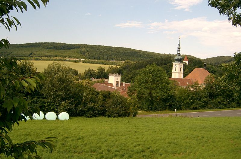
Винервальд (Wienerwald, Wienerwald)
 Hiking in Винервальд
Wienerwald, or the Vienna Woods, is a beautiful and expansive forested area located just west of Vienna, Austria. It is part of the Northern Limestone Alps and offers numerous hiking opportunities for outdoor enthusiasts of all skill levels. Here are some aspects of hiking in Wienerwald:
Scenic Trails
-
Variety of Trails: Wienerwald features a network of well-marked hiking trails. You can find short leisurely walks as well as longer, more challenging hikes. Trails often lead through dense forests, past charming villages, and along scenic viewpoints overlooking Vienna and the Danube.
-
Popular Routes: Some notable hikes include:
- Triesting Valley to Kaltenleutgeben: A moderate hike that showcases beautiful landscapes and picturesque villages.
- Weidlingbach to Leopoldsberg: This hike offers stunning views of Vienna and the Danube River from the summit of Leopoldsberg.
- Vranik Peak: A slightly more challenging route with rewarding panoramic views.
Flora and Fauna
Wienerwald is rich in biodiversity, home to a variety of plants, flowers, and wildlife. As you hike, you might encounter deer, wild boar, and several bird species. The area is especially beautiful in the spring, with blooming wildflowers, and in the autumn, when the foliage turns vibrant colors.
Trail Conditions
The trails are generally well-maintained, but conditions can vary depending on the season. In winter, snow can make some paths difficult, while summer can bring mud and slippery sections after rainfall. Always check the local weather and trail conditions before heading out.
Accessibility
Wienerwald is easily accessible from Vienna by public transport, such as the S-Bahn or buses. Many trailheads can be reached within a short ride from the city. This makes it an ideal destination for both day hikes and longer excursions.
Facilities
Along the trails, you’ll find numerous heurigen (wine taverns) where you can rest and enjoy local wines and traditional Austrian cuisine. Ensure to carry plenty of water and snacks, especially on longer hikes, as some sections might have limited amenities.
Safety Tips
- Plan Your Route: Choose a trail that matches your fitness level and experience.
- Check the Weather: Conditions can change rapidly, so be prepared with appropriate clothing and gear.
- Stay on Marked Trails: This helps protect the natural landscape and ensures your safety.
- Hike with a Companion: If possible, hike with a friend or let someone know your plans if hiking alone.
Overall, hiking in Wienerwald is an enriching experience, combining natural beauty, cultural heritage, and tranquility—all just a stone's throw from the bustling city of Vienna!
- Страна:

- Почтовый код: 2392
- Телефонный код: 02238
- Код автомобильного номера: MD
- Координаты: 48° 6' 0" N, 16° 8' 0" E


- GPS треки (wikiloc): [Ссылка]
- Высота над уровнем моря: 649 м m
- Площадь: 48.16 кв.км
- Население: 2858
- Веб сайт: http://www.wienerwald.org/
- Википедия русская: wiki(ru)
- Википедия английская: wiki(en)
- Википедия национальная: wiki(de)
- Хранилище Wikidata: Wikidata: Q686849
- Катеория в википедии: [Ссылка]
- код Freebase: [/m/02qzjzr]
- код GeoNames: Альт: [7871857]
- код VIAF: Альт: [248082623]
- код GND: Альт: [4612320-9]
- идентификатор местоположения ArchINFORM: [11198]
- код австрийского муниципалитета: [31726]
Граничит с регионами:

Брайтенфурт-бай-Вин
Hiking in Брайтенфурт-бай-Вин
Breitenfurt bei Wien is a charming village located just south of Vienna, Austria, and offers a variety of hiking opportunities for outdoor enthusiasts. Here are some insights about hiking in this area:...
- Страна:
- Почтовый код: 2384
- Телефонный код: 02239
- Код автомобильного номера: MD
- Координаты: 48° 8' 0" N, 16° 9' 0" E
- GPS треки (wikiloc): [Ссылка]
- Высота над уровнем моря: 295 м m
- Площадь: 27 кв.км
- Население: 5853
- Веб сайт: [Ссылка]

Хинтербрюль
Hiking in Хинтербрюль
Hinterbrühl, located in the Lower Austrian region, is a charming area that serves as an excellent destination for hiking enthusiasts. It is situated near the Vienna Woods, offering beautiful landscapes and a range of hiking trails suitable for different skill levels. Here are some key points about hiking in Hinterbrühl:...
- Страна:
- Код автомобильного номера: MD
- Координаты: 48° 5' 0" N, 16° 14' 0" E
- GPS треки (wikiloc): [Ссылка]
- Высота над уровнем моря: 280 м m
- Площадь: 16.93 кв.км
- Население: 4029
- Веб сайт: [Ссылка]

Кальтенлойтгебен
Hiking in Кальтенлойтгебен
Kaltenleutgeben is a picturesque village located just outside of Vienna, Austria, surrounded by beautiful natural landscapes that are perfect for hiking enthusiasts. The region offers various trails that cater to different skill levels, making it an ideal spot for both beginners and experienced hikers....
- Страна:
- Почтовый код: 2391
- Телефонный код: 02238
- Код автомобильного номера: MD
- Координаты: 48° 6' 55" N, 16° 11' 55" E
- GPS треки (wikiloc): [Ссылка]
- Высота над уровнем моря: 356 м m
- Площадь: 17.5 кв.км
- Население: 3276
- Веб сайт: [Ссылка]

Алланд
Hiking in Алланд
Alland is a beautiful area located in the Lower Austria region, known for its picturesque landscapes, rolling hills, and lush forests. Hiking in Alland offers a wonderful opportunity to enjoy nature, discover local flora and fauna, and experience the tranquility of the outdoors....
- Страна:
- Почтовый код: 2565; 2534; 2533; 2532; 2500
- Телефонный код: 02258
- Код автомобильного номера: BN
- Координаты: 48° 3' 30" N, 16° 4' 50" E
- GPS треки (wikiloc): [Ссылка]
- Высота над уровнем моря: 331 м m
- Площадь: 68.71 кв.км
- Население: 2622
- Веб сайт: [Ссылка]

Хайлигенкройц
Hiking in Хайлигенкройц
Heiligenkreuz, located in Lower Austria, is a picturesque area that offers some fantastic hiking opportunities, appealing to both beginners and experienced hikers. Nestled in the Vienna Woods (Wienerwald), Heiligenkreuz is renowned for its natural beauty, historical sites, and well-marked trails....
- Страна:
- Телефонный код: 02258
- Код автомобильного номера: BN
- Координаты: 48° 3' 23" N, 16° 7' 45" E
- GPS треки (wikiloc): [Ссылка]
- Высота над уровнем моря: 312 м m
- Площадь: 29.5 кв.км
- Население: 1525
- Веб сайт: [Ссылка]

Клаузен-Леопольдсдорф
Hiking in Клаузен-Леопольдсдорф
Klausen-Leopoldsdorf, located in Austria, is a lovely area for hiking enthusiasts. Nestled within the Vienna Woods (Wienerwald), this picturesque village offers access to a variety of hiking trails that cater to different skill levels. Here’s an overview of what you can expect when hiking in this region:...
- Страна:
- Почтовый код: 2533
- Телефонный код: 02257
- Код автомобильного номера: BN
- Координаты: 48° 5' 0" N, 16° 0' 0" E
- GPS треки (wikiloc): [Ссылка]
- Высота над уровнем моря: 375 м m
- Площадь: 60.03 кв.км
- Население: 1681
- Веб сайт: [Ссылка]


Гаден
- коммуна в Австрии, в федеральной земле Нижняя Австрия
Hiking in Гаден
Gaaden is a small village located in Austria, near the scenic region of the Wienerwald (Vienna Woods). While it may not be as widely known as larger hiking destinations, it offers several opportunities for outdoor enthusiasts looking for scenic trails and a peaceful environment....
- Страна:
- Почтовый код: 2531
- Телефонный код: 02237
- Код автомобильного номера: MD
- Координаты: 48° 3' 0" N, 16° 12' 0" E
- GPS треки (wikiloc): [Ссылка]
- Высота над уровнем моря: 323 м m
- Площадь: 24.78 кв.км
- Население: 1624
- Веб сайт: [Ссылка]
Вольфсграбен
Hiking in Вольфсграбен
Wolfsgraben is a picturesque area that offers a range of hiking opportunities for both beginners and experienced hikers. Located in the region near Vienna, Austria, it features beautiful landscapes, lush forests, and scenic trails that allow hikers to connect with nature....
- Страна:
- Телефонный код: 02233
- Код автомобильного номера: WU
- Координаты: 48° 9' 31" N, 16° 7' 5" E
- GPS треки (wikiloc): [Ссылка]
- Высота над уровнем моря: 323 м m
- Площадь: 17.44 кв.км
- Население: 1700
- Веб сайт: [Ссылка]