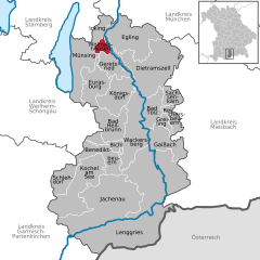
Вольфратсхаузен (Wolfratshausen, Wolfratshausen)
Wolfratshausen, located in Bavaria, Germany, is a charming town that serves as an excellent base for hiking enthusiasts. Nestled near the scenic Isar River and surrounded by beautiful landscapes, it offers a variety of hiking trails suited for different skill levels.
Popular Hiking Trails:
-
Isar Trail: This trail follows the course of the Isar River, offering a picturesque walk through lush forests and meadows. It's generally easy and suitable for families, with opportunities for birdwatching and picnicking along the way.
-
Thalkirchen to Wolfratshausen: This route traverses diverse terrain and connects the town to Munich via the Isar riverbanks. It is relatively flat and ideal for both hiking and cycling.
-
The Bavarian Forest: A short drive from Wolfratshausen, this region boasts numerous hiking paths with varying degrees of difficulty. You can explore dense forests and enjoy stunning views of the surrounding mountains.
-
Bergtouren: For more experienced hikers, there are numerous trails leading into the nearby Alps, with options for day hikes and multi-day treks. The nearby Tegernsee and Schliersee lakes offer fantastic hiking opportunities with breathtaking scenery.
Tips for Hiking in Wolfratshausen:
- Weather Check: Always check the weather forecast before heading out, as conditions can change rapidly.
- Proper Gear: Wear appropriate footwear and clothing for the season—waterproof gear is advisable in the rainy months.
- Hydration and Snacks: Bring plenty of water and snacks to keep your energy up during your hikes.
- Local Maps and Guides: Utilize local hiking maps, and consider joining guided tours if you're unfamiliar with the area.
Additional Activities:
Wolfratshausen isn’t just great for hiking; you can also enjoy canoeing on the Isar River, cycling, or visiting local attractions such as the town's historic center and traditional Bavarian cuisine in local taverns after your hike.
Overall, Wolfratshausen offers a wonderful combination of beautiful nature, outdoor activities, and cultural experiences, making it a fantastic destination for hikers of all levels.
- Страна:

- Почтовый код: 82515
- Телефонный код: 08171
- Код автомобильного номера: TÖL
- Координаты: 47° 54' 48" N, 11° 25' 40" E


- GPS треки (wikiloc): [Ссылка]
- Высота над уровнем моря: 576 м m
- Площадь: 9.13 кв.км
- Население: 17992
- Веб сайт: https://www.wolfratshausen.de/
- Википедия русская: wiki(ru)
- Википедия английская: wiki(en)
- Википедия национальная: wiki(de)
- Хранилище Wikidata: Wikidata: Q503160
- Галерея изображений в википедии: [Ссылка]
- Катеория в википедии: [Ссылка]
- код Freebase: [/m/0554sg]
- код GeoNames: Альт: [2806768]
- код BNF: [12433127s]
- код VIAF: Альт: [132549479]
- ID отношения в OpenStreetMap: [935131]
- код GND: Альт: [4108544-9]
- идентификатор местоположения ArchINFORM: [5540]
- код LCNAF: Альт: [n82129195]
- место в MusicBrainz: [d637a001-a3a0-4a46-9586-ec24555428cc]
- WOEID: [707648]
- код темы Quora: [Wolfratshausen]
- код Historical Gazetteer: [object_300251]
- код места в Facebook: [108750469149691]
- Bavarikon ID: [ODB_A00000969]
- идентификатор муниципалитетов в Германии: 09173147
Включает регионы:
Nantwein
Nantwein is a lesser-known hiking destination, and specific information could vary based on local resources, trails, and regulations. However, I can provide you with general advice on how to hike in regions that may include Nantwein or similar areas....
- Страна:

- Почтовый код: 82515
- Координаты: 47° 54' 51" N, 11° 26' 5" E


- GPS треки (wikiloc): [Ссылка]
Waldram
Waldram is a small-town area in Germany, located in Bavaria near the scenic landscape of the Bavarian Forest. Hiking in this region can be a delightful experience, thanks to its beautiful natural surroundings, diverse trails, and rich wildlife....
- Страна:

- Координаты: 47° 54' 4" N, 11° 26' 41" E


- GPS треки (wikiloc): [Ссылка]

