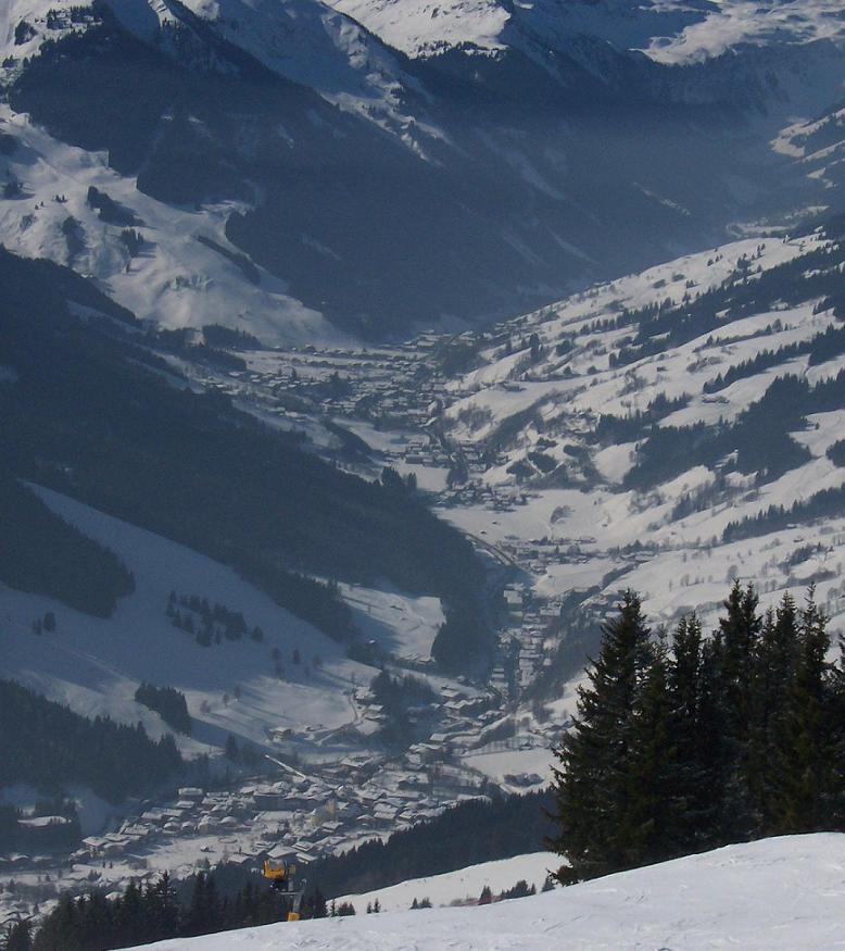
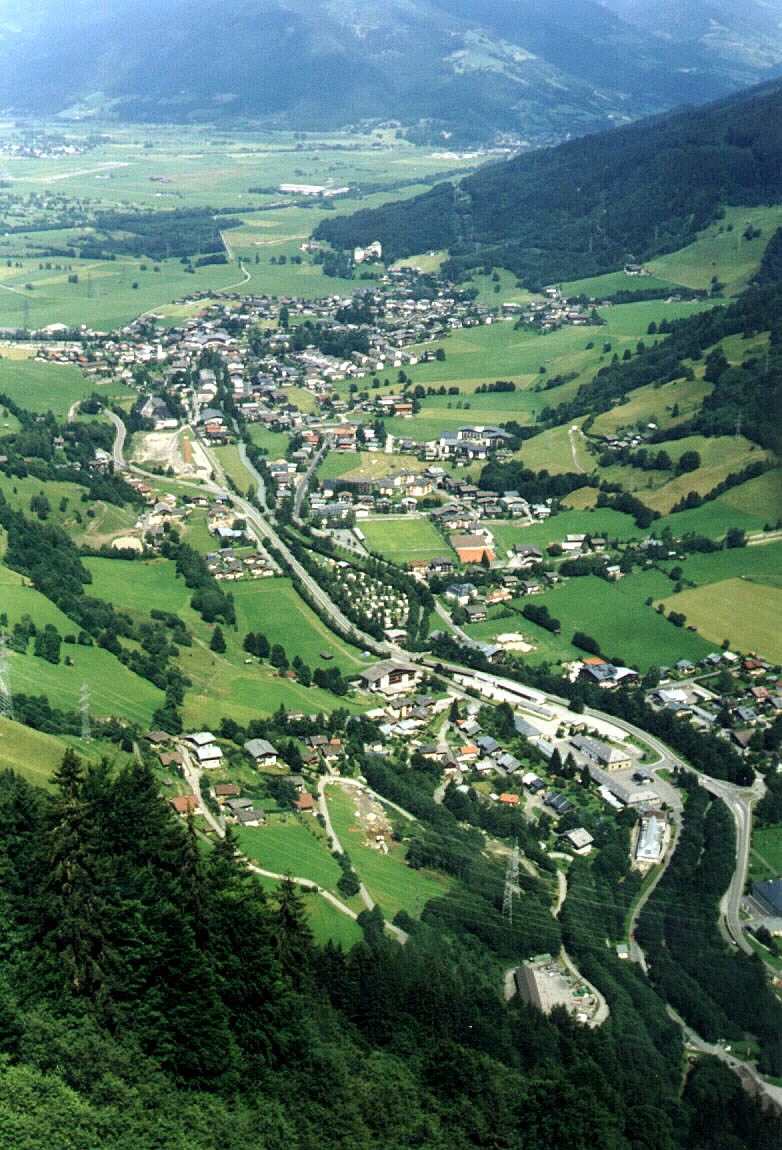
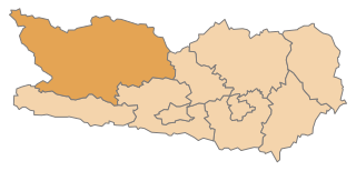
Целль-ам-Зе (Zell am See District, Bezirk Zell am See)

- округ в Австрии
 Hiking in Целль-ам-Зе
Zell am See District, located in the beautiful Austrian state of Salzburg, is a fantastic destination for hiking enthusiasts. The area is known for its stunning alpine scenery, including the crystal-clear Lake Zell, majestic mountains, and lush green valleys. Here are some highlights and tips for hiking in this picturesque region:
Hiking Trails
-
Zell am See to Schmittenhöhe: This is a popular hike offering breathtaking views of Lake Zell and the surrounding peaks. You can take a scenic cable car ride to the top and enjoy various trails that cater to different skill levels.
-
PATH OF THE SEVEN LAKES: A fantastic route that takes you past several pristine mountain lakes. It's suitable for family hiking and relatively easy, offering picturesque spots for picnicking.
-
Kaprun Glacier: For those looking for a more challenging hike, the trails around the Kaprun Glacier provide incredible panoramic views. Be mindful of the altitude and ensure you're well-prepared for changing weather conditions.
-
Pinzgauer Spaziergang: This is a lovely panoramic trail that runs along the mountainside, offering stunning views of the valley and the mountains. It’s a great option for a leisurely day hike.
Season & Weather
- Best Time to Hike: The hiking season generally runs from late spring (around May) to early autumn (late September to October). Summer months are the best for clear days and warmer temperatures.
- Weather: Mountain weather can be unpredictable, so always check forecasts before heading out, and be prepared for sudden changes.
Tips for Hiking
- Gear: Wear good quality hiking boots and bring appropriate clothing (layers are best). Don't forget essentials like a map, water, snacks, and a first-aid kit.
- Trail Information: Make use of local tourist information centers for maps and advice on trail conditions. Signage along trails is generally good, but it’s wise to have a map or a hiking app.
- Respect Nature: Stick to designated trails and follow Leave No Trace principles to preserve the landscape.
Additional Activities
Aside from hiking, Zell am See District offers various outdoor activities such as mountain biking, paragliding, and skiing in the winter months. The area also has lovely spots for relaxation by the lake, making it perfect for a complete outdoor experience.
Whether you're looking for a leisurely stroll or a challenging trek, Zell am See District has something for every type of hiker!
- Страна:

- Столица: Целль-ам-Зе
- Код автомобильного номера: ZE
- Координаты: 47° 21' 0" N, 12° 42' 0" E


- GPS треки (wikiloc): [Ссылка]
- Высота над уровнем моря: 761 м m
- Площадь: 2640.85 кв.км
- Население: 86441
- Веб сайт: https://www.salzburg.gv.at/dienststellen/bezirke/bh-zellamsee
- Википедия русская: wiki(ru)
- Википедия английская: wiki(en)
- Википедия национальная: wiki(de)
- Хранилище Wikidata: Wikidata: Q257897
- Катеория в википедии: [Ссылка]
- Карты в википедии: [Ссылка]
- код Freebase: [/m/06v3rs]
- код GeoNames: Альт: [2760633]
- код VIAF: Альт: [126736180]
- код GND: Альт: [4046112-9]
- идентификатор местоположения ArchINFORM: [14707]
Включает регионы:

Нойкирхен-ам-Гросфенедигер
Hiking in Нойкирхен-ам-Гросфенедигер
Neukirchen am Großvenediger is a picturesque village located in the Hohe Tauern National Park region of Austria, surrounded by stunning alpine scenery, making it an excellent destination for hiking enthusiasts. Here are some key points to consider when planning your hiking trip there:...
- Страна:
- Почтовый код: 5741
- Телефонный код: 06565
- Код автомобильного номера: ZE
- Координаты: 47° 15' 0" N, 12° 16' 0" E
- GPS треки (wikiloc): [Ссылка]
- Высота над уровнем моря: 858 м m
- Площадь: 165.86 кв.км
- Население: 2517
- Веб сайт: [Ссылка]

Зальфельден
Hiking in Зальфельден
Saalfelden, located in the scenic Salzburger Land region of Austria, is a fantastic destination for hiking enthusiasts. Surrounded by the stunning peaks of the Alps, this area offers diverse trails suitable for all skill levels, from leisurely walks to challenging alpine hikes. Here are some key highlights about hiking in Saalfelden:...
- Страна:
- Почтовый код: 5760
- Телефонный код: 06582
- Код автомобильного номера: ZE
- Координаты: 47° 25' 37" N, 12° 50' 54" E
- GPS треки (wikiloc): [Ссылка]
- Высота над уровнем моря: 744 м m
- Площадь: 118.36 кв.км
- Население: 16700
- Веб сайт: [Ссылка]
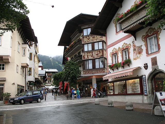

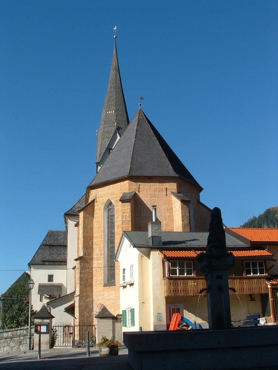
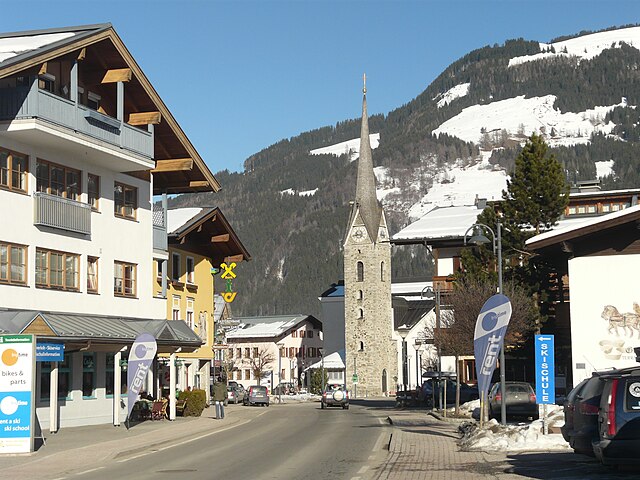
Целль-ам-Зе
Hiking in Целль-ам-Зе
Zell am See is a fantastic destination for hiking enthusiasts, renowned for its stunning alpine scenery, picturesque lake, and diverse trail options suitable for all levels of experience....
- Страна:
- Почтовый код: 5700
- Телефонный код: 06542
- Код автомобильного номера: ZE
- Координаты: 47° 19' 24" N, 12° 47' 53" E
- GPS треки (wikiloc): [Ссылка]
- Высота над уровнем моря: 757 м m
- Площадь: 55.17 кв.км
- Население: 9762
- Веб сайт: [Ссылка]

Леоганг
Hiking in Леоганг
Leogang, located in the Austrian Alps, is a popular destination for hiking enthusiasts due to its stunning natural landscapes, well-maintained trails, and diverse terrain. Whether you're looking for a leisurely stroll or a challenging hike, Leogang offers something for everyone. Here are some key points about hiking in Leogang:...
- Страна:
- Телефонный код: 06583
- Код автомобильного номера: ZE
- Координаты: 47° 25' 0" N, 12° 45' 0" E
- GPS треки (wikiloc): [Ссылка]
- Высота над уровнем моря: 788 м m
- Площадь: 90.27 кв.км
- Население: 3263
- Веб сайт: [Ссылка]

Лофер
Hiking in Лофер
Lofer, located in Austria’s Salzburg region, is a picturesque destination for hiking enthusiasts. Set against the stunning backdrop of the Alps, this charming town offers a variety of trails that cater to all skill levels. Here are some highlights to consider when hiking in Lofer:...
- Страна:
- Почтовый код: 5090
- Телефонный код: 06588
- Код автомобильного номера: ZE
- Координаты: 47° 35' 9" N, 12° 41' 37" E
- GPS треки (wikiloc): [Ссылка]
- Высота над уровнем моря: 626 м m
- Площадь: 55.63 кв.км
- Население: 2037
- Веб сайт: [Ссылка]

Уттендорф
Hiking in Уттендорф
Uttendorf is a stunning village located in the Pinzgau region of Austria, well-known for its picturesque landscapes and access to breathtaking hiking trails. The beautiful backdrop of the Hohe Tauern National Park and the surrounding mountains makes it a fantastic destination for hikers of all skill levels....
- Страна:
- Почтовый код: 5723
- Телефонный код: 06563
- Код автомобильного номера: ZE
- Координаты: 47° 16' 0" N, 12° 34' 0" E
- GPS треки (wikiloc): [Ссылка]
- Высота над уровнем моря: 804 м m
- Площадь: 167.75 кв.км
- Население: 2913
- Веб сайт: [Ссылка]
Зальбах-Хинтерглем
Hiking in Зальбах-Хинтерглем
Saalbach-Hinterglemm, located in the Austrian Alps, is a fantastic destination for hiking enthusiasts. This picturesque region is not only known for its winter sports but also offers a wealth of hiking opportunities during the summer months. Here are some highlights about hiking in Saalbach-Hinterglemm:...
- Страна:
- Телефонный код: 06541
- Код автомобильного номера: ZE
- Координаты: 47° 23' 0" N, 12° 38' 0" E
- GPS треки (wikiloc): [Ссылка]
- Высота над уровнем моря: 1003 м m
- Площадь: 125.46 кв.км
- Население: 2859
- Веб сайт: [Ссылка]


Кримль
Hiking in Кримль
Krimml, located in the Austrian state of Salzburg, is known for its stunning natural beauty, particularly the impressive Krimml Waterfalls, which are the highest waterfalls in Austria. Hiking in this area offers a variety of trails that cater to different skill levels, with opportunities to enjoy picturesque landscapes, alpine views, and the rich biodiversity of the Hohe Tauern National Park....
- Страна:
- Почтовый код: 5743
- Телефонный код: 06564
- Код автомобильного номера: ZE
- Координаты: 47° 13' 6" N, 12° 10' 24" E
- GPS треки (wikiloc): [Ссылка]
- Высота над уровнем моря: 1067 м m
- Площадь: 169.21 кв.км
- Население: 847
- Веб сайт: [Ссылка]

Динтен
Hiking in Динтен
Dienten am Hochkönig is a beautiful alpine village in Austria, located in the Salzburger Land region. This idyllic area is nestled at the foot of the Hochkönig mountain range, making it a fantastic destination for hiking enthusiasts....
- Страна:
- Почтовый код: 5652
- Телефонный код: 06461
- Код автомобильного номера: ZE
- Координаты: 47° 22' 0" N, 13° 0' 0" E
- GPS треки (wikiloc): [Ссылка]
- Высота над уровнем моря: 1071 м m
- Площадь: 49.79 кв.км
- Население: 761
- Веб сайт: [Ссылка]


Миттерзилль
Hiking in Миттерзилль
Mittersill, located in the Austrian Alps, is a popular destination for hiking and outdoor activities, especially during the summer months. The area offers breathtaking views, diverse landscapes, and a range of trails suitable for different skill levels....
- Страна:
- Телефонный код: 06562
- Код автомобильного номера: ZE
- Координаты: 47° 16' 0" N, 12° 28' 0" E
- GPS треки (wikiloc): [Ссылка]
- Высота над уровнем моря: 790 м m
- Площадь: 132.03 кв.км
- Население: 5380
- Веб сайт: [Ссылка]

Ункен
Hiking in Ункен
Unken is a picturesque village located in the Austria region of Salzburg, and it is a fantastic destination for hiking enthusiasts. Nestled in the Alps, Unken offers a variety of trails that cater to different skill levels, from easy walks to more challenging alpine routes....
- Страна:
- Почтовый код: 5091
- Телефонный код: 06589
- Код автомобильного номера: ZE
- Координаты: 47° 39' 1" N, 12° 43' 37" E
- GPS треки (wikiloc): [Ссылка]
- Высота над уровнем моря: 564 м m
- Площадь: 108.84 кв.км
- Население: 1954
- Веб сайт: [Ссылка]

Ленд
Hiking in Ленд
Lend, a charming village located in the scenic area of Salzburg, Austria, offers beautiful landscapes and a variety of hiking opportunities for both novice and experienced hikers. The region is surrounded by the breathtaking backdrop of the Alps, making it an excellent destination for outdoor enthusiasts....
- Страна:
- Телефонный код: 06416
- Код автомобильного номера: ZE
- Координаты: 47° 18' 0" N, 13° 3' 0" E
- GPS треки (wikiloc): [Ссылка]
- Высота над уровнем моря: 663 м m
- Площадь: 29.37 кв.км
- Население: 1368
- Веб сайт: [Ссылка]

Холлерсбах
Hiking in Холлерсбах
Hollersbach im Pinzgau is a picturesque village located in the Salzburger Land region of Austria, surrounded by stunning mountains and beautiful landscapes, making it a fantastic destination for hiking enthusiasts. Here are some highlights and tips for hiking in the area:...
- Страна:
- Почтовый код: 5731
- Телефонный код: 06562
- Код автомобильного номера: ZE
- Координаты: 47° 16' 0" N, 12° 25' 0" E
- GPS треки (wikiloc): [Ссылка]
- Высота над уровнем моря: 806 м m
- Площадь: 76.89 кв.км
- Население: 1220
- Веб сайт: [Ссылка]

Мариа-Альм
Hiking in Мариа-Альм
Maria Alm is a picturesque village located in the Salzburger Land region of Austria, nestled in the heart of the Austrian Alps. It's a fantastic destination for hiking enthusiasts, offering a range of trails that cater to various skill levels, from leisurely walks to challenging mountain hikes....
- Страна:
- Почтовый код: 5761
- Телефонный код: 06584
- Код автомобильного номера: ZE
- Координаты: 47° 23' 0" N, 12° 54' 0" E
- GPS треки (wikiloc): [Ссылка]
- Высота над уровнем моря: 802 м m
- Площадь: 125.41 кв.км
- Население: 2197
- Веб сайт: [Ссылка]

Брамберг-ам-Вильдкогель
Hiking in Брамберг-ам-Вильдкогель
Bramberg am Wildkogel is a charming village located in the Austrian Alps, known for its stunning landscapes and outdoor activities, making it a fantastic destination for hiking enthusiasts. The area offers a variety of hiking trails suitable for all experience levels, from easy walks to more challenging routes....
- Страна:
- Телефонный код: 06566
- Код автомобильного номера: ZE
- Координаты: 47° 16' 22" N, 12° 20' 53" E
- GPS треки (wikiloc): [Ссылка]
- Высота над уровнем моря: 819 м m
- Площадь: 117.19 кв.км
- Население: 3936
- Веб сайт: [Ссылка]
Капрун
Hiking in Капрун
Kaprun, located in the Austrian Alps near the picturesque Lake Zell, is a fantastic destination for hiking enthusiasts. The area offers a diverse range of hiking trails suitable for all skill levels, from easy walks to more challenging alpine routes. Here's what you can expect when hiking in Kaprun:...
- Страна:
- Почтовый код: 5710
- Телефонный код: 06547
- Код автомобильного номера: ZE
- Координаты: 47° 16' 21" N, 12° 45' 34" E
- GPS треки (wikiloc): [Ссылка]
- Высота над уровнем моря: 786 м m
- Площадь: 100.41 кв.км
- Население: 3177
- Веб сайт: [Ссылка]

Брук-ан-дер-Гросглокнерштрассе
Hiking in Брук-ан-дер-Гросглокнерштрассе
Bruck an der Großglocknerstraße is a picturesque town located in the Austrian state of Salzburg, close to the stunning Hohe Tauern National Park. This area offers breathtaking landscapes, diverse flora and fauna, and a variety of hiking trails suitable for all levels of hikers....
- Страна:
- Телефонный код: 06545
- Код автомобильного номера: ZE
- Координаты: 47° 16' 0" N, 12° 49' 0" E
- GPS треки (wikiloc): [Ссылка]
- Высота над уровнем моря: 756 м m
- Площадь: 45.74 кв.км
- Население: 4699
- Веб сайт: [Ссылка]

Раурис
- муниципалитет в Австрии
Hiking in Раурис
Rauris is a beautiful valley located in the Hohe Tauern National Park in Austria, known for its stunning landscapes, rich flora and fauna, and excellent hiking opportunities. Here are some highlights:...
- Страна:
- Почтовый код: 5661
- Телефонный код: 06544
- Код автомобильного номера: ZE
- Координаты: 47° 8' 55" N, 12° 57' 22" E
- GPS треки (wikiloc): [Ссылка]
- Высота над уровнем моря: 1695 м m
- Площадь: 233.02 кв.км
- Население: 3044
- Веб сайт: [Ссылка]

Санкт-Мартин-Лофер
Hiking in Санкт-Мартин-Лофер
Sankt Martin bei Lofer is a charming village located in the Salzburg region of Austria, surrounded by stunning alpine landscapes, making it a fantastic destination for hiking enthusiasts. Here are some key highlights about hiking in this area:...
- Страна:
- Почтовый код: 5092
- Телефонный код: 06588
- Код автомобильного номера: ZE
- Координаты: 47° 34' 0" N, 12° 42' 0" E
- GPS треки (wikiloc): [Ссылка]
- Высота над уровнем моря: 633 м m
- Площадь: 63.56 кв.км
- Население: 1153
- Веб сайт: [Ссылка]

Фуш-ан-дер-Гросглокнерштрассе
Hiking in Фуш-ан-дер-Гросглокнерштрассе
Fusch an der Großglocknerstraße is a picturesque village in Austria, nestled at the gateway to the Hohe Tauern National Park and near the famous Großglockner mountain, the highest peak in Austria. This area is a hiker's paradise, offering a variety of trails that cater to different skill levels, from leisurely walks to challenging alpine hikes....
- Страна:
- Почтовый код: 5672
- Телефонный код: 06546
- Код автомобильного номера: ZE
- Координаты: 47° 13' 0" N, 12° 49' 0" E
- GPS треки (wikiloc): [Ссылка]
- Высота над уровнем моря: 815 м m
- Площадь: 158.06 кв.км
- Население: 719
- Веб сайт: [Ссылка]
Штульфельден
Hiking in Штульфельден
Stuhlfelden is a picturesque village situated in the heart of the Austrian Alps, specifically in the Pinzgau region of Salzburg. It's surrounded by stunning alpine landscapes, making it an excellent destination for hiking enthusiasts....
- Страна:
- Почтовый код: 5724
- Телефонный код: 06562
- Код автомобильного номера: ZE
- Координаты: 47° 16' 0" N, 12° 31' 0" E
- GPS треки (wikiloc): [Ссылка]
- Высота над уровнем моря: 800 м m
- Площадь: 29.74 кв.км
- Население: 1604
- Веб сайт: [Ссылка]


Фихофен
Hiking in Фихофен
Viehhofen, a picturesque village located in the Salzburger Land region of Austria, is a fantastic destination for hiking enthusiasts. Nestled near the popular resort town of Saalbach-Hinterglemm, Viehhofen offers access to a variety of hiking trails that cater to different skill levels, making it an ideal spot for both beginners and experienced hikers....
- Страна:
- Почтовый код: 5752
- Телефонный код: 06542
- Код автомобильного номера: ZE
- Координаты: 47° 22' 0" N, 12° 43' 0" E
- GPS треки (wikiloc): [Ссылка]
- Высота над уровнем моря: 856 м m
- Площадь: 38.63 кв.км
- Население: 603
- Веб сайт: [Ссылка]

Вальд
- община в Австрии, Зальцбург, Целль-ам-Зе
Hiking in Вальд
Wald im Pinzgau, a picturesque village located in the Salzburg region of Austria, offers a wide range of hiking opportunities for outdoor enthusiasts. Nestled in the Hohe Tauern National Park, this region boasts stunning alpine scenery, pristine nature, and diverse trails suitable for various skill levels....
- Страна:
- Почтовый код: 5742
- Телефонный код: 06565
- Код автомобильного номера: ZE
- Координаты: 47° 15' 0" N, 12° 13' 0" E
- GPS треки (wikiloc): [Ссылка]
- Высота над уровнем моря: 885 м m
- Площадь: 69.24 кв.км
- Население: 1124
- Веб сайт: [Ссылка]

Таксенбах
Hiking in Таксенбах
Taxenbach, located in the Salzburg region of Austria, offers an array of picturesque hiking opportunities set against the stunning backdrop of the Hohe Tauern National Park. Here are some highlights and tips for hiking in Taxenbach:...
- Страна:
- Телефонный код: 06543
- Код автомобильного номера: ZE
- Координаты: 47° 17' 30" N, 12° 57' 51" E
- GPS треки (wikiloc): [Ссылка]
- Высота над уровнем моря: 776 м m
- Площадь: 88.24 кв.км
- Население: 2747
- Веб сайт: [Ссылка]
Майсхофен
Hiking in Майсхофен
Maishofen is a picturesque village located in the Salzburger Land region of Austria, close to the famous resort town of Zell am See. The area is known for its stunning natural beauty, featuring a backdrop of the Hohe Tauern mountains and numerous hiking opportunities....
- Страна:
- Почтовый код: 5751
- Телефонный код: 06542
- Код автомобильного номера: ZE
- Координаты: 47° 21' 0" N, 12° 48' 0" E
- GPS треки (wikiloc): [Ссылка]
- Высота над уровнем моря: 768 м m
- Площадь: 29.5 кв.км
- Население: 3601
- Веб сайт: [Ссылка]

Вайсбах-Лофер
Hiking in Вайсбах-Лофер
Weißbach bei Lofer is a picturesque village located in the Salzburger Land region of Austria, known for its stunning natural landscapes and excellent hiking opportunities. Here are some key highlights about hiking in the area:...
- Страна:
- Почтовый код: 5093
- Телефонный код: 06582
- Код автомобильного номера: ZE
- Координаты: 47° 31' 0" N, 12° 45' 0" E
- GPS треки (wikiloc): [Ссылка]
- Высота над уровнем моря: 666 м m
- Площадь: 69.57 кв.км
- Население: 429
- Веб сайт: [Ссылка]

Пизендорф
Hiking in Пизендорф
Piesendorf, located in the Austrian region of Salzburg, is a fantastic destination for hiking enthusiasts. Nestled near the beautiful Kaprun and Zell am See areas, Piesendorf offers a range of hiking trails suitable for various skill levels, from leisurely walks to more challenging hikes....
- Страна:
- Почтовый код: 5721
- Телефонный код: 06549
- Код автомобильного номера: ZE
- Координаты: 47° 16' 0" N, 12° 43' 0" E
- GPS треки (wikiloc): [Ссылка]
- Высота над уровнем моря: 785 м m
- Площадь: 50.97 кв.км
- Население: 3790
- Веб сайт: [Ссылка]

Нидернзилль
Hiking in Нидернзилль
Niedernsill is a charming village nestled in the Austrian Alps, located in the Pinzgau region of Salzburg. It offers a variety of hiking opportunities that cater to different skill levels, making it a great destination for both novice and experienced hikers....
- Страна:
- Почтовый код: 5722
- Телефонный код: 06548
- Код автомобильного номера: ZE
- Координаты: 47° 17' 0" N, 12° 39' 0" E
- GPS треки (wikiloc): [Ссылка]
- Высота над уровнем моря: 768 м m
- Площадь: 57 кв.км
- Население: 2694
- Веб сайт: [Ссылка]
Граничит с регионами:
Траунштайн
- район Баварии
Hiking in Траунштайн
Traunstein, located in Bavaria, Germany, is a beautiful area known for its picturesque landscapes, charming villages, and a variety of hiking opportunities. The region is characterized by its rolling hills, mountains, and lakes, making it ideal for outdoor enthusiasts. Here are some highlights for hiking in Traunstein:...
- Страна:

- Столица: Траунштайн
- Код автомобильного номера: TS
- Координаты: 47° 53' 24" N, 12° 34' 48" E
- GPS треки (wikiloc): [Ссылка]
- Высота над уровнем моря: 560 м m
- Площадь: 1533.92 кв.км
- Население: 145408
- Веб сайт: [Ссылка]

Берхтесгаденер-Ланд
- район Баварии
Hiking in Берхтесгаденер-Ланд
Berchtesgadener Land is a stunning region in Bavaria, Germany, known for its breathtaking landscapes, towering mountains, lush valleys, and crystal-clear lakes. It’s a hiker’s paradise with trails suitable for all levels of experience. Here are some highlights and tips for hiking in this beautiful area:...
- Страна:
- Столица: Бад-Райхенхалль
- Код автомобильного номера: BGL
- Координаты: 47° 44' 0" N, 12° 53' 0" E
- GPS треки (wikiloc): [Ссылка]
- Высота над уровнем моря: 465 м m
- Площадь: 840.00 кв.км
- Население: 90689
- Веб сайт: [Ссылка]


Больцано
- провинция в регионе Трентино — Альто-Адидже, Италия
Hiking in Больцано
South Tyrol, located in northern Italy, is a paradise for hikers and outdoor enthusiasts. This stunning region is characterized by its dramatic landscapes, which include the towering peaks of the Dolomites, lush valleys, and picturesque alpine meadows. Here are some key points about hiking in South Tyrol:...
- Страна:

- Столица: Больцано
- Почтовый код: 39010–39059; 39100
- Телефонный код: 0471; 0463; 0474; 0473; 0472
- Код автомобильного номера: BZ
- Координаты: 46° 30' 0" N, 11° 20' 0" E
- GPS треки (wikiloc): [Ссылка]
- Площадь: 7400.43 кв.км
- Население: 550432
- Веб сайт: [Ссылка]


Лиенц
Hiking in Лиенц
Lienz District, located in the eastern part of Tyrol, Austria, is a stunning area for hiking, known for its breathtaking alpine landscapes, picturesque villages, and a variety of trails suitable for all levels of hikers. Here are some key highlights and recommendations for hiking in this beautiful region:...
- Страна:
- Столица: Лиенц
- Код автомобильного номера: LZ
- Координаты: 46° 49' 0" N, 12° 46' 0" E
- GPS треки (wikiloc): [Ссылка]
- Высота над уровнем моря: 1961 м m
- Площадь: 2019.87 кв.км
- Население: 49033
- Веб сайт: [Ссылка]

Санкт-Йохан-Понгау
Hiking in Санкт-Йохан-Понгау
St. Johann im Pongau is a beautiful district located in Salzburg, Austria, known for its stunning alpine scenery and diverse hiking opportunities. Nestled within the stunning Eastern Alps, the area offers a mix of easy trails, challenging hikes, and beautiful scenery that attracts outdoor enthusiasts of all skill levels. Here are some key highlights and tips for hiking in the region:...
- Страна:
- Столица: Санкт-Йохан
- Код автомобильного номера: JO
- Координаты: 47° 21' 0" N, 13° 13' 59" E
- GPS треки (wikiloc): [Ссылка]
- Высота над уровнем моря: 1010 м m
- Площадь: 1755.37 кв.км
- Население: 79579
- Веб сайт: [Ссылка]

Кицбюэль
Hiking in Кицбюэль
Kitzbühel District, located in the Tyrol region of Austria, is a stunning destination for hiking enthusiasts. With its majestic mountains, lush valleys, and picturesque alpine villages, it offers a variety of hiking trails suitable for all levels, from beginners to experienced trekkers....
- Страна:
- Столица: Кицбюэль
- Код автомобильного номера: KB
- Координаты: 47° 30' 0" N, 12° 24' 0" E
- GPS треки (wikiloc): [Ссылка]
- Высота над уровнем моря: 1085 м m
- Площадь: 1163.28 кв.км
- Население: 63125
- Веб сайт: [Ссылка]


Швац
Hiking in Швац
Hiking in the Schwaz District, located in Tyrol, Austria, offers stunning landscapes, varied terrain, and a rich cultural experience. The area is surrounded by the impressive mountain ranges of the Alps, making it a fantastic location for both casual hikers and experienced trekkers....
- Страна:
- Столица: Швац
- Код автомобильного номера: SZ
- Координаты: 47° 24' 0" N, 11° 48' 0" E
- GPS треки (wikiloc): [Ссылка]
- Высота над уровнем моря: 1676 м m
- Площадь: 1843 кв.км
- Население: 81841
- Веб сайт: [Ссылка]

Шпитталь
Hiking in Шпитталь
Spittal an der Drau District, located in the Carinthia region of Austria, is a stunning destination for hiking enthusiasts. Surrounded by the dramatic landscapes of the Alps and lush valleys, this area offers a diverse range of hiking trails suitable for various skill levels, from gentle walks to challenging mountain hikes....
- Страна:
- Код автомобильного номера: SP
- Координаты: 46° 49' 59" N, 13° 18' 22" E
- GPS треки (wikiloc): [Ссылка]
- Высота над уровнем моря: 922 м m
- Площадь: 2764 кв.км
- Население: 76248
- Веб сайт: [Ссылка]