Égliseneuve-près-Billom (Égliseneuve-près-Billom)

- commune in Puy-de-Dôme, France
- Country:

- Postal Code: 63160
- Coordinates: 45° 43' 18" N, 3° 23' 28" E


- GPS tracks (wikiloc): [Link]
- Area: 16.66 sq km
- Population: 808
- Web site: http://egliseneuve-pres-billom.fr
- Wikipedia en: wiki(en)
- Wikipedia: wiki(fr)
- Wikidata storage: Wikidata: Q1049828
- Wikipedia Commons Category: [Link]
- Freebase ID: [/m/03qh9vy]
- GeoNames ID: Alt: [6440027]
- SIREN number: [216301465]
- BnF ID: [15269496k]
- PACTOLS thesaurus ID: [pcrttNp9J9lLgX]
- INSEE municipality code: 63146
Shares border with regions:


Bongheat
- commune in Puy-de-Dôme, France
- Country:
- Postal Code: 63160
- Coordinates: 45° 43' 37" N, 3° 25' 36" E
- GPS tracks (wikiloc): [Link]
- Area: 11.2 sq km
- Population: 438


Fayet-le-Château
- commune in Puy-de-Dôme, France
- Country:
- Postal Code: 63160
- Local Dialing Code: 05
- Coordinates: 45° 40' 42" N, 3° 24' 42" E
- GPS tracks (wikiloc): [Link]
- Area: 12.54 sq km
- Population: 349

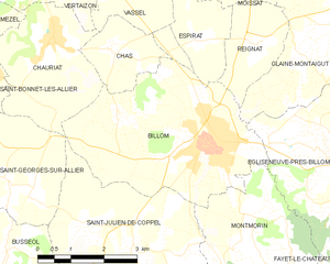
Billom
- commune in Puy-de-Dôme, France
- Country:
- Postal Code: 63160
- Coordinates: 45° 43' 22" N, 3° 20' 19" E
- GPS tracks (wikiloc): [Link]
- Area: 16.96 sq km
- Population: 4745
- Web site: [Link]


Montmorin
- commune in Puy-de-Dôme, France
- Country:
- Postal Code: 63160
- Coordinates: 45° 41' 55" N, 3° 21' 25" E
- GPS tracks (wikiloc): [Link]
- Area: 13.65 sq km
- Population: 728


Glaine-Montaigut
- commune in Puy-de-Dôme, France
- Country:
- Postal Code: 63160
- Coordinates: 45° 45' 21" N, 3° 23' 21" E
- GPS tracks (wikiloc): [Link]
- Area: 12.92 sq km
- Population: 557


Mauzun
- commune in Puy-de-Dôme, France
- Country:
- Postal Code: 63160
- Coordinates: 45° 42' 12" N, 3° 25' 51" E
- GPS tracks (wikiloc): [Link]
- Area: 0.99 sq km
- Population: 111