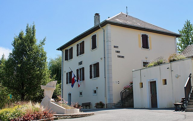
Étercy (Étercy)

- commune in Haute-Savoie, France
 Hiking in Étercy
Étercy seems to be a lesser-known location, and as of my last update, there isn’t extensive information specifically on hiking routes or trails there. However, if Étercy is a place you’re interested in hiking, I can offer general tips and advice that may be helpful for hiking in any new area:
-
Research Trails: Check local hiking websites, forums, or social media groups for information on any trails in Étercy. User-submitted content often provides valuable insights into trail conditions, difficulty levels, and the best times to visit.
-
Prepare for Varying Weather: Weather can change quickly in mountainous areas. Dress in layers, carry rain gear, and make sure to check the forecast before you head out.
-
Know Your Route: Make sure to have a map or a GPS device. It's always a good idea to know the trail you’ll be hiking and any potential alternative routes.
-
Safety Measures: Always let someone know your hiking plans, carry a first-aid kit, and have emergency supplies like a whistle and a flashlight.
-
Respect the Environment: Stay on marked trails, pack out what you bring in, and follow Leave No Trace principles to protect the natural surroundings.
-
Hydration and Snacks: Bring plenty of water and energy-rich snacks to keep your energy levels up during your hike.
If you're looking for a specific region or certain trails nearby, feel free to provide more details, and I can assist you further!
- Country:

- Postal Code: 74150
- Coordinates: 45° 53' 27" N, 6° 0' 34" E


- GPS tracks (wikiloc): [Link]
- Area: 4.55 sq km
- Population: 788
- Wikipedia en: wiki(en)
- Wikipedia: wiki(fr)
- Wikidata storage: Wikidata: Q289071
- Wikipedia Commons Category: [Link]
- Freebase ID: [/m/03ntz30]
- GeoNames ID: Alt: [6442948]
- SIREN number: [217401173]
- INSEE municipality code: 74117
Shares border with regions:

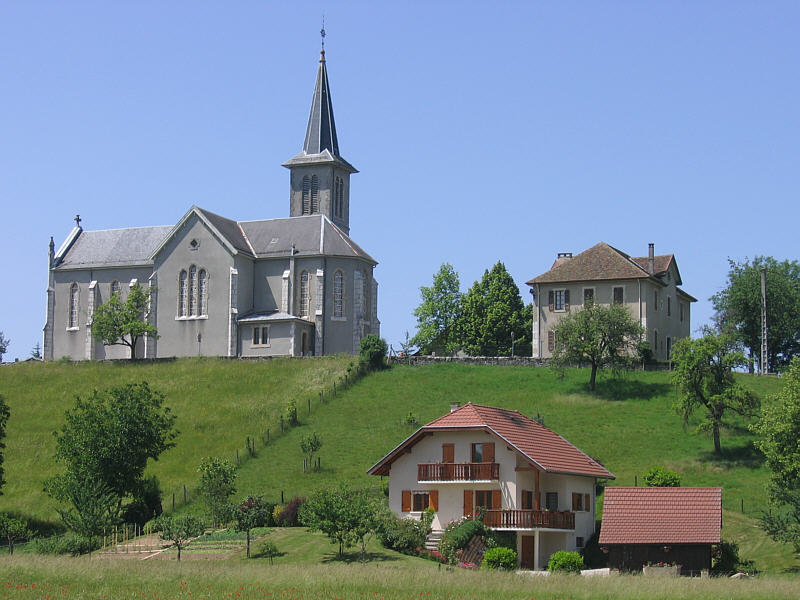
Vaulx
- commune in Haute-Savoie, France
Hiking in Vaulx
Vaulx is a charming village located in the Haute-Savoie region of the French Alps, known for its stunning natural landscapes and proximity to the majestic mountains. Hiking in this area can be a delightful experience for both beginners and seasoned hikers....
- Country:
- Postal Code: 74150
- Coordinates: 45° 55' 48" N, 5° 59' 44" E
- GPS tracks (wikiloc): [Link]
- Area: 11.19 sq km
- Population: 952
- Web site: [Link]


Marcellaz-Albanais
- commune in Haute-Savoie, France
Hiking in Marcellaz-Albanais
Marcellaz-Albanais is a charming commune located in the Haute-Savoie department in the Auvergne-Rhône-Alpes region of southeastern France. Nestled in the foothills of the Alps, it offers beautiful landscapes and a variety of hiking opportunities for outdoor enthusiasts....
- Country:
- Postal Code: 74150
- Coordinates: 45° 52' 29" N, 6° 0' 4" E
- GPS tracks (wikiloc): [Link]
- Area: 14.54 sq km
- Population: 1861
- Web site: [Link]

Chavanod
- commune in Haute-Savoie, France
Hiking in Chavanod
Chavanod is a picturesque commune located in the Haute-Savoie region of France, which is surrounded by stunning natural landscapes, making it a great destination for hiking enthusiasts. The area acts as a gateway to beautiful trails and offers a variety of routes for different skill levels, from simple walks to more challenging hikes....
- Country:
- Postal Code: 74650
- Coordinates: 45° 53' 24" N, 6° 2' 23" E
- GPS tracks (wikiloc): [Link]
- Area: 13.36 sq km
- Population: 2545
- Web site: [Link]


Lovagny
- commune in Haute-Savoie, France
Hiking in Lovagny
Lovagny, located in the Haute-Savoie region of France, is a picturesque destination for hiking enthusiasts. Nestled near the edge of the French Alps and close to Annecy, it offers a variety of trails suitable for different skill levels, from leisurely walks to challenging hikes....
- Country:
- Postal Code: 74330
- Coordinates: 45° 54' 15" N, 6° 1' 59" E
- GPS tracks (wikiloc): [Link]
- Area: 5.55 sq km
- Population: 1248
- Web site: [Link]


Hauteville-sur-Fier
- commune in Haute-Savoie, France
Hiking in Hauteville-sur-Fier
Hauteville-sur-Fier, located in the Auvergne-Rhône-Alpes region of France, offers a variety of hiking opportunities that appeal to outdoor enthusiasts. The area is characterized by its stunning natural landscapes, rolling hills, and proximity to the beautiful Lake Bourget....
- Country:
- Postal Code: 74150
- Coordinates: 45° 54' 13" N, 5° 58' 30" E
- GPS tracks (wikiloc): [Link]
- Area: 4.9 sq km
- Population: 922
- Web site: [Link]