Étrembières (Étrembières)


- commune in Haute-Savoie, France
 Hiking in Étrembières
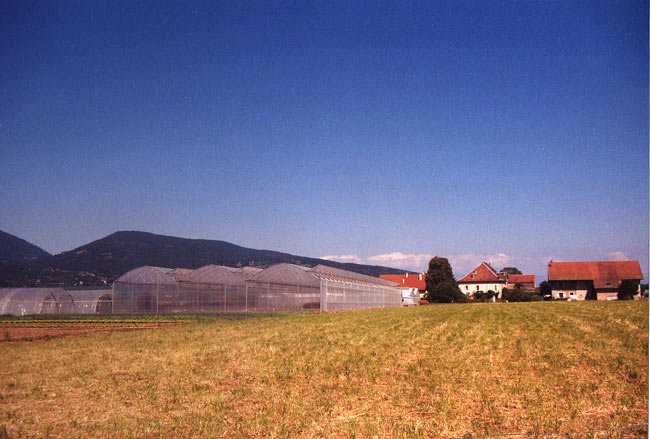
Étrembières, located in the Auvergne-Rhône-Alpes region of southeastern France, is known for its scenic landscape and proximity to the French-Swiss border. While it may not be as widely recognized as a hiking destination as some other areas in the Alps, it still offers a variety of outdoor activities and beautiful trails for hiking enthusiasts.
Hiking Trails:
- Local Trails: Étrembières features several local trails that weave through forests and offer panoramic views of the surrounding valleys and mountains. You can expect to find trails suitable for various skill levels.
- Nearby Natural Areas: The nearby Mont Salève is a popular area for hiking and provides stunning views of Geneva and Lake Geneva. There are several trails leading to the summit where you can enjoy breathtaking vistas.
Considerations:
- Difficulty Levels: Trails vary in difficulty, so it’s important to choose a hike that matches your skill level. Ensure you check local maps and guides for trail information.
- Weather: The weather can change rapidly in the mountains, so it’s essential to dress in layers and be prepared for differing conditions.
- Safety: Always carry enough water, snacks, and a first aid kit. Mobile coverage may be limited in remote areas, so consider bringing a physical map of the trails.
Local Tips:
- Guided Tours: If you're unfamiliar with the terrain or prefer a guided experience, consider joining a local hiking group or hiring a guide.
- Visit Tourist Centers: The local tourist office can provide maps, recommend trails, and offer information about current conditions.
Hiking in and around Étrembières can be an enjoyable experience, especially if you appreciate natural beauty and tranquil surroundings. Always remember to respect the environment and follow local regulations while hiking.
- Country:

- Postal Code: 74100
- Coordinates: 46° 10' 39" N, 6° 13' 33" E


- GPS tracks (wikiloc): [Link]
- Area: 5.43 sq km
- Population: 2436
- Web site: http://www.etrembieres.fr
- Wikipedia en: wiki(en)
- Wikipedia: wiki(fr)
- Wikidata storage: Wikidata: Q290880
- Wikipedia Commons Category: [Link]
- Freebase ID: [/m/03ntyrp]
- GeoNames ID: Alt: [3019364]
- SIREN number: [217401181]
- BnF ID: [15066757f]
- PACTOLS thesaurus ID: [pcrtvK94S3uNYI]
- INSEE municipality code: 74118
Shares border with regions:


Annemasse
- commune in Haute-Savoie, France
Hiking in Annemasse
Annemasse, located in the Haute-Savoie region of France, near the border with Switzerland, offers a variety of hiking opportunities that showcase its beautiful alpine scenery. Here are some highlights and considerations for hiking in and around Annemasse:...
- Country:
- Postal Code: 74100
- Coordinates: 46° 11' 42" N, 6° 14' 8" E
- GPS tracks (wikiloc): [Link]
- Area: 4.98 sq km
- Population: 35234
- Web site: [Link]

Arthaz-Pont-Notre-Dame
- commune in Haute-Savoie, France
Hiking in Arthaz-Pont-Notre-Dame
Arthaz-Pont-Notre-Dame is a small commune located in the Haute-Savoie department in the Auvergne-Rhône-Alpes region of southeastern France. While it may not be as widely known as some of the larger tourist destinations in the Alps, it offers some charming hiking opportunities in a picturesque setting....
- Country:
- Postal Code: 74380
- Coordinates: 46° 9' 32" N, 6° 16' 1" E
- GPS tracks (wikiloc): [Link]
- Area: 5.96 sq km
- Population: 1440
- Web site: [Link]


Vétraz-Monthoux
- commune in Haute-Savoie, France
Hiking in Vétraz-Monthoux
Vétraz-Monthoux is a charming commune located in the Haute-Savoie region of France, near the city of Geneva. It boasts a variety of outdoor activities, and hiking is one of the most popular pursuits in the area. Here are some highlights regarding hiking in Vétraz-Monthoux:...
- Country:
- Postal Code: 74100
- Coordinates: 46° 10' 27" N, 6° 15' 18" E
- GPS tracks (wikiloc): [Link]
- Area: 7.11 sq km
- Population: 8455


Monnetier-Mornex
- commune in Haute-Savoie, France
Hiking in Monnetier-Mornex
Monnetier-Mornex is a charming commune located in the Haute-Savoie region of France, nestled in the foothills of the French Alps. It offers numerous hiking opportunities, featuring stunning views of the surrounding mountains and beautiful landscapes....
- Country:
- Postal Code: 74560
- Coordinates: 46° 9' 42" N, 6° 13' 52" E
- GPS tracks (wikiloc): [Link]
- Area: 11.4 sq km
- Population: 2310
- Web site: [Link]


Bossey
- commune in Haute-Savoie, France
Hiking in Bossey
Bossey is a charming area located near Geneva, Switzerland, and offers a variety of hiking opportunities that cater to different skill levels. Set against the backdrop of the stunning Alps and Lake Geneva, the region is known for its beautiful landscapes, lush forests, and peaceful atmosphere....
- Country:
- Postal Code: 74160
- Coordinates: 46° 9' 6" N, 6° 9' 33" E
- GPS tracks (wikiloc): [Link]
- Area: 3.88 sq km
- Population: 957


Gaillard
- commune in Haute-Savoie, France
Hiking in Gaillard
Gaillard, located in the Haute-Savoie region of France near the Swiss border, offers a variety of hiking opportunities. While Gaillard itself is a small urban area, its proximity to the Alps provides easy access to stunning natural landscapes and various trails suitable for different skill levels....
- Country:
- Postal Code: 74240
- Coordinates: 46° 11' 6" N, 6° 12' 27" E
- GPS tracks (wikiloc): [Link]
- Area: 4.02 sq km
- Population: 11572
- Web site: [Link]