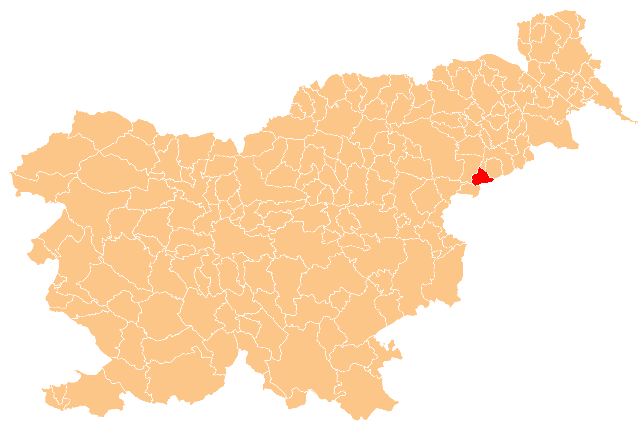
Žetale Municipality (Občina Žetale)
- municipality of Slovenia
Žetale is a charming village located in Slovenia, known for its picturesque landscapes and tranquility. While it may not be one of Slovenia's most prominent hiking destinations compared to places like the Julian Alps or Triglav National Park, it offers some beautiful trails and natural scenery that can provide a satisfying hiking experience.
Hiking Options in Žetale
-
Local Trails: Explore the various marked trails that weave through the countryside. These trails typically showcase the region's beautiful hills, forests, and rural landscapes.
-
Sveti Urh Hill: A short hike to this hill will reward you with panoramic views of the surrounding area. This is a popular spot for locals, and there are some trails leading up to the top that can be suitable for beginners.
-
Flora and Fauna: The area around Žetale is rich in flora and fauna. As you hike, take the time to observe the local wildlife and appreciate the diverse plant species.
-
Cultural Sites: Hiking can also be combined with cultural exploration. As you walk, you may come across traditional Slovenian architecture and historical points of interest, enhancing your overall experience.
Things to Keep in Mind
-
Weather: Check the weather conditions before heading out, as they can change quickly in Slovenia. Proper clothing and gear are important for a safe hiking experience.
-
Maps and Guides: Carry a local map or a hiking guidebook, as trails may not always be well-marked.
-
Respect Nature: Follow the Leave No Trace principles to help preserve the natural beauty of the area.
-
Local Advice: Consider seeking advice from locals or visitor centers for the best trails and information on current conditions.
Exploring Žetale through hiking can offer a peaceful retreat and an opportunity to connect with Slovenia's stunning nature without the crowds often found in more popular hiking destinations.
- Country:

- Postal Code: 2287
- Licence Plate Code: MB
- Coordinates: 46° 16' 56" N, 15° 48' 21" E


- GPS tracks (wikiloc): [Link]
- AboveSeaLevel: 323 м m
- Area: 38 sq km
- Web site: http://www.zetale.si/
- Wikipedia en: wiki(en)
- Wikipedia: wiki(sl)
- Wikidata storage: Wikidata: Q393910
- Wikipedia Commons Category: [Link]
- Freebase ID: [/m/0bnjr7]
- GeoNames ID: Alt: [3344923]
- ISO 3166-2 code: SI-191
- FIPS 10-4 (countries and regions): SIN6

