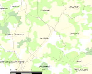
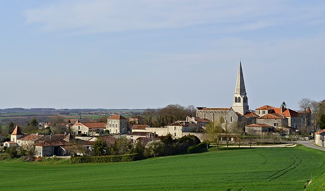
Aignes-et-Puypéroux (Aignes-et-Puypéroux)

- former commune in Charente, France
- Country:

- Postal Code: 16190
- Coordinates: 45° 27' 3" N, 0° 8' 40" E


- GPS tracks (wikiloc): [Link]
- Area: 12.99 sq km
- Population: 259
- Wikipedia en: wiki(en)
- Wikipedia: wiki(fr)
- Wikidata storage: Wikidata: Q338856
- Wikipedia Commons Category: [Link]
- Freebase ID: [/m/03mbc1j]
- GeoNames ID: Alt: [3038532]
- BnF ID: [15248443b]
- INSEE municipality code: 16004
Shares border with regions:

Chavenat
- former commune in Charente, France
- Country:
- Postal Code: 16320
- Coordinates: 45° 27' 21" N, 0° 10' 10" E
- GPS tracks (wikiloc): [Link]
- Area: 9.83 sq km
- Population: 210

Charmant
- former commune in Charente, France
- Country:
- Postal Code: 16320
- Coordinates: 45° 29' 46" N, 0° 11' 2" E
- GPS tracks (wikiloc): [Link]
- Area: 17.15 sq km
- Population: 367


Chadurie
- commune in Charente, France
- Country:
- Postal Code: 16250
- Coordinates: 45° 29' 44" N, 0° 8' 15" E
- GPS tracks (wikiloc): [Link]
- Area: 16.42 sq km
- Population: 508


Pérignac
- commune in Charente, France
- Country:
- Postal Code: 16250
- Coordinates: 45° 27' 52" N, 0° 4' 38" E
- GPS tracks (wikiloc): [Link]
- Area: 25.52 sq km
- Population: 470


Montmoreau-Saint-Cybard
- former commune in Charente, France
- Country:
- Postal Code: 16190
- Coordinates: 45° 23' 56" N, 0° 7' 51" E
- GPS tracks (wikiloc): [Link]
- AboveSeaLevel: 82 м m
- Area: 12 sq km
- Population: 1061
- Web site: [Link]


Saint-Amant-de-Montmoreau
- former commune in Charente, France
- Country:
- Postal Code: 16190
- Coordinates: 45° 23' 44" N, 0° 9' 24" E
- GPS tracks (wikiloc): [Link]
- Area: 27.2 sq km
- Population: 695