Alby-sur-Chéran (Alby-sur-Chéran)

- commune in Haute-Savoie, France
 Hiking in Alby-sur-Chéran
Alby-sur-Chéran, located in the Haute-Savoie region of France, offers a variety of hiking opportunities that showcase the natural beauty of the surrounding countryside, including stunning views of the Chéran River and the nearby mountains. Here are some highlights for hikers considering this area:
Hiking Trails
-
Sentier de la Chérron: This trail follows the Chéran River and offers scenic views and a relatively gentle terrain, making it suitable for families and beginners.
-
Les Balcons du Chéran: This trail provides stunning panoramic views of the valley and the surrounding mountains. It’s a moderate hike, with some elevation gain, rewarding hikers with breathtaking vistas.
-
Mont Veyrier: For those seeking a more challenging hike, Mont Veyrier offers steep ascents but rewards hikers with impressive scenic views of Lake Annecy and the surrounding peaks.
Flora and Fauna
The region is rich in biodiversity, and hikers might encounter various species of plants and animals. Bring a field guide if you're interested in identifying local flora and fauna.
Best Time to Hike
The best time for hiking in Alby-sur-Chéran is spring through fall (April to October) when the weather is mild, and the trails are generally accessible. Be mindful of seasonal conditions; summer can be hot, while early spring and late fall may have variable weather.
Preparation and Safety
- Trail Information: Always check local trail maps and conditions before heading out, as trails may vary in difficulty and accessibility.
- Gear: Wear appropriate footwear and carry sufficient water, food, and a first-aid kit. A backpack and trekking poles may also enhance your hiking experience.
- Local Regulations: Familiarize yourself with local rules regarding wildlife, camping, and trail etiquette to ensure a respectful and safe hiking experience.
Additional Activities
Aside from hiking, Alby-sur-Chéran and the surrounding area offer opportunities for cycling, fishing, and enjoying local cuisine in nearby villages or at local markets.
Visiting Alby-sur-Chéran provides a wonderful chance to immerse yourself in the natural beauty of the French Alps, while also enjoying the local culture and hospitality. Whether you are a seasoned hiker or a novice, there are trails to fit every level of experience!
- Country:

- Postal Code: 74540
- Coordinates: 45° 49' 0" N, 6° 1' 15" E


- GPS tracks (wikiloc): [Link]
- Area: 6.56 sq km
- Population: 2528
- Web site: http://www.mairie-alby-sur-cheran.fr
- Wikipedia en: wiki(en)
- Wikipedia: wiki(fr)
- Wikidata storage: Wikidata: Q530694
- Wikipedia Commons Category: [Link]
- Freebase ID: [/m/03ntx4t]
- GeoNames ID: Alt: [3038236]
- SIREN number: [217400027]
- BnF ID: [15274262q]
- PACTOLS thesaurus ID: [pcrtONUrASEBFZ]
- INSEE municipality code: 74002
Shares border with regions:


Chapeiry
- commune in Haute-Savoie, France
Hiking in Chapeiry
Chapeiry is a picturesque village located in the Auvergne-Rhône-Alpes region of France, nestled near the beautiful Lake Geneva. It offers stunning natural scenery that is ideal for hiking enthusiasts. Here are some key things to know about hiking in Chapeiry:...
- Country:
- Postal Code: 74540
- Coordinates: 45° 50' 44" N, 6° 2' 15" E
- GPS tracks (wikiloc): [Link]
- Area: 5.76 sq km
- Population: 775


Héry-sur-Alby
- commune in Haute-Savoie, France
Hiking in Héry-sur-Alby
Héry-sur-Alby is a charming village located in the Savoie region of France, nestled in the picturesque French Alps. The area offers numerous hiking opportunities with stunning views, diverse landscapes, and a chance to explore the local flora and fauna....
- Country:
- Postal Code: 74540
- Coordinates: 45° 47' 49" N, 6° 0' 47" E
- GPS tracks (wikiloc): [Link]
- Area: 7.33 sq km
- Population: 972
- Web site: [Link]


Mûres
- commune in Haute-Savoie, France
Hiking in Mûres
Mûres, located in the picturesque region of Romania, offers a variety of hiking opportunities for both novice and experienced hikers. The area is characterized by its stunning landscapes, rich biodiversity, and well-maintained trails, making it an excellent destination for outdoor enthusiasts. Here are some key points about hiking in Mûres:...
- Country:
- Postal Code: 74540
- Coordinates: 45° 48' 21" N, 6° 2' 19" E
- GPS tracks (wikiloc): [Link]
- Area: 5.23 sq km
- Population: 675
- Web site: [Link]


Marigny-Saint-Marcel
- commune in Haute-Savoie, France
Hiking in Marigny-Saint-Marcel
Marigny-Saint-Marcel is a charming commune located in the French region of Auvergne-Rhône-Alpes, offering beautiful landscapes and a rich natural environment ideal for hiking enthusiasts. Here are some highlights and tips for hiking in and around Marigny-Saint-Marcel:...
- Country:
- Postal Code: 74150
- Coordinates: 45° 49' 45" N, 5° 59' 9" E
- GPS tracks (wikiloc): [Link]
- Area: 7.35 sq km
- Population: 683
- Web site: [Link]
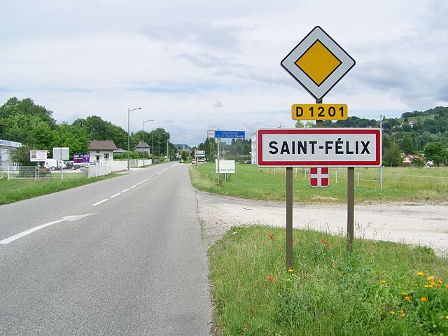

Saint-Félix
- commune in Haute-Savoie, France
Hiking in Saint-Félix
Saint-Félix, located in the Haute-Savoie region of France, is a charming village that offers a range of hiking opportunities for outdoor enthusiasts. The region is known for its stunning alpine scenery, lush forests, and breathtaking views of the surrounding mountains....
- Country:
- Postal Code: 74540
- Coordinates: 45° 48' 3" N, 5° 58' 20" E
- GPS tracks (wikiloc): [Link]
- Area: 6.6 sq km
- Population: 2404
- Web site: [Link]

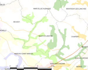
Saint-Sylvestre
- commune in Haute-Savoie, France
Hiking in Saint-Sylvestre
Saint-Sylvestre, located in the Haute-Savoie department of the Auvergne-Rhône-Alpes region in France, offers a beautiful setting for hiking enthusiasts. Nestled in the French Alps, this area is characterized by stunning natural landscapes, including alpine meadows, wooded areas, and panoramic views of the surrounding mountains....
- Country:
- Postal Code: 74540
- Coordinates: 45° 50' 15" N, 6° 1' 9" E
- GPS tracks (wikiloc): [Link]
- Area: 5.34 sq km
- Population: 597


Viuz-la-Chiésaz
- commune in Haute-Savoie, France
Hiking in Viuz-la-Chiésaz
Viuz-la-Chiésaz, located in the Haute-Savoie region of France, is a picturesque area offering beautiful hiking opportunities. Nestled near the mountains and surrounded by nature, this small village provides access to various trails that cater to different skill levels, from leisurely walks to more challenging hikes....
- Country:
- Postal Code: 74540
- Coordinates: 45° 48' 39" N, 6° 3' 42" E
- GPS tracks (wikiloc): [Link]
- Area: 13.91 sq km
- Population: 1342