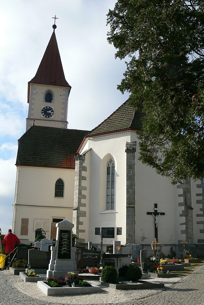
Altenfelden (Altenfelden)

- municipality in Austria
 Hiking in Altenfelden
Altenfelden, located in Austria, is a picturesque destination that offers a variety of hiking opportunities for outdoor enthusiasts. The area is characterized by its beautiful landscapes, rolling hills, and lush forests, making it a great location for both casual walkers and seasoned hikers.
Hiking Trails
-
Local Trails: Altenfelden has several marked hiking trails that cater to different skill levels. These trails usually vary in length and difficulty, ranging from easy, family-friendly paths to more challenging routes that may require some uphill trekking.
-
Scenic Views: Many trails in the region provide stunning views of the surrounding countryside, especially in the fall when the leaves change colors. Look for viewpoints or lookout points along the way to truly appreciate the natural beauty of the area.
-
Nature Reserves: Hiking in or around nature reserves can also provide opportunities to observe local wildlife and unique flora. Be sure to respect the environment and stay on marked paths to preserve these delicate ecosystems.
Preparation
- Gear: Proper hiking gear is essential. Wear sturdy hiking boots, dress in layers, and bring essential gear such as a water bottle, snacks, a map of the trails, and a basic first-aid kit.
- Weather: Always check the weather before heading out, as conditions can change rapidly in mountainous regions. It’s wise to be prepared for rain or sudden temperature drops.
Local Attractions
- Historical Sites: In addition to hiking, Altenfelden may offer historical sites or local cultural experiences. Consider visiting nearby towns or landmarks for a more rounded experience.
- Community Events: Check if there are any local hiking events or festivals during your visit, as these can enhance your experience and provide opportunities to meet fellow hikers.
Hiking Etiquette
- Respect the trails and other hikers by following Leave No Trace principles. This includes packing out all trash, sticking to established paths, and not disturbing wildlife.
Overall, Altenfelden offers a peaceful retreat for anyone looking to enjoy nature through hiking. Whether you're a beginner or an experienced hiker, there are plenty of opportunities to explore the beautiful Austrian landscape. Enjoy your hike!
- Country:

- Postal Code: 4121
- Local Dialing Code: 07282
- Licence Plate Code: RO
- Coordinates: 48° 29' 10" N, 13° 58' 8" E


- GPS tracks (wikiloc): [Link]
- AboveSeaLevel: 598 м m
- Area: 26.33 sq km
- Population: 2219
- Web site: http://www.altenfelden.at/
- Wikipedia en: wiki(en)
- Wikipedia: wiki(de)
- Wikidata storage: Wikidata: Q437073
- Wikipedia Commons Category: [Link]
- Freebase ID: [/m/03gv964]
- GeoNames ID: Alt: [7872102]
- VIAF ID: Alt: [242285918]
- Austrian municipality key: [41304]
Shares border with regions:
Kleinzell im Mühlkreis
- municipality in Austria
Hiking in Kleinzell im Mühlkreis
Kleinzell im Mühlkreis is a charming village in Austria, surrounded by beautiful landscapes ideal for hiking enthusiasts. The region offers a variety of trails that cater to different skill levels, making it a fantastic destination for both beginners and experienced hikers....
- Country:
- Postal Code: 4115
- Local Dialing Code: 07282
- Licence Plate Code: RO
- Coordinates: 48° 27' 24" N, 13° 59' 45" E
- GPS tracks (wikiloc): [Link]
- AboveSeaLevel: 548 м m
- Area: 16 sq km
- Population: 1546
- Web site: [Link]

Niederkappel
- municipality in Austria
Hiking in Niederkappel
Niederkappel is a charming village located in the Mühlviertel region of Upper Austria. The area is known for its stunning natural landscapes, including rolling hills, forests, and picturesque fields, making it a great destination for hiking enthusiasts. Here are some highlights and tips for hiking in Niederkappel:...
- Country:
- Postal Code: 4133
- Local Dialing Code: 07286
- Licence Plate Code: RO
- Coordinates: 48° 27' 57" N, 13° 52' 55" E
- GPS tracks (wikiloc): [Link]
- AboveSeaLevel: 549 м m
- Area: 23 sq km
- Population: 985
- Web site: [Link]

Kirchberg ob der Donau
- municipality in Austria
Hiking in Kirchberg ob der Donau
Kirchberg ob der Donau is a charming village located in the beautiful region of the Danube Valley in Austria. The area is rich in natural beauty, featuring rolling hills, forests, and stunning views of the Danube River, making it an ideal destination for hiking enthusiasts....
- Country:
- Postal Code: 4131
- Local Dialing Code: 07282
- Licence Plate Code: RO
- Coordinates: 48° 26' 42" N, 13° 56' 10" E
- GPS tracks (wikiloc): [Link]
- AboveSeaLevel: 591 м m
- Area: 21 sq km
- Population: 1055
- Web site: [Link]

Lembach im Mühlkreis
- municipality in Austria
Hiking in Lembach im Mühlkreis
Lembach im Mühlkreis is a picturesque village located in Upper Austria, surrounded by beautiful landscapes and rolling hills, making it an excellent destination for hiking enthusiasts. The region offers a variety of trails that cater to different skill levels, from casual walkers to experienced hikers....
- Country:
- Postal Code: 4132
- Local Dialing Code: 07286
- Licence Plate Code: RO
- Coordinates: 48° 29' 44" N, 13° 53' 44" E
- GPS tracks (wikiloc): [Link]
- AboveSeaLevel: 552 м m
- Area: 8 sq km
- Population: 1530
- Web site: [Link]

Neufelden
- municipality in Austria
Hiking in Neufelden
Neufelden, located in the beautiful region of Upper Austria, offers a variety of hiking opportunities amidst scenic landscapes, rolling hills, and lush forests. Here are some highlights and tips for hiking in and around Neufelden:...
- Country:
- Postal Code: 4120
- Local Dialing Code: 07282
- Licence Plate Code: RO
- Coordinates: 48° 29' 3" N, 14° 0' 7" E
- GPS tracks (wikiloc): [Link]
- AboveSeaLevel: 517 м m
- Area: 10 sq km
- Population: 1276
- Web site: [Link]

Arnreit
- municipality in Austria
Hiking in Arnreit
Arnreit is a picturesque village nestled in the Mühlviertel region of Upper Austria, known for its beautiful landscapes and diverse hiking opportunities. Here's an overview to help you make the most of your hiking experience in Arnreit:...
- Country:
- Postal Code: 4122
- Local Dialing Code: 07282
- Licence Plate Code: RO
- Coordinates: 48° 31' 33" N, 13° 59' 45" E
- GPS tracks (wikiloc): [Link]
- AboveSeaLevel: 604 м m
- Area: 20 sq km
- Population: 1154
- Web site: [Link]

Hörbich
- municipality in Austria
Hiking in Hörbich
Hörbich is a lovely destination for hiking enthusiasts, located in the picturesque Bavarian region of Germany. It's known for its scenic landscapes, dense forests, and beautiful trails that cater to various skill levels. Here are some highlights about hiking in Hörbich:...
- Country:
- Postal Code: 4132
- Local Dialing Code: 07286
- Licence Plate Code: RO
- Coordinates: 48° 31' 6" N, 13° 54' 54" E
- GPS tracks (wikiloc): [Link]
- AboveSeaLevel: 570 м m
- Area: 11 sq km
- Population: 420
- Web site: [Link]