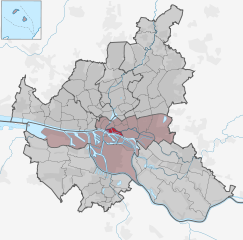
Altstadt (Hamburg) (Hamburg-Altstadt)

- borough of Hamburg, Germany
 Hiking in Altstadt (Hamburg)
While Hamburg is more renowned for its vibrant culture and historic architecture than for traditional hiking trails, there are still some great opportunities for walking and exploring the city, especially in and around Altstadt (the Old Town).
Hiking and Walking in Altstadt, Hamburg:
-
St. Michael's Church (Michaeliskirche):
- Start your adventure at this iconic landmark. Climb the tower for panoramic views of the city and the harbor.
-
Historic Alsterarkaden:
- Stroll through these beautiful arcades along the Alster River. It's a picturesque area ideal for leisurely walks, with cafes and shops lining the route.
-
Speicherstadt:
- Adjacent to Altstadt, the historic warehouse district offers a unique walking experience with red-brick buildings, canals, and bridges. The paths here are perfect for a walking tour that bridges history and scenic views.
-
The Planten un Blomen Park:
- Although not in Altstadt itself, this nearby park is worth a visit for its expansive green spaces, walking paths, and botanical gardens. It’s a great place to relax after walking through the city.
-
Walking Tours:
- Consider joining a guided walking tour to learn more about the history and architecture of Altstadt. Many local guides offer themed tours that focus on the city’s maritime heritage or its historical significance.
-
Harbor Walks:
- The waterfront area offers paths along the Elbe River, providing stunning views of the harbor, including the Elbphilharmonie. Walking along the water can be refreshing and offers a blend of urban and natural scenery.
Tips for Hiking in Urban Areas:
- Wear Comfortable Shoes: As you’ll be walking on various surfaces, ensure you have supportive footwear suitable for city exploration.
- Stay Hydrated: Carry water, especially during warm weather, to keep hydrated.
- Plan Your Route: While wandering can be enjoyable, having a basic route in mind might help you cover the highlights without missing key sites.
- Check Local Events: Sometimes, Hamburg hosts outdoor events or markets that might be fun to integrate into your walking schedule.
Overall, while you won't find rugged hiking trails in Hamburg's Altstadt, the city offers a wonderful blend of historical exploration and urban walking that can be just as rewarding!
- Country:

- Coordinates: 53° 33' 0" N, 10° 0' 0" E


- GPS tracks (wikiloc): [Link]
- AboveSeaLevel: 8 м m
- Area: 1.2 sq km
- Population: 2257
- Web site: http://www.hamburg.de/hamburg-altstadt/
- Wikipedia en: wiki(en)
- Wikipedia: wiki(de)
- Wikidata storage: Wikidata: Q1551
- Wikipedia Commons Gallery: [Link]
- Wikipedia Commons Category: [Link]
- Wikipedia Commons Maps Category: [Link]
- VIAF ID: Alt: [150434026]
- OSM relation ID: [110485]
- archINFORM location ID: [4892]
- Library of Congress authority ID: Alt: [no2002057893]
- Encyclopædia Britannica Online ID: [place/Altstadt-city-district-Hamburg-Germany]
- National Library of Israel ID: [001063949]
Shares border with regions:


Hamburg-Neustadt
- quarter of Hamburg, Germany
Hiking in Hamburg-Neustadt
Neustadt, located within the city limits of Hamburg, is primarily an urban area known for its historical architecture, cultural attractions, and vibrant atmosphere. While Neustadt itself is not typically known for traditional hiking as one might find in national parks or rural settings, there are plenty of opportunities for walking, exploring, and enjoying the outdoors in and around the district....
- Country:
- Postal Code: 20459; 20457; 20359; 20355; 20354
- Coordinates: 53° 33' 7" N, 9° 59' 8" E
- GPS tracks (wikiloc): [Link]
- AboveSeaLevel: 10 м m
- Area: 2.2 sq km
- Population: 12657
- Web site: [Link]


St. Georg (Hamburg)
- quarter in Hamburg, Germany
Hiking in St. Georg (Hamburg)
St. Georg is a vibrant district in Hamburg, Germany, known for its multicultural atmosphere, historic architecture, and proximity to the city's central attractions. While it may not be a traditional hiking destination with expansive trails typical of national parks or rural areas, there are still plenty of options for walking and exploring in and around St. Georg....
- Country:
- Postal Code: 20099; 20097; 20095
- Coordinates: 53° 33' 18" N, 10° 0' 44" E
- GPS tracks (wikiloc): [Link]
- AboveSeaLevel: 12 м m
- Area: 1.8 sq km
- Population: 10814

HafenCity
- quarter in the district of Hamburg-Mitte in Hamburg, Germany
Hiking in HafenCity
HafenCity is primarily known as a modern urban development project in Hamburg, Germany, rather than a traditional hiking destination. This area features a mix of residential, commercial, and recreational spaces along the waterfront. While it may not offer typical hiking trails like those found in natural parks or mountainous regions, there are still plenty of opportunities for walking and exploring....
- Country:
- Local Dialing Code: 040
- Coordinates: 53° 32' 30" N, 9° 59' 36" E
- GPS tracks (wikiloc): [Link]
- AboveSeaLevel: 8 м m
- Area: 2.4 sq km